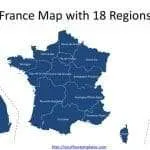
France map with regions
The France map with regions PowerPoint deck includes 20 maps, with two slide of France map with 13 regions or 18 regions; the remaining...
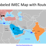
India-Middle East-Europe Economic Corridor Map
The India-Middle East-Europe Economic Corridor Map or IMEC map template in PowerPoint format includes 4 slides. Firstly, we have the blank India-Middle East-Europe Economic...
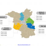
Free downloads Brandenburg Map
The Free downloads of Brandenburg Map Template (German: Brandenburg karte) in PowerPoint format includes two slides, that is, the Brandenburg outline map and Brandenburg...
Free Germany Map with 16 States
Germany map with 16 states, highlighting Baden-Württemberg, Bavaria, Hesse, Lower Saxony, and North Rhine-Westphalia states. Germany outline map labeled with Berlin, Hamburg, Munich, Cologne,...
Blank templates Schleswig-Holstein Map
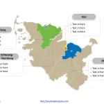
The Blank templates of Schleswig-Holstein Map Template (German: Schleswig-Holstein karte) in PowerPoint format includes two slides, that is, the Schleswig-Holstein outline map and Schleswig-Holstein...
Free Romania Map with 41 Counties and One City
The Romania Map Template includes two slides. Romania map with 41 counties and one city, highlighting Bucharest, Iași County, Prahova County, and Bacău County....
Free Montenegro Editable Map
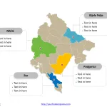
Montenegro Editable map with twenty-three municipalities, labeling major municipalities, Podgorica, Nikšić, Bijelo Polje, and Bar. Montenegro Editable map labeled with capital and major cities,...
6 Metropolitan counties of England map
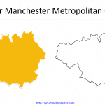
The 6 Metropolitan counties of England map with outlines including Greater Manchester, Merseyside, South Yorkshire, Tyne and Wear, West Midlands, and West Yorkshire. Our...
Free Slovakia Editable Map
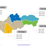
Slovakia Political map with 8 krajov, labeling with major regions, Prešov Region, Košice Region, Nitra Region, and Žilina Region. Slovakia outline map labeling with...
City maps Amsterdam
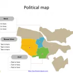
The Amsterdam city maps Template in PowerPoint format includes two slides, that is, the Amsterdam outline map and Amsterdam zip-code map. Firstly, our Amsterdam...


