Free Luxembourg Editable Map
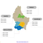
Luxembourg map with 12 cantons, labeling major cantons, Esch-sur-Alzette, Luxembourg, Capellen, and Diekirch. The Outline map labeled with capital and major cities, Luxembourg City,...
Shape Belgium with Regions and Provinces
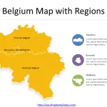
Belgium is a country with a rich history and a diverse culture. One of the things that make Belgium unique is its administrative divisions....
Free Switzerland Map
The Switzerland map template includes two slides. Switzerland map with 26 cantons, labeling major cantons, Zürich, Bern, Vaud, and Aargau. Switzerland map labeled with...
Free Liechtenstein Editable Map
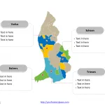
Liechtenstein Country political map with eleven communes, labeling major communes, Schaan, Vaduz, Triesen, and Balzers. Liechtenstein Outline map labeled with capital and major cities,...
Map of Italy Regions
The Map of Italy Regions PowerPoint deck includes 21 maps, with one slide of Italy map with 20 regions; the remaining slides are for...
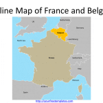
Map of France and Belgium Template
Map of France and Belgium has four slides, presenting the outline and sub-divisions of the two countries. The two countries are located in the...
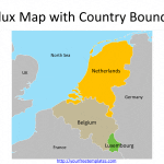
Benelux Map Template
The Benelux is the European region located between France and Germany, composing three countries, i.e. Belgium, the Netherlands, and Luxembourg to form the political...
Most populated city in United Kingdom 1-10
Most populated city in United Kingdom 1-10 is the ones with population over 400 thousand people, including London, Birmingham, Glasgow, Liverpool, Bristol, Manchester, Sheffield,...
9 England Region Map
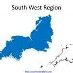
The 9 England Region Map with outlines including East Midlands, East of England, London, North East, North West, South East, South West, West Midlands,...
Belgium Map with 10 Provinces and the Capital Region
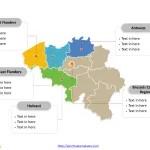
The Belgium Map Template includes two slides. Belgium map with 10 provinces and one region, highlighting Brussels-Capital Region, Antwerp, Hainaut, East Flanders, and West...


