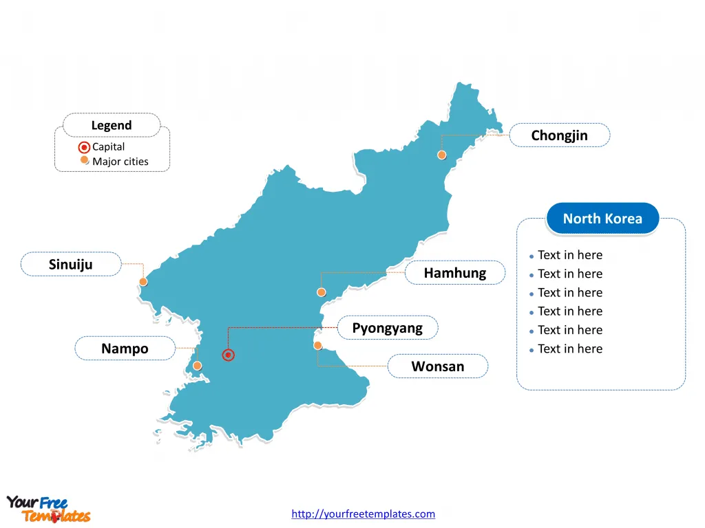
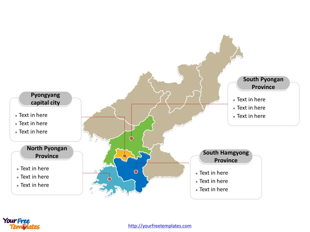
The North Korea Map Template includes two slides. North Korea map with nine provinces and two special cities, labeling with major provinces, Pyongyang capital city, South Pyongan Province, North Pyongan Province, and South Hamgyong Province. North Korea map labeling with national capital and major cities, Pyongyang, Hamhung, Chongjin, Nampo, Wonsan, and Sinuiju.
Location North Korea, officially known as the Democratic People’s Republic of Korea, is located on the Korean Peninsula in East Asia. It shares its borders with China to the north and Russia in the extreme northeast. The country is also separated from South Korea by the Demilitarized Zone, with the Sea of Japan to the east and the Yellow Sea to the west.
Population As of the latest available data, North Korea’s population is estimated to be around 26.2 million people. The country’s population growth rate has slowed, and it faces challenges related to aging demographics and workforce implications.
Economy North Korea operates under a command economy model, with the government controlling all economic decisions. The country’s major industries include mining and the production of military products. It has a limited presence in international trade, with China being its primary trading partner. The nation’s economy has faced challenges, including the impact of sanctions and limited engagement in global commerce.
Neighboring Countries North Korea shares its borders with China to the north and Russia in the northeast. These neighboring countries significantly influence North Korea’s economic, political, and strategic dynamics, impacting its trade and geopolitical positioning.
Slide 1, North Korea map labeled with capital and major cities.
Pyongyang is both the nation’s capital as well as its largest city, other major cities including Hamhung, Chongjin, Nampo, Wonsan, and Sinuiju.
Capital and Major Cities on North Korea map
Pyongyang Pyongyang, the capital and largest city of North Korea, is a political, cultural, and economic hub. It is a city of immense historical and architectural significance, featuring landmarks like the Kumsusan Palace of the Sun and the Juche Tower. The city serves as the epicenter of the country’s political power and houses numerous governmental and administrative institutions.
Hamhung Hamhung, the second largest city, is an industrial center known for its chemical and metallurgical industries. It is situated in the South Hamgyong Province and contributes significantly to North Korea’s manufacturing sector.
Chongjin Chongjin, located in the North Hamgyong Province, is a major port city and an important industrial center. It plays a crucial role in the country’s economy, particularly in trade and manufacturing.
Nampo Nampo, a port city in the South Pyongan Province, is a key transportation and industrial center. It is a vital hub for the country’s maritime trade and economic activities.
Wonsan Wonsan, located in the Kangwon Province, is a port city known for its scenic beauty and historical sites. It has significant potential for tourism and economic development.
Sinuiju Sinuiju, a city in the North Pyongan Province, is a major border town adjacent to Dandong, China. It serves as an important gateway for trade and economic cooperation with China.
Slide 2, North Korea map labeled with major administration districts.
North Korea is a country with nine provinces and two special cities, with North Korea city representing one of the official regions; they are Pyongyang capital city, South Pyongan Province, North Pyongan Province, Chagang Province, South Hwanghae Province, North Hwanghae Province, Kangwon Province, South Hamgyong Province, North Hamgyong Province, Ryanggang Province, Rason special city. Every individual political subdivision is an editable shape.
Major Provinces on North Korea map
Pyongyang Capital City The Pyongyang Capital City is the political, economic, and cultural nucleus of North Korea. It encompasses the capital city and its surrounding areas, representing the heart of the country’s administrative and urban landscape.
South Pyongan Province The South Pyongan Province, with Nampo and Kaechon, is a region of economic significance, housing key industrial and transportation facilities. It is an important center for manufacturing and trade.
North Pyongan Province The North Pyongan Province, with Chongju and Sinuiju, is known for its industrial and commercial activities. It is a region with strategic importance for North Korea’s economic and trade linkages.
South Hamgyong Province The South Hamgyong Province, with Hamhung and Tanchon, is a vital region for North Korea’s industrial and maritime activities. It plays a crucial role in the country’s industrial and trade landscape.
In conclusion, North Korea’s capital, major cities, and provinces reflect the country’s economic, political, and cultural dynamics. From the political power center of Pyongyang to the industrial cities of Hamhung and Chongjin, each locale offers a unique glimpse into North Korea’s diverse urban and regional landscape.
Looking for Premium maps, please visit our affiliate site: https://editablemaps.com/ or https://ofomaps.com/
Size: 94K
Type: PPTX
Aspect Ratio: Standard 4:3
Click the blue button to download it.
Download the 4:3 Template
Aspect Ratio: Widescreen 16:9
Click the green button to download it.
Download the 16:9 Template
