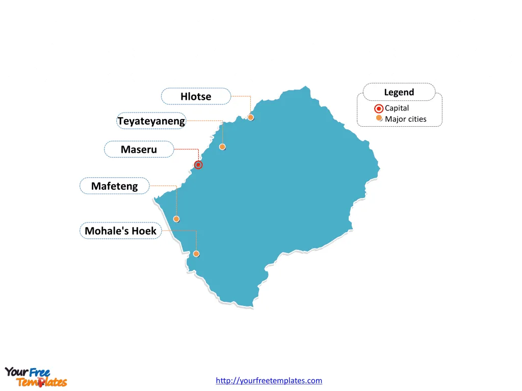
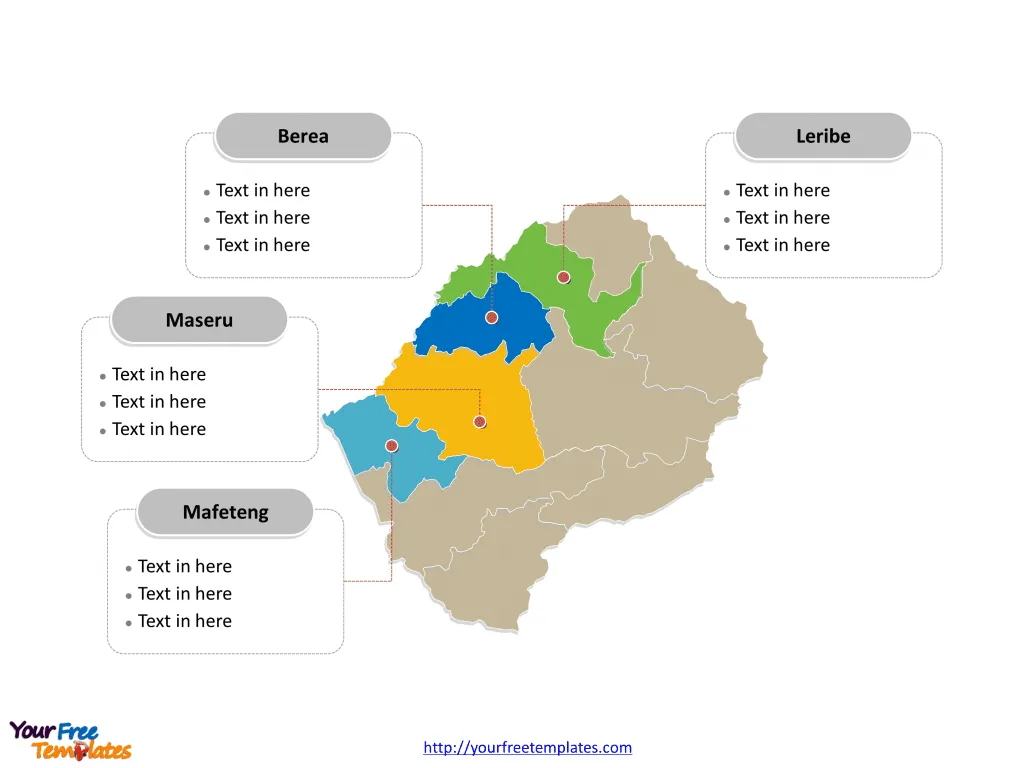
The Lesotho Map Template in PowerPoint format includes two slides, that is, the Lesotho outline map and Lesotho political map. Firstly, our Lesotho outline map template has capital and major cities on it, which are Maseru, Hlotse, Teyateyaneng, Mafeteng, and Mohale’s Hoek. Secondly, there are 10 Districts in our Lesotho political map template of divisions, labeling the most populated divisions that are Maseru, Leribe, Berea, and Mafeteng.
Lesotho, a small, mountainous, landlocked country, is entirely surrounded by South Africa. It has a population of approximately 2.4 million people and a per capita gross domestic product (GDP) of $999.7. The economy is primarily driven by agriculture, with challenges such as limited arable land and vulnerability to food shortages.
Lesotho’s unique geography has led to significant labor migration to South Africa, with remittances accounting for about 20% of its GDP. The country faces socio-economic challenges, with nearly half of its population living below the poverty line. Despite these challenges, Lesotho has achieved progress in education, aiming for universal primary education and boasting one of the highest adult literacy rates in Africa. Additionally, Lesotho has the second-highest HIV/AIDS prevalence rate globally, contributing to its demographic and health challenges.
Slide 1, Lesotho map labeled with capital and major cities.
Maseru is the capital and largest city of Lesotho, furthermore, other major cities including Hlotse, Teyateyaneng, Mafeteng, and Mohale’s Hoek. So our Lesotho map slide has the capital and major cities on the outline. Consequently users can remove cities or include new ones to create their unique Lesotho maps and apply in different decks.
Slide 2, Lesotho map labeled with major districts.
The Lesotho map is the country political division of 10 Districts. They are Berea, Butha-Buthe, Leribe, Mafeteng, Maseru, Mohale’s Hoek, Mokhotlong, Qacha’s Nek, Quthing, and Thaba-Tseka. What is more, every individual political subdivision is an editable shape. As a result, you can change the texts, colors, sizes, highlight some map shapes, and add your contents. At the same time you can also refer to the fully labeled Lesotho map in Wikipedia. Most important of all, analysts from marketing research companies, consultants from professional firms have thought highly of yourfreetemplates.com very much; because our maps can save their time and create good-looking maps.
Size:94K
Type: PPTX
Aspect Ratio: Standard 4:3
Click the blue button to download it.
Download the 4:3 Template
Aspect Ratio: Widescreen 16:9
Click the green button to download it.
Download the 16:9 Template
