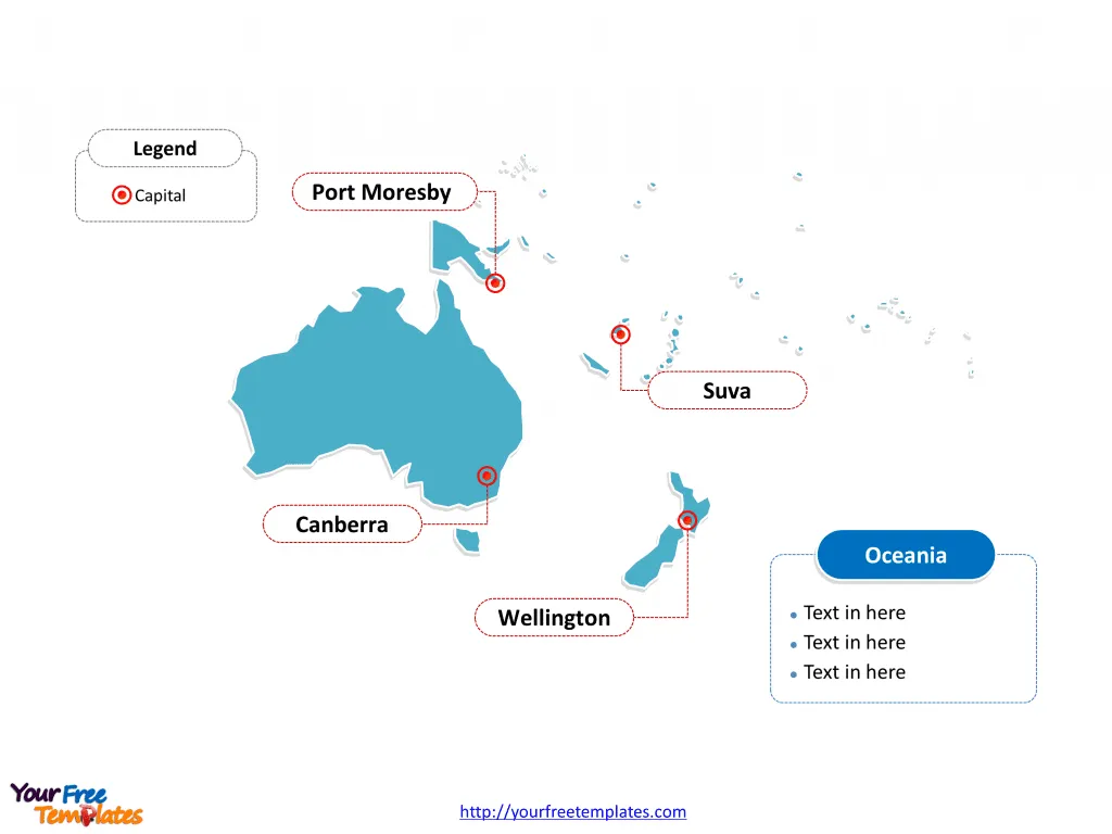
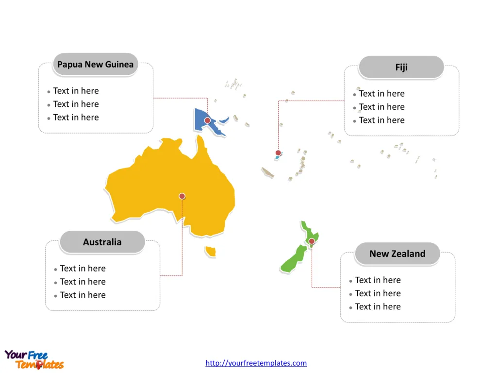
The Oceania Map Template includes two slides. Oceania map with over 5 countries, highlighting Australia, New Zealand, Papua New Guinea, and Fiji countries. Oceania map labeled with Canberra, Wellington, Port Moresby, and Suva cities.
Oceania is a geographic region that spans the eastern and western hemispheres and consists of the islands of the tropical Pacific Ocean. Covering an area of about 8.525 million square kilometers, it includes Australasia, Melanesia, Micronesia, and Polynesia. Oceania’s boundaries are defined by the Pacific Ocean to the east, Asia to the west, and the Americas to the northeast.
Slide 1, Oceania map labeled with capitals
Major Cities on Oceania map
Canberra: Canberra is the capital city of Australia, located in the southeastern part of the country. It is a planned city with a design shaped by the natural vegetation and topography, often described as a “bush capital.” Canberra is the political center of Australia, housing important institutions such as the Parliament House, the High Court, and numerous national museums and galleries.
Wellington: Wellington is the capital city of New Zealand, located on the southern tip of the North Island. It’s known for its strong cultural presence, hosting the Museum of New Zealand Te Papa Tongarewa, the New Zealand Symphony Orchestra, and the annual Wellington International Arts Festival. The city is also the political heart of New Zealand, with the iconic Beehive building serving as the executive wing of the parliamentary complex.
Port Moresby: Port Moresby is the capital and largest city of Papua New Guinea, situated on the shores of the Gulf of Papua. It is the administrative and commercial center of the country, with a complex cultural tapestry due to its status as the most populous city in the country.
Suva: Suva is the capital and the largest metropolitan city in Fiji, located on the southeast coast of the island of Viti Levu. As the political, economic, and cultural center of Fiji, Suva hosts the majority of the urban population and offers an array of colonial-era architecture, parks, and residential and commercial areas.
Slide 2, Oceania map labeled with major countries
Oceania has 14 countries and 9 dependencies, with major countries are Australia, New Zealand, Papua New Guinea, and Fiji. Other countries and dependencies are Solomon Islands, Federated States Of Micronesia, Vanuatu, Samoa, Kiribati, Tonga, Marshall Islands, Palau, Tuvalu, and Nauru. There are also 3 subregions for this continent, which composing of Melanesia, Micronesia, and Polynesia in Pacific Ocean. Every individual country is an editable shape.
Major Countries on Oceania map
Australia: Australia is a sovereign country comprising the mainland of the Australian continent, the island of Tasmania, and numerous smaller islands. It is the largest country in Oceania and the world’s sixth-largest country by total area. Major cities include Sydney, Melbourne, Brisbane, Perth, and Adelaide, and the country is known for its diverse landscapes and wildlife.
New Zealand: New Zealand is an island country located in the southwestern Pacific Ocean. It consists of two main landmasses—the North Island and the South Island—and around 600 smaller islands. New Zealand is known for its stunning natural landscapes, Maori culture, and is a popular location for filming due to its diverse scenery.
Papua New Guinea: Papua New Guinea, located in Melanesia, occupies the eastern half of New Guinea (the world’s second-largest island) and numerous offshore islands. It is one of the most culturally diverse countries in the world, with over 800 languages spoken among its population.
Fiji: Fiji is an archipelago of more than 330 islands, with Viti Levu and Vanua Levu being the two major islands that contain the bulk of the population. Fiji is known for its rugged landscapes, palm-lined beaches, coral reefs with clear lagoons, and rich cultural heritage.
Oceania is a region of great diversity, with its countries and cities offering a blend of indigenous cultures, colonial history, and modern developments. Each country and its cities contribute to the region’s unique character and are important centers of cultural, economic, and political activity.
Looking for Premium maps, please visit our affiliate site: https://editablemaps.com/ or https://ofomaps.com/
Size: 100K
Type: PPTX
Aspect Ratio: Standard 4:3
Click the blue button to download it.
Download the 4:3 Template
Aspect Ratio: Widescreen 16:9
Click the green button to download it.
Download the 16:9 Template
