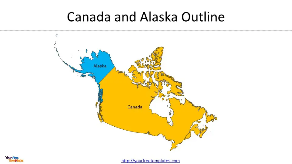
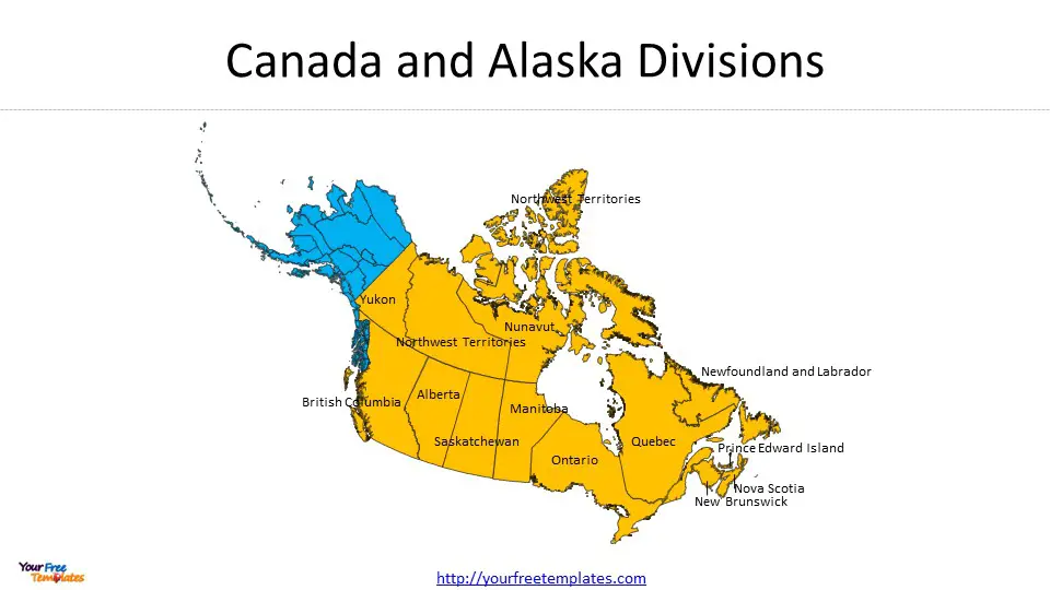
Map of canada and alaska template in PowerPoint format includes two slides. Firstly, we have the Canada and Alaska map template with outline boundary. Secondly, we present Canada and Alaska map with 13 provinces and territories, 20 boroughs respectively. As the same diagram PowerPoint template series, you can also find our US and Canada, US and Mexico, Canada, US and Mexico, Mexico and Central America PowerPoint templates.
Canada and Alaska are known for their sprawling natural beauty, encompassing everything from lush forests and towering mountains to serene lakes and arctic tundra. For travelers and adventurers looking to explore these regions, having a detailed map is indispensable. Maps not only help in navigation but also provide insight into the geography, topography, and key attractions of these areas. Here’s a guide to understanding and using maps for Canada and Alaska.
Slide 1, Canada and Alaska map with outline boundary.
Geography and Landscape
- Canada: The Canadian map showcases the country’s ten provinces and three territories. It is marked by the Great Lakes, the Rocky Mountains, and vast forested regions. Canada’s extensive coastline is also a prominent feature, especially in areas like the Maritime Provinces.
- Alaska: On the Alaskan map, you will notice the rugged terrain dominated by the Alaska Range and the famous Denali peak, the highest in North America. The Aleutian Islands stretch into the Pacific, and the expansive tundra of the north slopes toward the Arctic Ocean.
Slide 2, Canada and Alaska Map with 13 provinces and territories, 19 boroughs respectively
Political Maps: our maps focus on national boundaries, county divisions. They are useful for getting a sense of the administrative regions and planning inter-city travel.
Cities and Population Centers:
- Canada: Major cities like Toronto, Vancouver, Montreal, and Calgary are clearly marked. These urban centers are hubs of culture and history.
- Alaska: Anchorage, Fairbanks, Juneau, and Nome are among the key cities and towns depicted on the map of Alaska, each offering unique experiences.
Canada is comprised of 10 provinces and 3 territories.
- The 10 provinces: Alberta, British Columbia, Manitoba, New Brunswick, Newfoundland and Labrador, Nova Scotia, Ontario, Prince Edward Island, Quebec, and Saskatchewan.
- Three territories: Northwest Territories, Nunavut, and Yukon Territory
Alaska is divided into 19 organized boroughs and one Unorganized Borough.
- Aleutians East Borough, Anchorage, Bristol Bay Borough, Denali Borough, Fairbanks North Star Borough, Haines Borough, Juneau, Kenai Peninsula Borough, Ketchikan Gateway Borough, Kodiak Island Borough, Lake and Peninsula Borough, Matanuska-Susitna Borough, North Slope Borough, Northwest Arctic Borough, Petersburg Borough, Sitka, Skagway, Unorganized Borough, Wrangell, and Yakutat
- The unorganized borough has been divided into 12 census areas
Economy of Canada and Alaska: A Synergistic Combination
The economies of Canada and Alaska present a unique and important combination, highlighting the synergy between a large diversified economy and a resource-rich region. Canada, as the second-largest country in the world by land area, boasts a highly developed and diversified economy. It is renowned for its natural resources, including its vast reserves of oil, natural gas, and minerals, alongside a robust manufacturing sector, technology industry, and a strong agricultural base.
Alaska, although a part of the United States, shares a geographical and economic bond with Canada, especially in the context of natural resources. The state’s economy is heavily reliant on oil and gas production, fishing, and tourism. Its proximity to Canada facilitates cross-border trade and investment, especially in the energy sector and natural resources. This synergy is crucial for several reasons:
- Energy Security and Trade: The combination of Canadian and Alaskan resources contributes significantly to North American energy security. It fosters a stable supply of oil and natural gas, which is vital for both domestic consumption and international trade.
- Economic Growth: Cross-border investments between Alaska and Canada in sectors like mining, energy, and infrastructure drive economic growth, create jobs, and foster innovation in both regions.
- Environmental Stewardship: Collaboration in environmental management and sustainable resource extraction is crucial, given the ecological sensitivities of both regions. This partnership is essential for preserving the natural beauty and ecological integrity of the North American continent.
In conclusion, the economic interplay between Canada and Alaska underpins a vital part of North America’s economy, emphasizing the importance of their natural resources, trade relations, and shared environmental responsibilities.
For other interesting maps, pls visit our ofomaps.com
Size:990K
Type: PPTX
Aspect Ratio: Standard 4:3
Click the blue button to download the maps.
Download the 4:3 Template
Aspect Ratio: Widescreen 16:9
Click the green button to download the maps.
Download the 16:9 Template
