The California Orange County map images are showing city boundaries and Orange County CA zip code map. The image downloadable is 300 dpi appropriate for printing. You can click the link below do download the high-resolution image. You can also find our Los Angeles map, Washington DC, Texas county map, Florida County map, Pennsylvania map, Virtual Reality, Carbon neutral, Circular economy, Carbon footprint, Data Mining, Machine Learning, cloud computing, Artificial Intelligence and BlockChain templates.
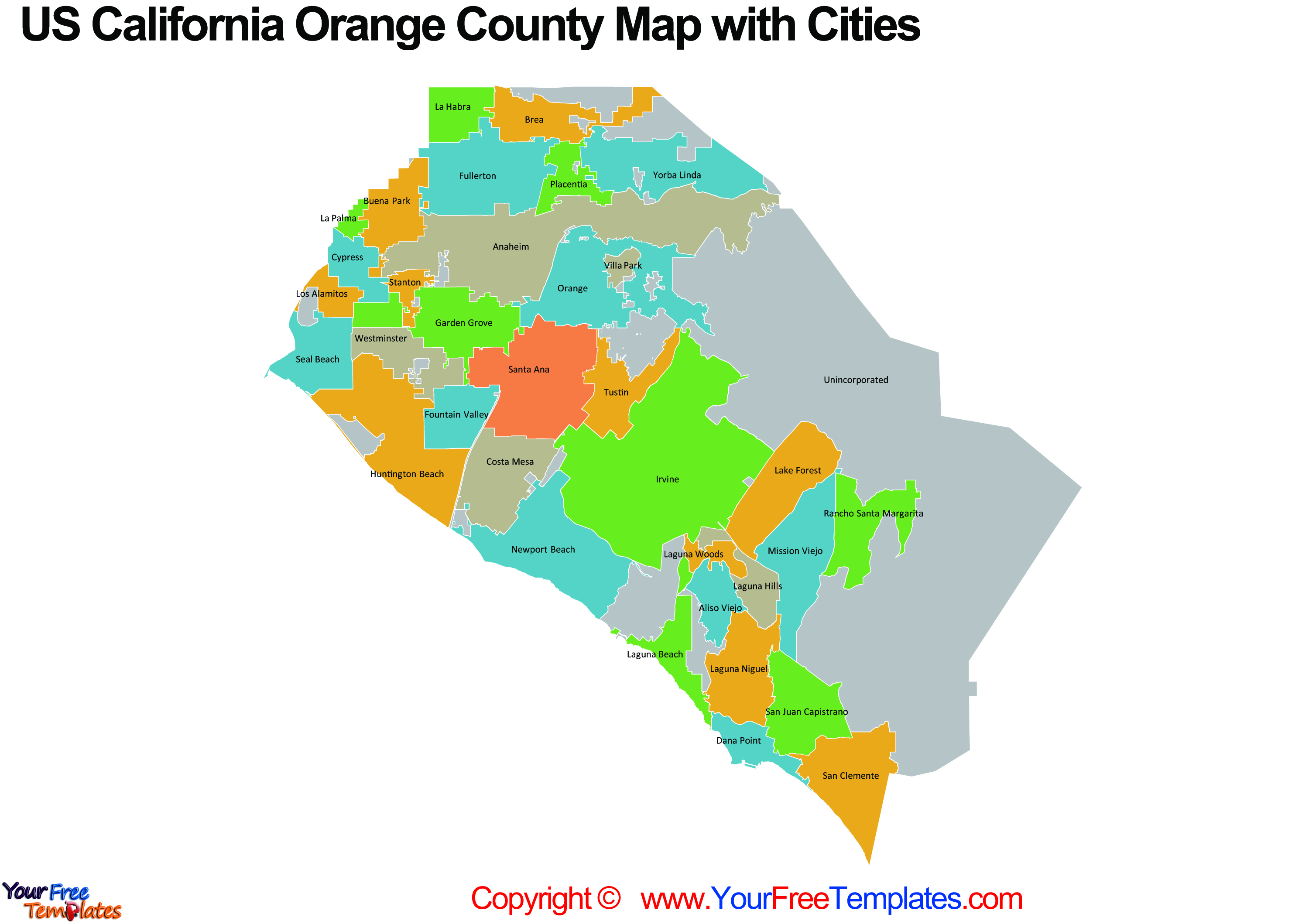
Map image 1, California Orange County map with City Boundaries
It is well known that the 34 cities in Orange county are Aliso Viejo, Anaheim, Brea, Buena Park, Costa Mesa, Cypress, Dana Point, Fountain Valley, Fullerton, Garden Grove, Huntington Beach, Irvine, La Habra, La Palma, Laguna Beach, Laguna Hills, Laguna Niguel, Laguna Woods, Lake Forest, Los Alamitos, Mission Viejo, Newport Beach, Orange, Placentia, Rancho Santa Margarita, San Clemente, San Juan Capistrano, Santa Ana, Seal Beach, Stanton, Tustin, Villa Park, Westminster, and Yorba Linda. It is also noted that there are unincorporated areas filled in grey color.

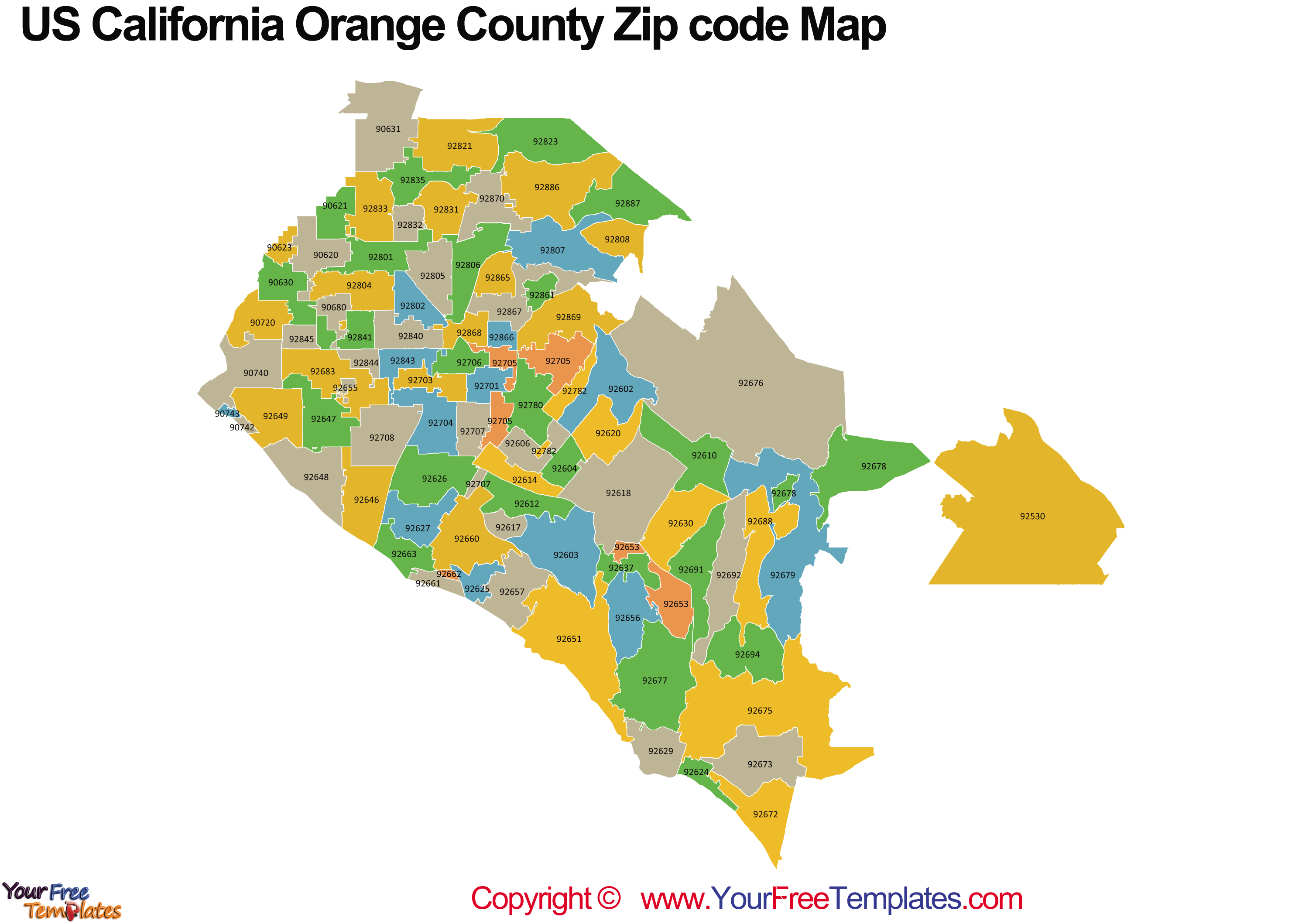
Map image 2, Orange County CA zip code map
There are 89 zip codes in California Orange county, which are 92705, 92706, 92707, 92708, 92780, 92782, 92801, 92802, 92804, 92805, 92806, 92807, 92808, 92821, 92823, 92831, 92832, 92833, 92835, 92840, 92841, 92843, 92844, 92845, 92861, 92865, 92866, 92867, 92868, 92869, 92870, 92886, 92887, 90720, 90740, 90742, 90743, 92530, 92602, 92603, 92604, 92606, 92610, 92612, 92614, 92617, 92618, 92620, 92624, 92625, 92626, 92627, 92629, 92630, 92637, 92646, 92647, 92648, 92649, 92651, 92653, 92655, 92656, 92657, 92660, 92661, 92662, 92663, 92672, 92673, 92675, 92676, 92677, 92678, 92679, 92683, 92688, 92691, 92692, 92694, 92701, 92703, 92704, 90620, 90621, 90623, 90630, 90631, 90680.

All data is the offical GIS, please check here for details.
Type: JPG
Orange County map with City Boundaries-Size:2.1M
Click the blue button to download it.
Download the Orange-County-Map-City-Boundaries
Orange County Zip code map-Size:1.3M
Click the green button to download it.
Download the California Orange County Zip code map


