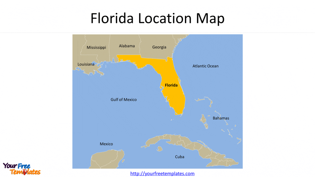
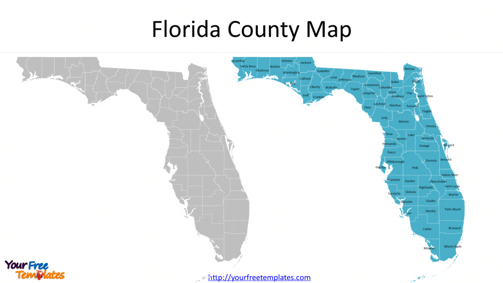
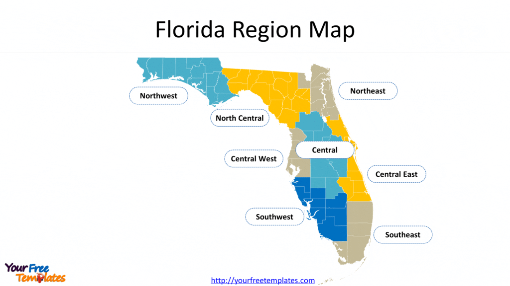
The Florida county map printable Template in PowerPoint format includes three slides. Firstly the Florida map with neighboring states and countries. Secondly the FL counties map labeled with county names and editable Florida county lines. The third is the Florida region map. You can also find our Florida powerpoint map, Virtual Reality, Carbon neutral, Circular economy, Carbon footprint, Data Mining, Machine Learning, cloud computing, Artificial Intelligence and BlockChain templates.
Slide 1, Florida location map
Our State of Florida map is for the southernmost state in the southeastern region of the United States, known as the Sunshine State; the neighboring states are Georgia, Alabama, Mississippi and Louisiana. Cuba, Mexico and Bahamas are countries with marine border with Florida. The Mexico Gulf and Atlantic Ocean are surrounding the state.

Slide 2, US Florida county map with names
There are 67 Counties in our Fl counties map. They are Alachua, Baker, Bay, Bradford, Brevard, Broward, Calhoun, Charlotte, Citrus, Clay, Collier, Columbia, DeSoto, Dixie, Duval/City of Jacksonville, Escambia, Flagler, Franklin, Gadsden, Gilchrist, Glades, Gulf, Hamilton, Hardee, Hendry, Hernando, Highlands, Hillsborough, Holmes, Indian River, Jackson, Jefferson, Lafayette, Lake, Lee, Leon, Levy, Liberty, Madison, Manatee, Marion, Martin, Miami-Dade, Monroe, Nassau, Okaloosa, Okeechobee, Orange, Osceola, Palm Beach, Pasco, Pinellas, Polk, Putnam, Santa Rosa, Sarasota, Seminole, St. Johns, St. Lucie, Sumter, Suwannee, Taylor, Union, Volusia, Wakulla, Walton, and Washington. The most populated counties in Florida State are Miami-Dade County, Broward County, Palm Beach County, and Hillsborough County.

Slide 3, Florida county map by region
It is known that this Florida county map printable is divided into 8 regions, which are Northwest Florida, North Central Florida, Northeast Florida, Central West Florida, Central Florida, Central East Florida, Southwest Florida, and Southeast Florida.

Looking for Premium maps, please visit our affiliate site: https://editablemaps.com/ or https://ofomaps.com/
Size:1120K
Type: PPTX
[sociallocker]Aspect Ratio: Standard 4:3
Click the blue button to download it.
Download the 4:3 Template
Aspect Ratio: Widescreen 16:9
Click the green button to download it.
Download the 16:9 Template[/sociallocker]


