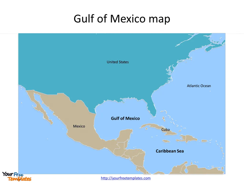
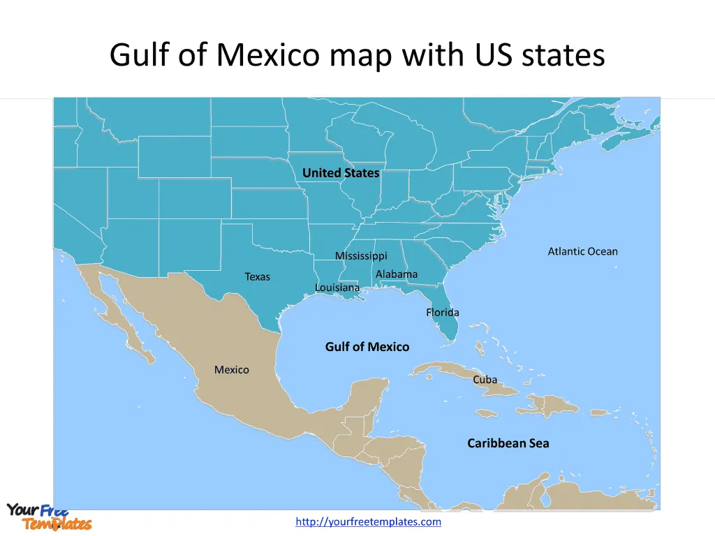
The Map of Gulf of Mexico Template in PowerPoint format includes two slides, that is, the Gulf of Mexico map with country outlines and Mexico Gulf map with US states. Firstly, our Gulf of Mexico outline map free templates have major countries on it. Secondly, there are major US states in our Gulf of Mexico map free templates, highlighting the most important states.
The Gulf of Mexico is a vast ocean basin located in the southeastern segment of North America. It is bounded by the United States to the north and northeast, Mexico to the west and southwest, and Cuba to the southeast. The Gulf connects with the Atlantic Ocean through the Florida Straits between the U.S. and Cuba, and with the Caribbean Sea via the Yucatán Channel between Mexico and Cuba. Covering an area of about 1,550,000 square kilometers, it plays a critical role in the local and global economy, environmental systems, and geopolitical strategy.
Slide 1, Gulf of Mexico map with major Countries
The Gulf of Mexico is connected to part of the Atlantic Ocean through the Florida Straits between the United States and Cuba, and with the Caribbean Sea (with which it forms the American Mediterranean Sea) via the Yucatán Channel between Mexico and Cuba.:
- United States: The U.S. Gulf coast stretches from the western tip of Florida to the Texas-Mexico border, encompassing a diverse range of ecosystems and major urban centers.
- Mexico: Mexico’s Gulf coast runs from the tip of the Yucatán Peninsula to the U.S. border, including important ports like Veracruz and Tampico.
- Cuba: The island nation of Cuba sits to the southeast of the Gulf, with its northern shores opening onto the Gulf waters, contributing to the region’s cultural and economic diversity.
Local Economy
The Gulf of Mexico’s economy is diverse and robust, driven by a variety of sectors including energy, tourism, fishing, and shipping. The energy sector is particularly dominant, with the Gulf being one of the most important regions for oil and natural gas production in the United States and Mexico. The U.S. side of the Gulf, in particular, is dotted with thousands of oil platforms, contributing significantly to the country’s oil output. The region also supports major fishing and seafood industries, providing a significant portion of the seafood consumed in the United States.
Tourism is another economic pillar, with the Gulf’s beautiful beaches, vibrant marine life, and warm climate attracting millions of visitors each year. Cities and towns along the Gulf coast, from Cancun in Mexico to Naples in Florida, benefit from tourism-related activities, including hospitality, recreational fishing, water sports, and cruise ship operations.

Slide 2, Mexico Gulf map with US states.
Several U.S. states have coastlines along the Gulf of Mexico, each contributing uniquely to the region’s economy and culture:
- Florida: Known for its tourism-driven economy with beautiful beaches along the Gulf Coast, including those in the Tampa Bay area and the Florida Panhandle.
- Alabama,: Features a smaller coastline with important ports and a thriving seafood industry.
- Mississippi: Offers significant contributions to the fishing and shipping industries.
- Louisiana: Home to the Mississippi River Delta and a hub for the oil and gas industry, as well as a culturally rich region with a strong maritime heritage.
- Texas: Boasts a long coastline with major economic activities including oil production, shipping, and tourism, especially in cities like Houston and Corpus Christi.
Strategic Importance
Strategically, the Gulf of Mexico holds immense significance. Its location serves as a crucial maritime route for international trade, particularly for the transportation of oil and gas. The Gulf’s ports, including the Port of South Louisiana and the Port of Houston, are among the busiest in the world, facilitating the export and import of goods across the Americas and beyond.
Additionally, the Gulf plays a pivotal role in national security for the United States and Mexico, with both countries maintaining a naval presence to protect their interests, ensure the safe passage of goods, and prevent illegal activities such as drug trafficking and unauthorized migration.

The Gulf of Mexico is a region of immense ecological beauty, economic vitality, and strategic significance. Its waters and coastlines support a rich diversity of life and livelihoods, making it an invaluable asset to the surrounding countries and the world at large.
Looking for Premium maps, please visit our affiliate site: https://ofomaps.com/
Size:325K
Type: PPTX
Aspect Ratio: Standard 4:3
Click the blue button to download it.
Download the 4:3 Template
Aspect Ratio: Widescreen 16:9
Click the green button to download it.
Download the 16:9 Template


