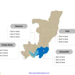
Republic of the Congo Map with 12 Departments
The Republic of the Congo Map Template includes two slides. Republic of the Congo map with twelve departments, labeling major departments, Brazzaville, Pointe-Noire, Bouenza,...
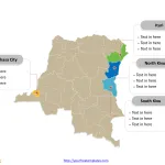
Democratic Republic of Congo Map with 26 Provinces
Democratic Republic of Congo Map Template includes three slides. Congo map with 26 provinces, labeling major provinces, Kinshasa, Nord-Kivu, Sud-Kivu, and Ituri. Congo map...
Central African Republic Map with 16 Prefectures
The Central African Republic Map Template includes two slides. Central African Republic map with 16 administrative prefectures, highlighting Ouham, Ouham-Pendé, Ombella-M'Poko, and Mambéré-Kadéï prefectures....
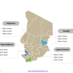
Chad Map with 23 Regions
The Map of Chad Template includes two slides. Chad map with 23 regions, highlighting N'Djamena (capital), Mayo-Kebbi Est, Ouaddaï, Logone Occidental regions. Chad map...
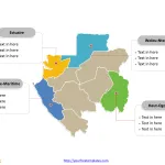
Gabon Map with 9 Provinces
The Gabon Map Template includes two slides. Gabon map with 9 provinces, highlighting Estuaire, Haut-Ogooué, Ogooué-Maritime, and Woleu-Ntem provinces. Gabon map outline labeled with...
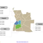
Angola Map with 18 Provinces
The Angola MapTemplate includes two slides. Angola map with 18 provinces, highlighting Benguela, Huambo, Huíla, and Luanda provinces. Angola map outline labeled with Luanda,...


