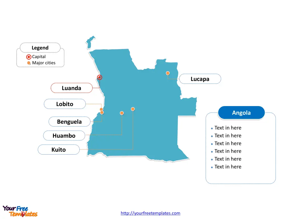
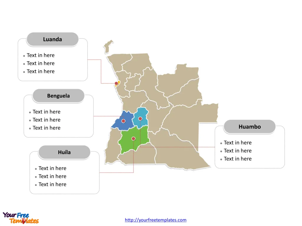
The Angola MapTemplate includes two slides. Angola map with 18 provinces, highlighting Benguela, Huambo, Huíla, and Luanda provinces. Angola map outline labeled with Luanda, Huambo, Lobito, Benguela, Lucapa, and Kuito cities.
Angola, located in Southern Africa, is a vast country with a population of over 30 million people. The nation’s economy is largely driven by its abundant natural resources, particularly oil and diamonds, although efforts are being made to diversify into agriculture, manufacturing, and renewable energy. Angola shares its borders with Democratic Republic of the Congo, Namibia, Republic of the Congo, and Zambia.
The country’s strategic coastal position has historically made it an important maritime trade hub. Despite its economic potential, Angola faces development challenges, including rebuilding infrastructure after a prolonged civil war and addressing issues related to governance, healthcare, and education.
Slide 1, Angola map labeled with capital and major cities.
Its capital and largest city is Luanda, other major cities including Huambo, Lobito, Benguela, Lucapa, and Kuito.
Major Cities on Angola Map
Luanda
Luanda, the capital and largest city of Angola, is a vibrant port city blending Portuguese-style colonial landmarks with traditional African housing and modern industrial complexes. With a population exceeding 2.5 million, Luanda is a key center for commerce, industry, and administration.

Huambo
Huambo, a city in the central highlands, is known for its rich history and cultural significance. With a population of over 225,000, Huambo is a major urban center and an important hub for trade and agriculture.
Lobito
Lobito, a coastal city in the Benguela Province, is a significant port and industrial center. The city, with a population of over 145,000, plays a crucial role in the country’s maritime trade and economic activities.
Benguela
Benguela, a major city on the Atlantic coast, has historical importance as a former Portuguese colonial hub. With a population exceeding 100,000, the city is recognized for its cultural heritage and economic significance.
Lucapa
Lucapa, located in the Lunda Norte Province, is renowned for its diamond mining activities. The city’s diamond mines contribute significantly to the region’s economy and global diamond trade.
Kuito
Kuito, situated in the central highlands, is known for its strategic location and historical significance. The city, with a population of over 350,000, serves as a key administrative and commercial center in the region.
Slide 2, Angola map labeled with major administration districts.
Angola map shows the country divided into eighteen provinces, Bengo, Benguela, Bié, Cabinda, Cuando Cubango, Cuanza Norte, Cuanza Sul, Cunene, Huambo, Huíla, Luanda, Lunda Norte, Lunda Sul, Malanje, Moxico, Namibe, Uíge, and Zaire. The most populated provinces are Luanda, Benguela, Huambo and Huila. Every individual political subdivision is an editable shape.
Major Provinces on Angola Map
Benguela
The Benguela Province, home to Lobito and Benguela, is a coastal region with a rich historical and economic legacy, particularly in maritime trade and industry.

Huambo
The Huambo Province, where Huambo and Kuito are located, is a central highland region known for its cultural heritage, agricultural productivity, and historical significance.
Huíla
The Huíla Province, encompassing Lubango, is celebrated for its diverse landscapes, agricultural activities, and cultural vibrancy, making it an important region in Angola’s economic and social fabric.
Luanda
The Luanda Province, housing the capital city of Luanda, is a crucial administrative, commercial, and industrial center, playing a pivotal role in the country’s development and governance.
In conclusion, Angola’s major cities and provinces represent a tapestry of historical, cultural, and economic significance, each contributing to the country’s rich heritage and contemporary development.
Looking for Premium maps, please visit our affiliate site: https://editablemaps.com/ or https://ofomaps.com/
Size: 102K
Type: PPTX
Aspect Ratio: Standard 4:3
Click the blue button to download it.
Download the 4:3 Template
Aspect Ratio: Widescreen 16:9
Click the green button to download it.
Download the 16:9 Template


