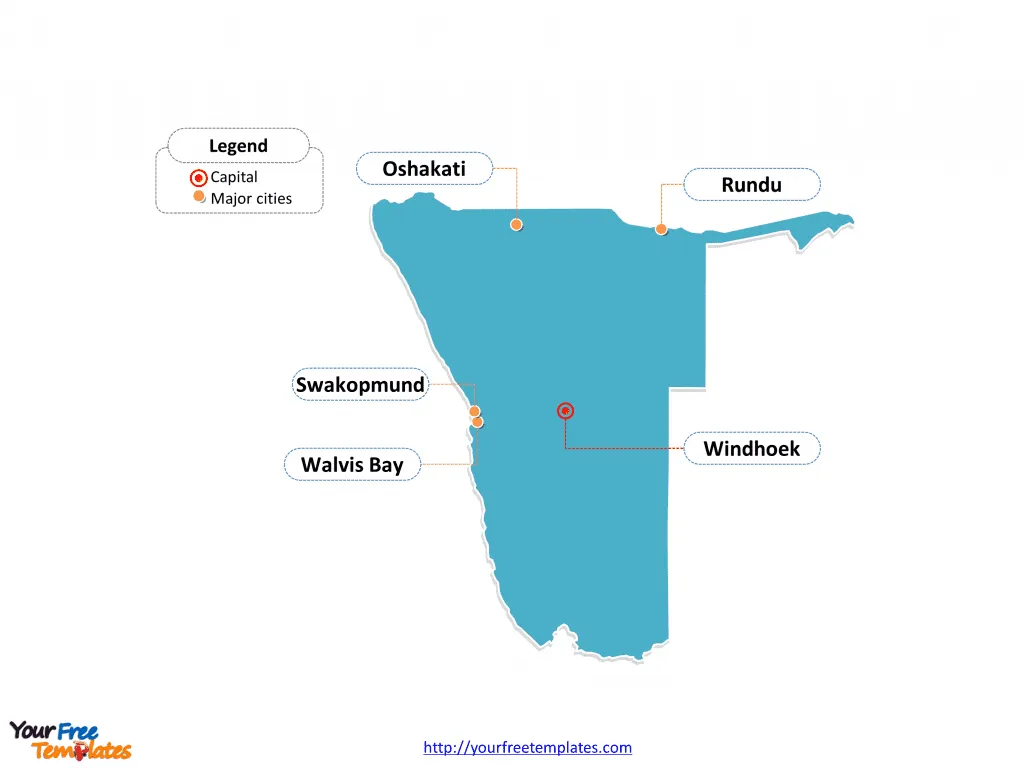
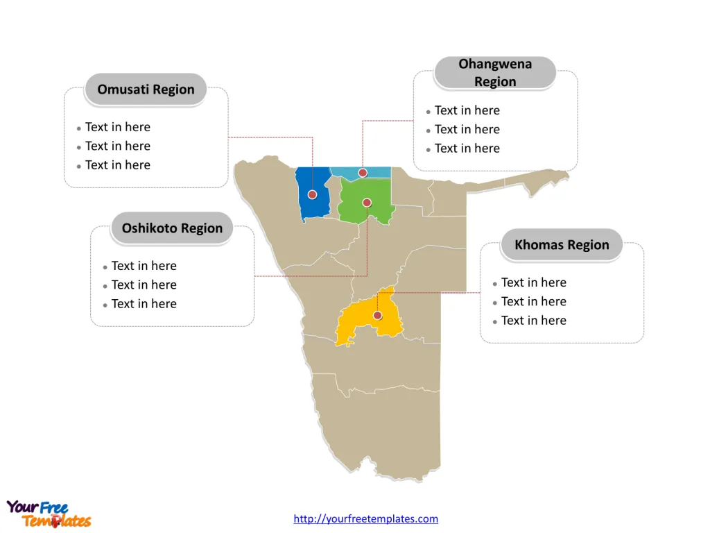
The Namibia Map Template includes two slides. Namibia map with 14 regions, labeling major regions, Khomas Region, Ohangwena Region, Omusati Region, and Oshikoto Region. Namibia Outline map labeled with capital and major cities, Windhoek, Walvis Bay, Rundu, Swakopmund, and Oshakati.
Location of Namibia Namibia is a country located in southern Africa, bordering the Atlantic Ocean, Angola, Botswana, South Africa, and Zambia. The country features the Namib Desert along its coast and the Kalahari Desert in the east, contributing to its diverse geography.
Population The estimated population of Namibia as of 2022 is approximately 2,727,409 people. The majority of Namibians reside in rural areas, particularly in the well-watered north and northeast parts of the country.
Economy Namibia has a mixed economic system with a variety of private freedom combined with centralized economic planning and government regulation. The country’s economy is closely linked to South Africa, with a significant portion of its revenues coming from the Southern African Customs Union. The nation’s economy is heavily dependent on the extraction and processing of minerals for export, with mining accounting for a substantial portion of its GDP.
Neighboring Countries Namibia shares its borders with several countries, including Angola to the north, Botswana to the east, South Africa to the southeast and south, and Zambia to the northeast. These neighboring countries play a significant role in trade and regional cooperation with Namibia.
Slide 1, Namibia map labeled with capital and major cities.
Its capital and largest city is Windhoek, other major cities including Walvis Bay, Rundu, Swakopmund, and Oshakati.
Major Cities on Namibia Map
Windhoek
- Population: Windhoek, the capital city of Namibia, has an estimated population of 486,169 as of the latest census in 2023.
- Significance: Windhoek is a bustling city located in the Khomas Region and serves as the political, economic, and cultural center of Namibia. The city showcases a mix of historical German colonial architecture and modern African urban lifestyle.

Walvis Bay
- Population: Walvis Bay, a major port city, has a population of approximately 118,625 people.
- Significance: Walvis Bay, situated in the Erongo Region, is a crucial transport and economic hub known for its natural harbor, fisheries, and industrial activities.
Rundu
- Population: Rundu, located in the Kavango East Region, has a population of around 118,625 people.
- Significance: Rundu is a significant city known for its location along the Kavango River, serving as a commercial and administrative center for the region.
Swakopmund
- Population: Swakopmund, a coastal city, has a population of approximately 75,921 people.
- Significance: Swakopmund, situated in the Erongo Region, is a popular tourist destination known for its German colonial architecture, beautiful beaches, and outdoor recreational activities.
Oshakati
- Population: Oshakati, located in the Oshana Region, has a population of around 27,784 people.
- Significance: Oshakati is a major urban center in northern Namibia, serving as an important commercial and administrative hub for the region.
Slide 2, Namibia map labeled with major administration districts.
Namibia is a country divided into 14 regions: they are Karas Region, Erongo Region, Hardap Region, Kavango East Region, Kavango West Region, Khomas Region, Kunene Region, Ohangwena Region, Omaheke Region, Omusati Region, Oshana Region, Oshikoto Region, Otjozondjupa Region, and Zambezi Region. Every individual political subdivision is an editable shape.
Major Regions on Namibia Map
Khomas Region
- Capital: Windhoek serves as the capital of the Khomas Region.
- Significance: The Khomas Region, with Windhoek at its center, is the political and economic heart of Namibia, housing key government institutions and a vibrant business community.

Ohangwena Region
- Capital: The regional capital of Ohangwena is Eenhana.
- Significance: The Ohangwena Region, located in the northern part of Namibia, is known for its agricultural activities and cultural heritage.
Omusati Region
- Capital: The regional capital of Omusati is Outapi.
- Significance: The Omusati Region is an important agricultural and commercial area, contributing to Namibia’s food production and economic growth.
Oshikoto Region
- Capital: The regional capital of Oshikoto is Tsumeb.
- Significance: The Oshikoto Region is notable for its mining activities, cultural diversity, and historical landmarks.
These major cities and regions play essential roles in shaping Namibia’s urban landscape, economic development, and cultural diversity, contributing to the country’s overall progress and identity.
Looking for Premium maps, please visit our affiliate site: https://editablemaps.com/ or https://ofomaps.com/
Size: 93K
Type: PPTX
Aspect Ratio: Standard 4:3
Click the blue button to download it.
Download the 4:3 Template
Aspect Ratio: Widescreen 16:9
Click the green button to download it.
Download the 16:9 Template


