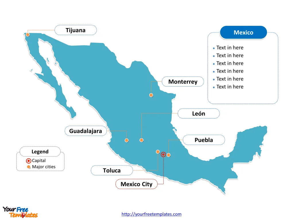
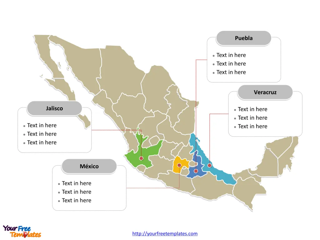
The Mexico Map Template includes two slides. Mexico map with 31 states and 1 federal district, highlighting Jalisco, México, Puebla, and Veracruz states. Mexico PowerPoint map labeled with Mexico City, Guadalajara, Monterrey, Puebla, Toluca, Tijuana, and León cities.
Slide 1, Mexico map labeled with capital and major cities.
Nestled between the United States to the north and the Central American nations to the south, Mexico is a vibrant country marked by diverse landscapes that include beaches, mountains, and deserts. It is bordered by the Pacific Ocean to the west and the Gulf of Mexico and Caribbean Sea to the east.
Its capital and largest city is Mexico City, other major cities including Guadalajara, Monterrey, Puebla, Toluca, Tijuana, and León on Mexico map.
Major Cities:
- Mexico City – The heart of the nation and the capital, Mexico City is the sprawling, bustling metropolis known for its rich history, vibrant culture, and as a hub of economic activity.
- Guadalajara, Jalisco – Renowned for being the birthplace of mariachi music and tequila, Guadalajara is Mexico’s second-largest city and is rich in culture and traditions.
- Monterrey, Nuevo León – As one of the most important economic centers in the country, Monterrey is known for its industrial prowess and stunning surrounding mountains.
- Puebla, Puebla – This city is famous for its culinary heritage, colonial architecture, and significant history.
- Cancún, Quintana Roo – A world-famous tourist destination, known for its stunning Caribbean beaches, resorts, and nightlife.

Slide 2, Mexico map labeled with major administration districts.
Mexico is a country composed of 31 states and 1 federal district in this Mexico map: Aguascalientes, Baja California, Baja California Sur, Campeche, Chiapas, Chihuahua, Coahuila, Colima, Durango, Guanajuato, Guerrero, Hidalgo, Jalisco, México, Michoacán, Morelos, Nayarit, Nuevo León, Oaxaca, Puebla, Querétaro, Quintana Roo, San Luis Potosí, Sinaloa, Sonora, Tabasco, Tamaulipas, Tlaxcala, Veracruz, Yucatán, Zacatecas and Distrito Federal. Every individual political subdivision in our Mexico map is an editable shape.
Some of the major states on Mexico map.
- Jalisco – Besides Guadalajara, it’s home to the town of Tequila and the beautiful Lake Chapala.
- Nuevo León – Dominated by the bustling city of Monterrey and known for its business opportunities.
- Oaxaca – Celebrated for its indigenous cultures, artisan crafts, and culinary delights.
- Chiapas – Rich in natural beauty, from the Palenque ruins to the stunning Sumidero Canyon.
- Yucatán – Known for the famous Chichen Itza ruins, cenotes, and unique Mayan heritage.
Federal District:
- Mexico City (Ciudad de México) – The Federal District, akin to Washington D.C. in the United States, is not part of any state but serves as the country’s capital and federal seat of government.

Mexico’s Economy: An Overview
Mexico’s economy is a vibrant and complex mix of modern industry, agriculture, and services, making it one of the most significant in Latin America and the 15th largest in the world by nominal GDP. Its economy is characterized by its rich natural resources, a diverse manufacturing sector, and a rapidly growing service industry.
Natural Resources and Agriculture: Mexico is rich in natural resources such as silver, crude oil, copper, gold, and zinc, which play a crucial role in its export earnings. The country is one of the world’s top producers of silver and oil, although it has faced challenges with declining oil production in recent years. Agriculture also remains an important sector, with Mexico being a major producer of products like avocados, lemons, and tomatoes. The agricultural sector has benefited from the country’s varied climate and terrain, allowing for a wide range of crops.
Manufacturing and Trade: The manufacturing sector in Mexico is highly developed, with a strong focus on automobiles, electronics, and consumer goods. The country is a major exporter of manufactured products, thanks to its participation in the North American Free Trade Agreement (NAFTA), now updated and replaced by the United States-Mexico-Canada Agreement (USMCA). This trade agreement has bolstered Mexico’s trade relationships with its neighbors, particularly the United States, which is its largest trading partner.
Services and Tourism: The service sector, including tourism, financial services, and telecommunications, has seen substantial growth and diversification in recent years. Mexico’s rich cultural heritage and warm climate make it a popular destination for tourists from around the globe, contributing significantly to the nation’s GDP. The financial services sector is expanding, with a growing middle class and increased foreign investment.
Challenges and Opportunities: Mexico’s economy faces challenges such as income inequality, labor market informalities, and the need for educational reform to boost productivity. However, the country’s young workforce and ongoing economic reforms present opportunities for growth and development.
The Mexican government has implemented various economic reforms aiming to modernize labor laws, improve competitiveness, and reduce the regulatory burden on businesses. These reforms, along with investment in infrastructure and innovation, are designed to enhance the economy’s potential for sustained growth and to integrate it further into the global market.
Overall, Mexico’s economy offers a dynamic and evolving landscape with an array of sectors contributing to its resilience and potential for future prosperity.
Detailed Mexico map of political administrative divisions please refer to Wikipedia Mexico.
Size: 150K
Type: PPTX
Aspect Ratio: Standard 4:3
Click the blue button to download it.
Download the 4:3 Template
Aspect Ratio: Widescreen 16:9
Click the green button to download it.
Download the 16:9 Template


