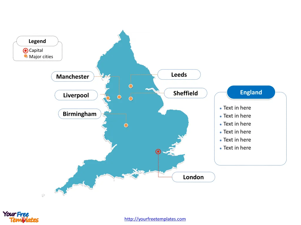
Firstly England map with 83 counties, labeling with major counties, Kent, Essex, Hampshire, and Lancashire. Secondly Map of England with 9 regions, labeling with major regions, South East, London, North West, and East of England. Thirdly England outline map labeling with country capital and major cities, London, Birmingham, Sheffield, Manchester, Liverpool, and Leeds.
Slide 1, England map labeled with capital and major cities.
England is a country that is part of the United Kingdom in Europe. It is noted that Great Britain, which is composing of four countries, which are England, Scotland, Wales and Northern Ireland. Its capital and largest city is London, other major cities including Birmingham, Sheffield, Manchester, Liverpool, and Leeds.
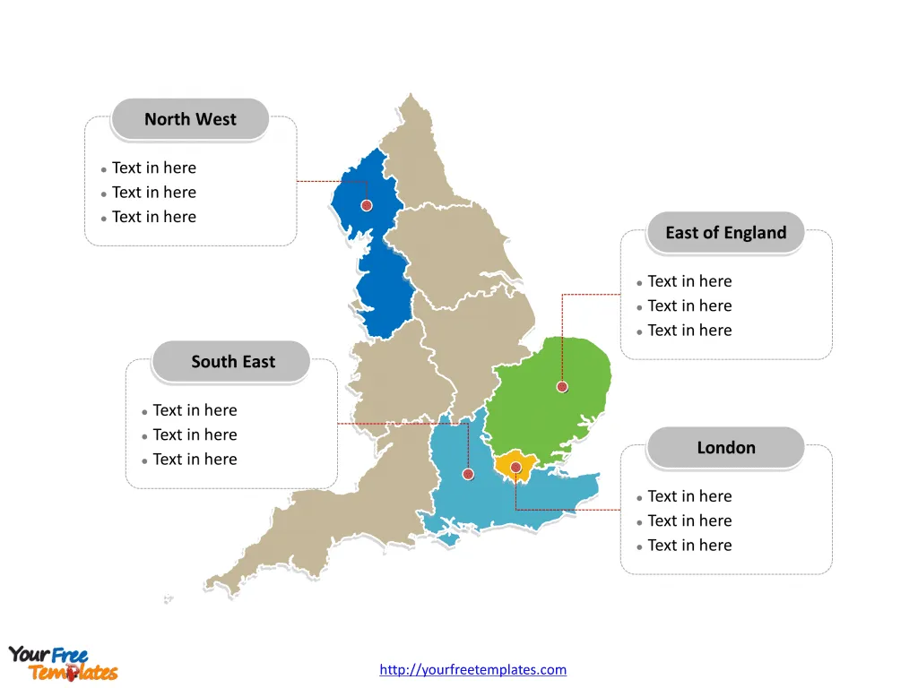
Slide 2, Map of England labeled with major regions.
England is divided into nine government office regions, each comprising several counties and districts. These regions were created in 1994 for various administrative purposes. Here, we will explore these nine regions and highlight some of the major counties within the 83 metropolitan and non-metropolitan counties of England.
East of England
The East of England region is known for its flat landscape, comprising counties such as Norfolk, Suffolk, and Essex. Norfolk and Suffolk offer picturesque rural landscapes and coastlines, while Essex, with its proximity to London, is a mix of modern urban areas and historic countryside.
East Midlands
This region includes counties like Nottinghamshire, Derbyshire, and Leicestershire. Nottinghamshire is famous for the legend of Robin Hood. Derbyshire is known for the scenic Peak District National Park, and Leicestershire for its storied history and the discovery of King Richard III’s remains.
London
The capital’s region is Greater London, a ceremonial county and the political, economic, and cultural heart of the country. It consists of 32 boroughs, each with its unique character, from the historic City of Westminster to the diverse and vibrant borough of Camden.
North East
Comprising counties such as Northumberland, County Durham, and Tyne and Wear, the North East is rich in history with Roman sites like Hadrian’s Wall and vibrant cities such as Newcastle upon Tyne.
North West
Home to the metropolitan counties of Greater Manchester and Merseyside, the North West region is a hub of industry, culture, and sport. Manchester is a thriving metropolis known for its music scene and football teams, while Liverpool, part of Merseyside, boasts a rich maritime history and cultural heritage, including The Beatles.
South East
The South East is the most populous region and includes significant counties like Kent, Surrey, and Hampshire. Kent is known as the “Garden of England” for its orchards and hop gardens, Surrey for its affluent towns and proximity to London, and Hampshire for its ports like Southampton and Portsmouth.
South West
This region encompasses counties such as Devon, Cornwall, and Somerset. It is famed for its rugged coastlines, moorlands, and cultural heritage, with Cornwall being recognized for its distinct language and traditions.
West Midlands
The West Midlands includes the metropolitan county of the same name, encompassing cities like Birmingham and Coventry. The region is historically known as the “Black Country” for its role in the Industrial Revolution.
Yorkshire and the Humber
Featuring the metropolitan county of West Yorkshire, which includes the city of Leeds known for its shopping and nightlife, and South Yorkshire with Sheffield, this region boasts a rich industrial past and areas of natural beauty such as the Yorkshire Dales.
Slide 3, England map labeled with major counties.
England is a country with 83 metropolitan and non-metropolitan counties.
Major Counties
Within these regions, there are both metropolitan and non-metropolitan counties, some of which are unitary authorities responsible for all local government functions.
Metropolitan Counties
- Greater Manchester: An urban county with a strong industrial heritage.
- Merseyside: Known for its cultural contributions, especially music.
- South Yorkshire: An area with a rich history in steel production.
- West Yorkshire: Noted for its historical significance in the textile industry.
- Tyne and Wear: Renowned for Newcastle and its shipbuilding past.
Non-Metropolitan Counties
- Kent: A county known for its beautiful landscapes and historic cities like Canterbury.
- Essex: Combines modern cities with charming rural towns.
- Surrey: One of the Home Counties bordering London, known for its affluent areas.
Unitary Authorities
- Buckinghamshire: A county with market towns and rolling countryside.
- Cornwall: Known for its distinct cultural identity and stunning coastal scenery.
- Durham: Home to the historic city of Durham with its famous cathedral and castle.
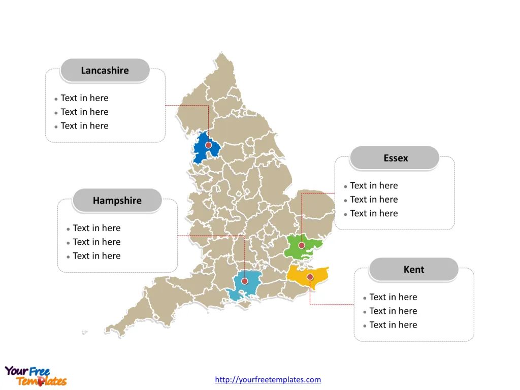
Every individual political subdivision is an editable shape. Check detailed England map in Wikipedia.
Size: 335K
Type: PPTX
[sociallocker]Aspect Ratio: Standard 4:3
Click the blue button to download it.
Download the 4:3 Template
Aspect Ratio: Widescreen 16:9
Click the green button to download it.
Download the 16:9 Template[/sociallocker]
