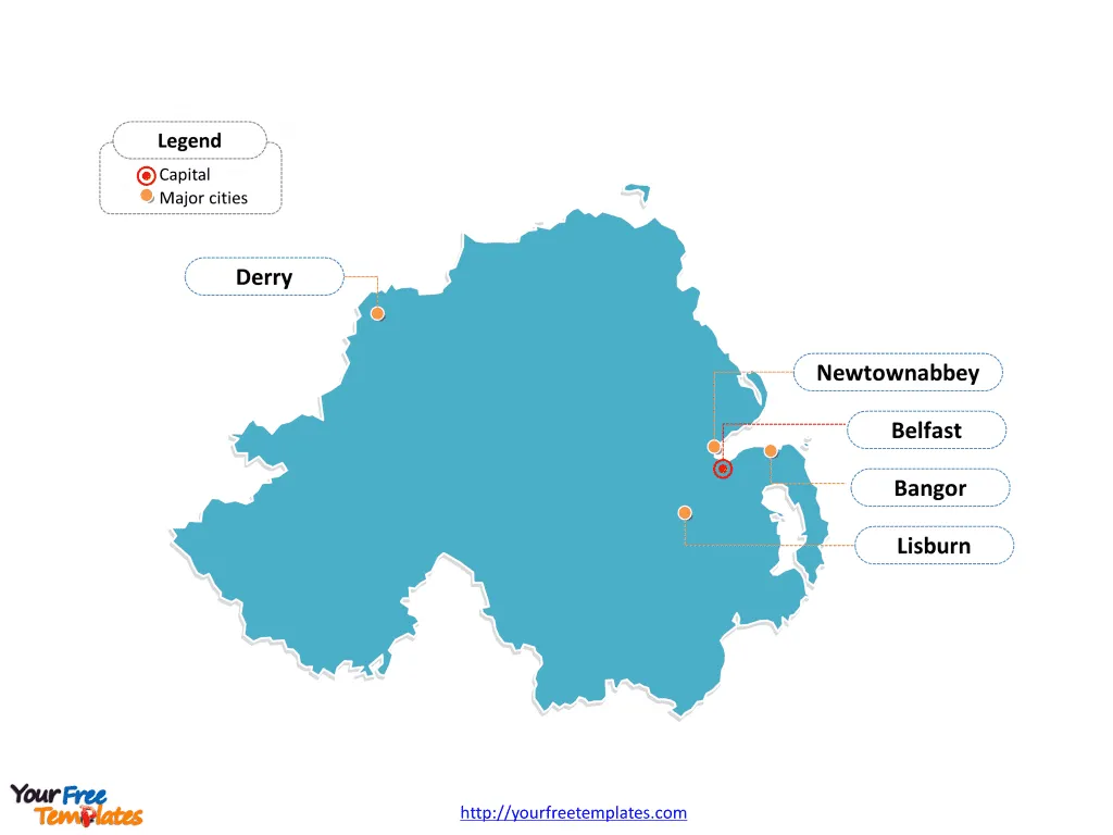
The Northern Ireland Map Template includes three slides. Northern Ireland map with 11 districts, labeling with major districts, Belfast, Armagh City, Banbridge and Craigavon, Newry, Mourne and Down, Ards and North Down. Northern Ireland map labeling with country capital and major cities, Belfast, Derry, Lisburn, Newtownabbey, and Bangor.
Northern Ireland, occupying about one-sixth of the island of Ireland, is separated from Scotland by the narrow North Channel and shares borders with the Republic of Ireland to the south and west. It is bordered by the Irish Sea to the east and southeast and the Atlantic Ocean to the north. With a population of approximately 1,810,863, its economy has strong links with the Republic of Ireland and Great Britain. Northern Ireland’s GDP per capita is greater than both North East England and Wales.
The region has strong trade ties with the European Union, North America, and Asia & Oceania. Despite historical challenges, the economy has grown rapidly, particularly in the 1990s, benefiting from the peace dividend. However, there are regional disparities, with areas of high deprivation, and unemployment rates have fallen substantially in recent years.
Slide 1, Northern Ireland map labeled with capital and major cities.
Northern Ireland is a part of the United Kingdom in the north-east of Ireland. Its capital and largest city is Belfast, other major cities including Derry, Lisburn, Newtownabbey, and Bangor.
Northern Ireland’s Capital and Major Cities on Northern Ireland map
Belfast: The Vibrant Capital
Belfast, the capital and largest city of Northern Ireland, stands as a bustling metropolis with a rich industrial and maritime heritage. With a population of over 340,000, Belfast is a significant economic, cultural, and administrative hub, boasting a vibrant arts scene, historical landmarks, and a thriving waterfront district.

Derry: A Historical Gem
Derry, also known as Londonderry, is celebrated for its rich historical heritage and stunning city walls. With a population of over 85,000, Derry offers a blend of cultural richness and historical significance, making it a compelling destination for visitors and a vibrant hub for residents.
Lisburn: A Picturesque Township
Lisburn, situated southwest of Belfast, offers a serene escape with its picturesque landscapes and charming city center. With a population of over 71,000, Lisburn stands out for its blend of historical charm and modern conveniences, creating an inviting atmosphere for visitors and residents.
Newtownabbey: A Thriving Suburb
Newtownabbey, located north of Belfast, is known for its thriving suburban atmosphere and close proximity to the bustling capital. With a population of over 85,000, Newtownabbey offers a blend of residential comfort and urban accessibility, making it an appealing destination for those seeking a balance between city life and tranquility.
Bangor: A Coastal Haven
Bangor, situated on the coast of County Down, offers a unique blend of coastal beauty and historical charm. With a population of over 60,000, Bangor stands as a captivating destination for visitors and residents, boasting scenic coastal views and a vibrant town center.
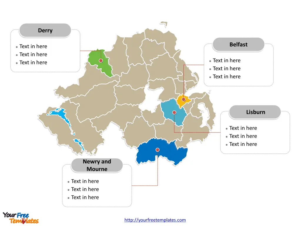
Slide 2, Northern Ireland map labeled with former major Local Government Districts.
Northern Ireland is a country former with 26 districts; they are Antrim, Ards, Armagh, Ballymena, Ballymoney, Banbridge, Belfast, Carrickfergus, Castlereagh, Coleraine, Cookstown, Craigavon, Derry, Down, Dungannon and South Tyrone, Fermanagh, Larne, Limavady, and Lisburn. Every individual political subdivision is an editable shape.

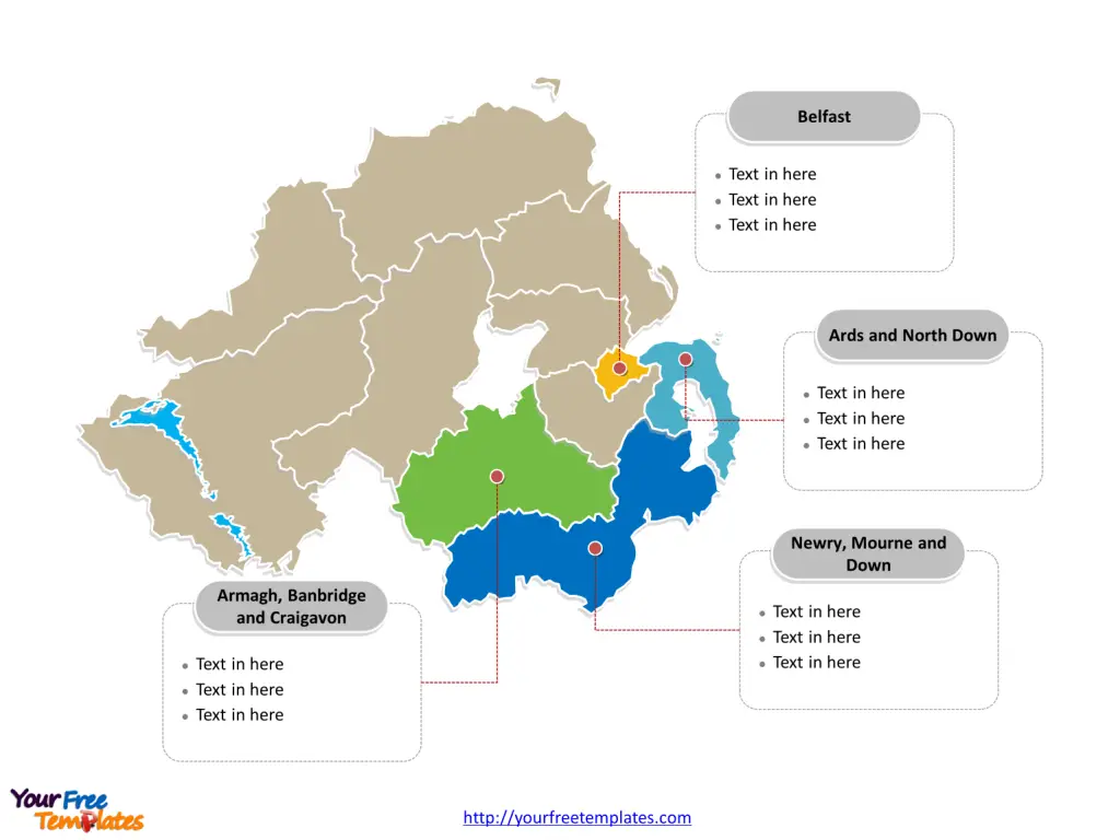
Slide 3, Northern Ireland map labeled with current major administration districts.
In 1st 2015 when 26 districts were merged into eleven larger districts Northern Ireland is a country with eleven districts; they are Antrim and Newtownabbey, Ards and North Down, Armagh City, Banbridge and Craigavon, Belfast, Causeway Coast and Glens, Derry City and Strabane, Fermanagh and Omagh, Lisburn and Castlereagh, Mid and East Antrim, Mid Ulster, Newry, Mourne and Down. Every individual political subdivision is an editable shape.
Major Districts on Northern Ireland map
Belfast District
The Belfast District, encompassing the capital city, is a significant administrative, economic, and cultural hub, playing a pivotal role in shaping Northern Ireland’s national identity and development.

Armagh City, Banbridge, and Craigavon District
The Armagh City, Banbridge, and Craigavon District offers a blend of historical significance and economic influence, shaping the region’s urban and rural landscape.
Newry, Mourne, and Down District
The Newry, Mourne, and Down District, with Newry as a notable city, is celebrated for its natural beauty and cultural allure, contributing to Northern Ireland’s diverse urban and rural fabric.
Ards and North Down District
The Ards and North Down District, encompassing Bangor, is known for its coastal allure and historical significance, adding to Northern Ireland’s rich tapestry of cultural and natural attractions.
Northern Ireland’s capital, major cities, and significant districts collectively contribute to the region’s cultural, historical, and economic landscape, making it a captivating destination for visitors and a dynamic hub for residents.
The diverse array of urban centers and significant districts showcases Northern Ireland’s unique blend of historical heritage, urban vibrancy, and natural beauty, making it a compelling subject for exploration and discovery.
Looking for Premium maps, please visit our affiliate site: https://editablemaps.com/ or https://ofomaps.com/
Size: 205K
Type: PPTX
Aspect Ratio: Standard 4:3
Click the blue button to download it.
Download the 4:3 Template
Aspect Ratio: Widescreen 16:9
Click the green button to download it.
Download the 16:9 Template


