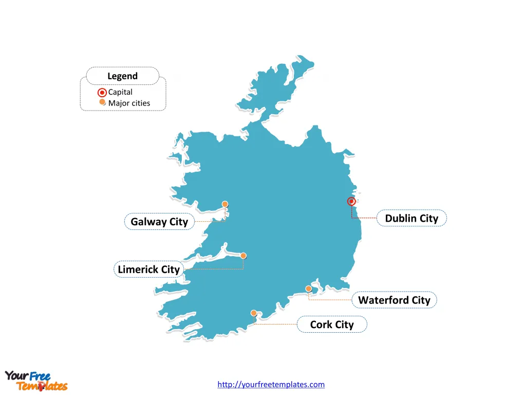
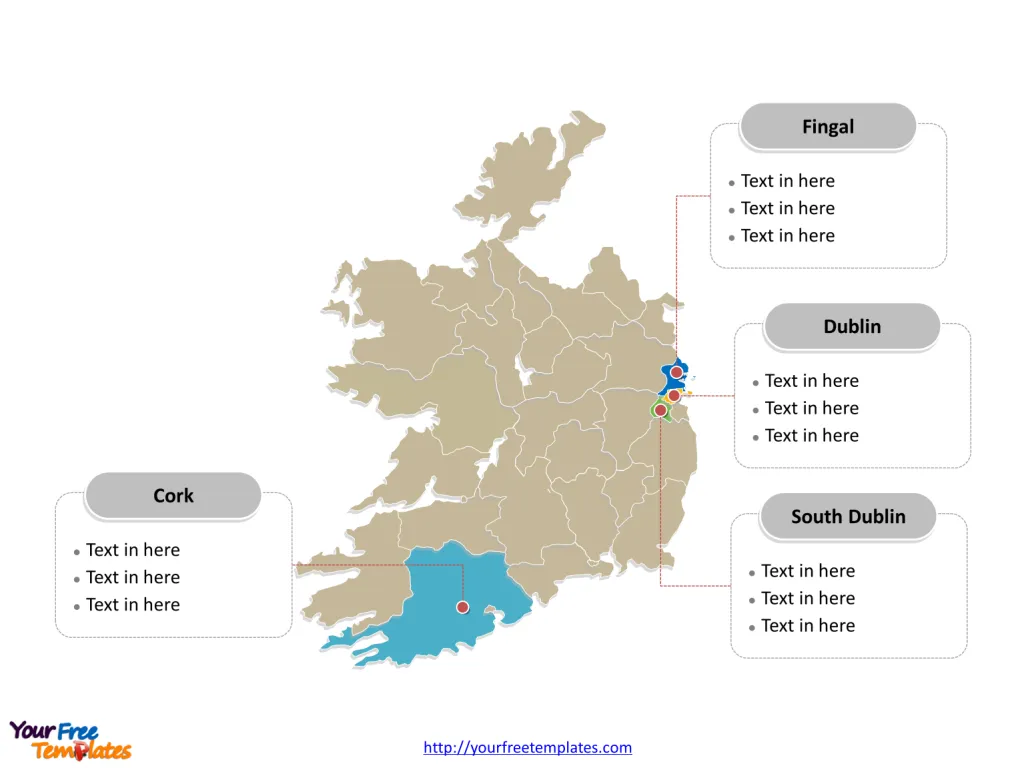
The Ireland Map Template includes two slides. Republic of Ireland map with thirty-one local authorities, labeling major counties, Dublin, Cork, Fingal, and South Dublin. Ireland map labeled with capital and major cities, Dublin, Belfast, Cork, Limerick and Waterford.
Ireland, located in Northwestern Europe, is an island nation that shares its borders with the United Kingdom. The Republic of Ireland, occupying most of the island, has a population of over 4.9 million people.
The country’s economy is classified as a high-income economy and is heavily reliant on industries such as pharmaceuticals, technology, and agriculture. Ireland’s major trading partners include the United States, the United Kingdom, Belgium, Germany, and Switzerland. The nation’s geographic proximity to the United Kingdom influences its trade relationships and political interactions, shaping its economic outlook and regional dynamics.
Slide 1, Ireland map labeled with capital and major cities.
Its capital and largest city is Dublin, other major cities including Cork, Limerick and Waterford.
Capital and Major Cities on Ireland Map
Dublin: The Dynamic Capital
Dublin, the capital and largest city of Ireland, is located on the country’s eastern coast. With a population of over 1.2 million in the Greater Dublin Area, the city serves as a significant economic, cultural, and administrative center. Dublin’s historical landmarks, vibrant arts scene, and modern urban developments make it a prominent global city.

Belfast: A City of Resilience
Belfast, the capital of Northern Ireland, is the largest city in the region. With a population of approximately 340,000, Belfast is known for its rich history, diverse cultural offerings, and redeveloped waterfront. The city’s resilience and evolving identity contribute to its significance within Northern Ireland.
Cork: A Hub of Creativity
Cork, the second-largest city in Ireland, is situated in the province of Munster. With a population of over 210,000, Cork is celebrated for its welcoming atmosphere, rich cultural heritage, and thriving arts scene. The city’s status as a center for education, industry, and the arts adds to its allure.
Limerick: A City of Heritage
Limerick, located in the province of Munster, is the third-largest city in Ireland with a population of approximately 94,192. Known for its historical waterfront and connection to the Shannon River, Limerick’s cultural richness and modern revitalization make it a captivating destination.
Waterford: A Coastal Gem
Waterford, situated in the province of Munster, is known for its scenic coastal beauty and historical significance. With a population of over 53,504, the city’s maritime heritage and cultural attractions add to its appeal as a destination for visitors and residents alike.
Slide 2, Ireland map labeled with major administration districts.
Republic of Ireland map shows the country divided into thirty-one local authorities: Carlow, Cavan, Clare, Cork, Cork City, Donegal, Dublin City, Dún Laoghaire–Rathdown, Fingal, Galway, Galway City, Kerry, Kildare, Kilkenny, Laois, Leitrim, Limerick, Longford, Louth, Mayo, Meath, Monaghan, Offaly, Roscommon, Sligo, South Dublin, Tipperary, Waterford, Westmeath, Wexford, and Wicklow. Every individual political subdivision is an editable shape.
Major Counties on Ireland Map
The Dublin County encompasses the capital city and serves as a significant administrative, economic, and cultural hub, playing a pivotal role in shaping Ireland’s national identity and development.

The Cork County, with Cork as its largest city, offers a blend of cultural richness and economic significance, contributing to the region’s importance within Ireland’s landscape.
The Fingal County, located in the province of Leinster, covers a diverse area and plays a vital role in Ireland’s economic, administrative, and cultural fabric.
The South Dublin County is known for its blend of urban and rural landscapes, contributing to Ireland’s economic, administrative, and cultural diversity.
Ireland’s capital, major cities, and significant counties collectively contribute to the country’s cultural, historical, and economic landscape, making it a captivating destination for visitors and a dynamic hub for residents.
Looking for Premium maps, please visit our affiliate site: https://editablemaps.com/ or https://ofomaps.com/
Size: 168K
Type: PPTX
Aspect Ratio: Standard 4:3
Click the blue button to download it.
Download the 4:3 Template
Aspect Ratio: Widescreen 16:9
Click the green button to download it.
Download the 16:9 Template


