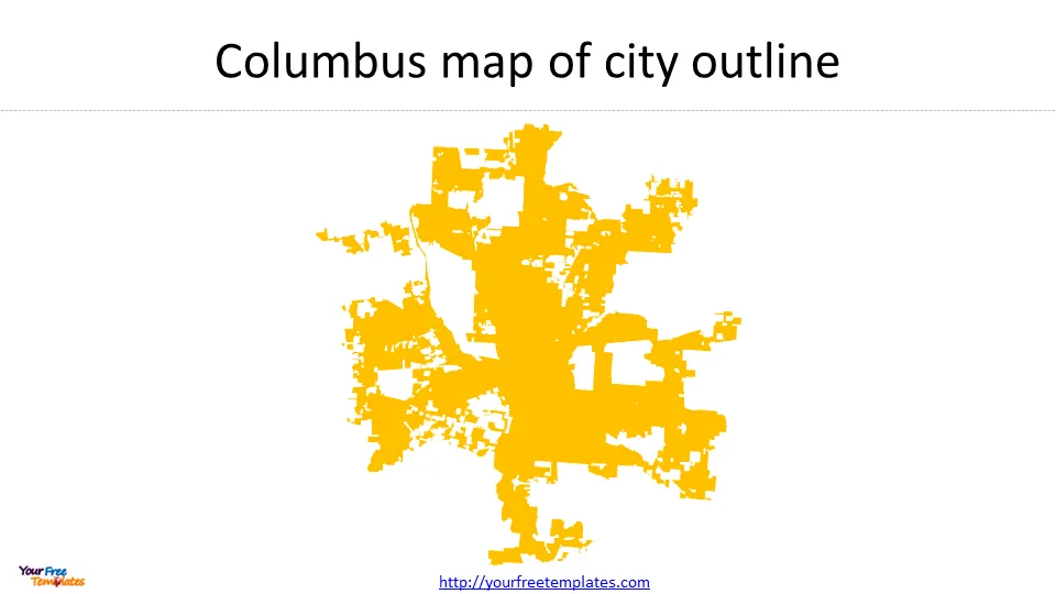
The Columbus map template in PowerPoint format includes 4 slides. Firstly, we have the Columbus map template for the city outline. Secondly, we present Columbus Area Commissions. In the end it is Columbus map template for Community Planning Areas and City Council Districts templates. As the same diagram PowerPoint template series, you can also find our Carbon footprint, Carbon neutral, Data Mining, Machine Learning, cloud computing, Artificial Intelligence and BlockChain PowerPoint templates.
Slide 1, Columbus map of city outline.
Columbus is the largest city in Ohio and the state capital. It is a diverse, bustling city with a thriving arts and culture scene, a rich history, and plenty of outdoor activities. Columbus is known for its friendly residents, beautiful parks, and world-class museums. The city is also home to a fantastic culinary scene, with many great restaurants serving a variety of delicious cuisines.

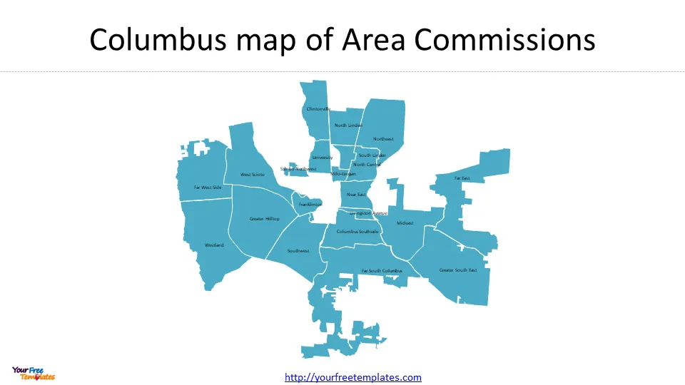
Slide 2, Columbus map with Area Commissions
The Ohio Columbus Area Commission is not a specific commission or entity, but rather a reference to the various area commissions in Columbus, Ohio. These commissions are groups of volunteer residents appointed by the mayor and city council members to provide advice and guidance on zoning, development, and other community issues within a specific geographic area.

There are 21 Area Commissions in Ohio Columbus city. They are 5th by Northwest, Clintonville, Columbus Southside, Far East, Far South Columbus, Far West Side, Franklinton, Greater Hilltop, Greater South East, Livingston Avenue, Mideast, Milo-Grogan, Near East, North Central, North Linden, Northeast, South Linden, Southwest, University, West Scioto, and Westland.
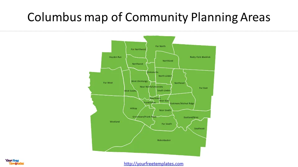
Slide 3, Columbus map with Community Planning Areas
Community planning areas are used by City departments for a variety of planning and reporting purposes.

There are 27 Community Planning Areas in Ohio Columbus city. They are Clintonville, Downtown, Eastland/Brice, Eastmoor/Walnut Ridge, Far East, Far North, Far Northwest, Far South, Far West, Franklinton, Greenlawn/Frank Road, Hayden Run, Hilltop, Near East, Near North/University, Near South, North Linden, Northeast, Northland, Northwest, Rickenbacker, Rocky Fork-Blacklick, South Linden, Southeast, West Olentangy, West Scioto, and Westland.
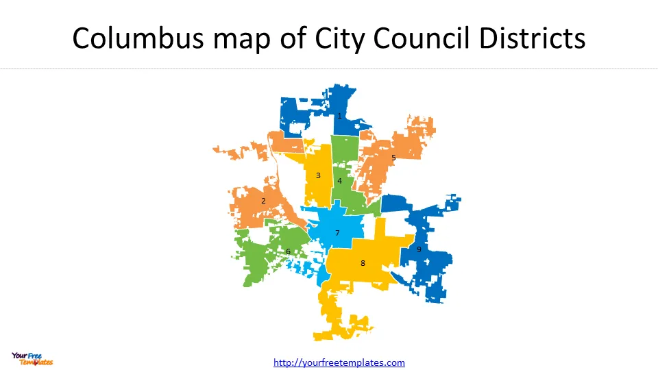
Slide 4, Columbus map City Council Districts
There are nine council districts in Columbus. The Columbus City Council is the lawmaking body of Columbus, Ohio.

The top 3 must-do activities in Columbus, Ohio are as follows.
- Visit the Columbus Zoo and Aquarium
The Columbus Zoo and Aquarium is one of the top-rated zoos in the country, and it is a must-see attraction for animal lovers of all ages. The zoo is home to over 10,000 animals, including rare and endangered species from around the world. Be sure to check out the Heart of Africa exhibit, which features a replica African savanna and allows visitors to get up close and personal with giraffes, zebras, and other African wildlife.
- Explore the Franklin Park Conservatory and Botanical Gardens
The Franklin Park Conservatory and Botanical Gardens is a beautiful oasis in the heart of Columbus. The conservatory features a variety of indoor and outdoor gardens, including a tropical rainforest, a desert garden, and a butterfly garden. There are also several art installations and exhibitions on display throughout the year.
- Tour the Ohio Statehouse
The Ohio Statehouse is a historic building that has been the seat of Ohio’s government since 1857. The building is open to the public for tours, which include a visit to the House and Senate chambers, the Rotunda, and the Governor’s office. Be sure to check out the Statehouse Museum, which features exhibits on Ohio’s history and government.
For other interesting maps, pls visit our ofomaps.com
Size:304K
Type: PPTX
Aspect Ratio: Standard 4:3
Click the blue button to download the maps.
Download the 4:3 Template
Aspect Ratio: Widescreen 16:9
Click the green button to download the maps.
Download the 16:9 Template


