Calgary is the largest city in the Alberta province of Canada. Our Calgary downtown map has three slides, labeling the location, the names or codes of 62 communities in central sector of Calgary.
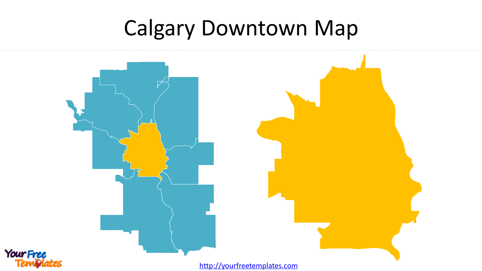
Slide 1, City of calgary map with sectors
The Calgary Downtown is located in the Central sector of this city. In addition to the center, you can also find the 7 sectors of Calgary, which are East, North East, North, North West, West, South and South East.

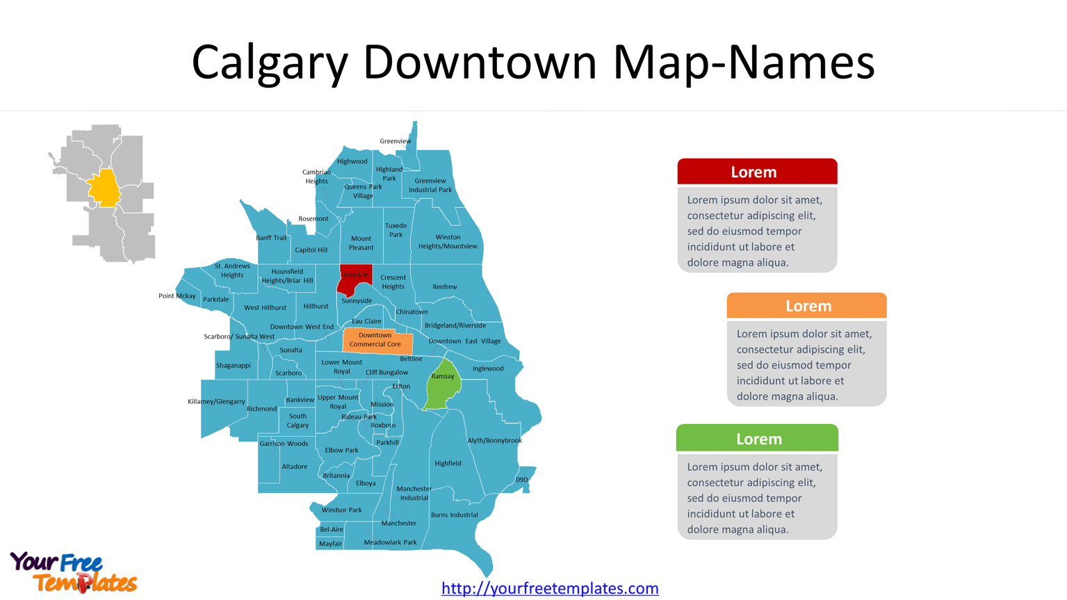
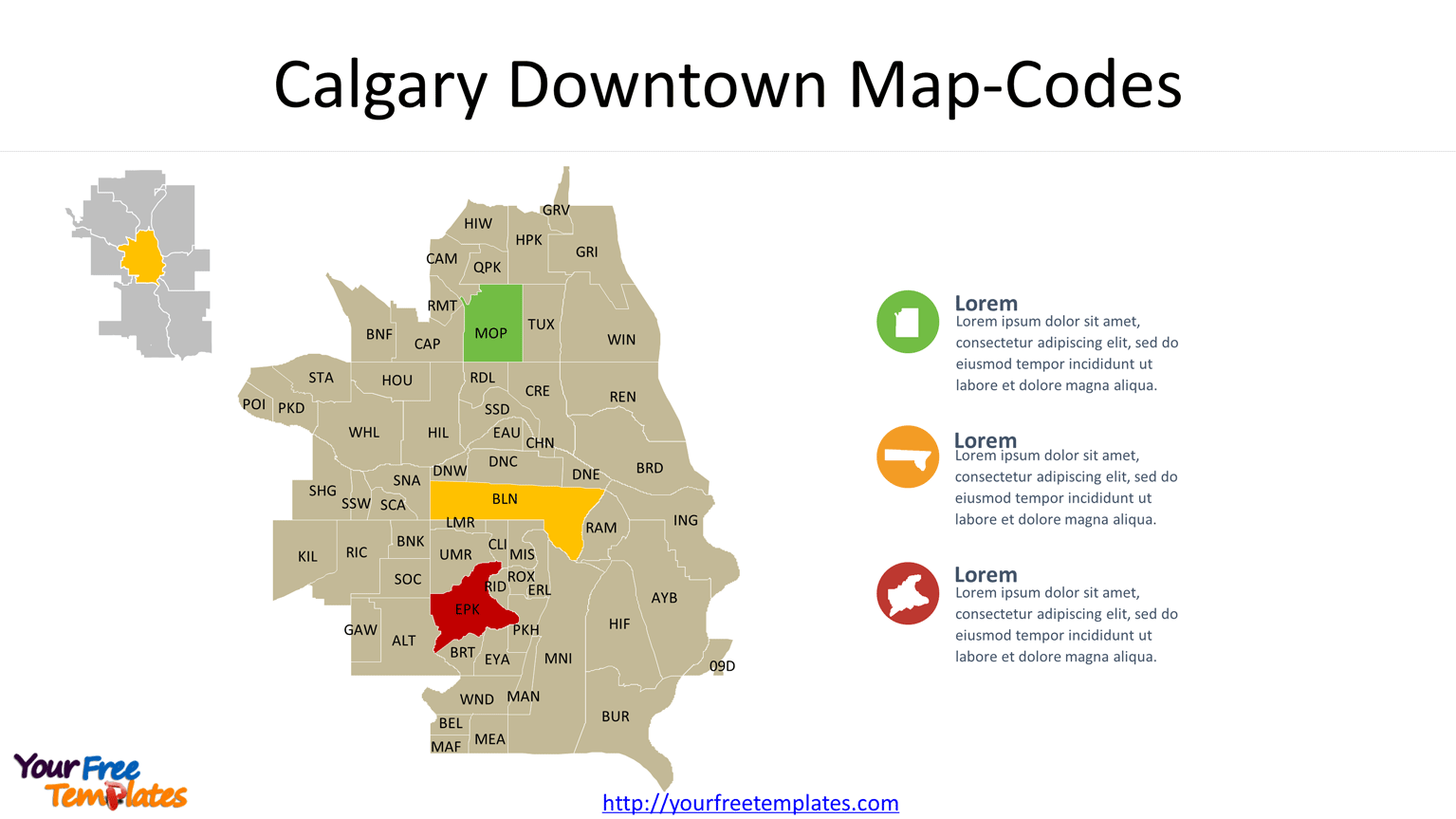
Slide 2&3, Calgary Downtown Map with Names or Codes of communities
It is well noted that there are 62 communities for the downtown. They are listed below with codes in the brackets.

For this downtown calgary map, they are listed below with codes in the brackets. They are 09D(09D), Altadore(ALT), Alyth/Bonnybrook(AYB), Bel-Aire(BEL), Beltline(BLN), Banff Trail(BNF), Bankview(BNK), Bridgeland/Riverside(BRD), Britannia(BRT), Burns Industrial(BUR), Cambrian Heights(CAM), Capitol Hill(CAP), Chinatown(CHN), Cliff Bungalow(CLI), Crescent Heights(CRE), Downtown Commercial Core(DNC), Downtown East Village(DNE), Downtown West End(DNW), Eau Claire(EAU), Elbow Park(EPK), Erlton(ERL), Elboya(EYA), Garrison Woods(GAW), Greenview Industrial Park(GRI), Greenview(GRV), Highfield(HIF), Hillhurst(HIL), Highwood(HIW), Hounsfield Heights/Briar Hill(HOU), Highland Park(HPK), Inglewood(ING), Killarney/Glengarry(KIL), Lower Mount Royal(LMR), Mayfair(MAF), Manchester(MAN), Meadowlark Park(MEA), Mission(MIS), Manchester Industrial(MNI), Mount Pleasant(MOP), Parkdale(PKD), Parkhill(PKH), Point Mckay(POI), Queens Park Village(QPK), Ramsay(RAM), Rosedale(RDL), Renfrew(REN), Richmond(RIC), Rideau Park(RID), Rosemont(RMT), Roxboro(ROX), Scarboro(SCA), Shaganappi(SHG), Sunalta(SNA), South Calgary(SOC), Sunnyside(SSD), Scarboro/ Sunalta West(SSW), St. Andrews Heights(STA), Tuxedo Park(TUX), Upper Mount Royal(UMR), West Hillhurst(WHL), Winston Heights/Mountview(WIN), and Windsor Park(WND). The data is coming from the city council.

You may like to check Calgary ward map with two slides, labeling the numbers of 14 wards and the names of councilors representing each ward.

And other Canadian provinces of British Columbia, Manitoba, New Brunswick, Newfoundland and Labrador, Nova Scotia, Ontario, Prince Edward Island, Quebec, and Saskatchewan. To have the outlines of provinces and the most populated subdivisions.
Size:395K
Type: PPTX
[sociallocker]Aspect Ratio: Standard 4:3
Click the blue button to download it.
Download the 4:3 Template
Aspect Ratio: Widescreen 16:9
Click the green button to download it.
Download the 16:9 Template[/sociallocker]


