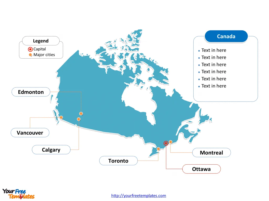
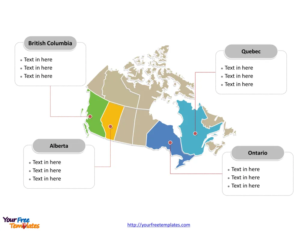
The Canada Map Template in PowerPoint format includes two slides, that is, the country outline and political slides. Firstly, our country outline map blank templates have capital and major cities on it, which are Toronto, Montreal, Vancouver, Calgary, and Edmonton. Secondly, there are ten provinces and 3 territories in our country map template of divisions, labeling the most populated Provinces that are Ontario, Quebec, British Columbia, and Alberta.
Canada is the second-largest country in the world by land area and is located in the northern part of North America. It’s bordered by three oceans: the Atlantic to the east, the Pacific to the west, and the Arctic to the north. To the south, it shares the world’s longest bi-national land border with the United States.
The Canada Map blank templates include two slides.
Slide 1, Canada Map labeled with capital and major cities
Its capital and largest city is Toronto, Montreal, Vancouver, Calgary, and Edmonton. You can found them in our Canada map free blank templates.
- Toronto, Ontario – Known as Canada’s largest city, Toronto is a bustling metropolis that is the financial and cultural heart of the country.
- Montreal, Quebec – Renowned for its vibrant arts scene and historical architecture, Montreal is the largest city in Quebec and the second-largest in Canada.
- Vancouver, British Columbia – Located on the west coast, Vancouver is famous for its scenic beauty and is a gateway to the Pacific Rim.
- Calgary, Alberta – Known for its energy sector and the world-famous Calgary Stampede, Calgary is a dynamic city near the Rocky Mountains.
- Ottawa, Ontario – The national capital of Canada, Ottawa is the political center of the country and home to numerous national museums and institutions.

Slide 2, Map of Canada labeled with major Provinces.
It is noted that the Canada political slide is the country political division of ten provinces and 3 territories.
Provinces: Canada has ten provinces, each with its own capital and distinct features:
- Alberta – With Edmonton as its capital, it’s known for its natural resources and beautiful national parks.
- British Columbia – Victoria serves as the capital, and the province is renowned for its Pacific coastline and mountain ranges.
- Manitoba – Its capital, Winnipeg, is often referred to as the “Gateway to the West.”
- New Brunswick – Fredericton is the capital, and the province is known for its picturesque maritime landscapes.
- Newfoundland and Labrador – St. John’s, the capital, is the easternmost point of North America.
- Nova Scotia – Halifax is the capital, with rich maritime history and culture.
- Ontario – Toronto serves as the capital and is the most populous province.
- Prince Edward Island – Charlottetown is the birthplace of Canadian Confederation and the province’s capital.
- Quebec – Quebec City is the province’s capital, with a unique French-Canadian culture.
- Saskatchewan – Regina is the capital, known for its vast prairies and agriculture.

Territories:
- Northwest Territories – Yellowknife is the capital, known for its indigenous cultures and northern lights.
- Nunavut – Iqaluit is the capital and is the newest, largest, and most northerly territory of Canada, known for its Inuit communities.
- Yukon – Whitehorse is the capital, famous for the Klondike Gold Rush and pristine wilderness.
What is more, every individual political subdivision is an editable shape. The labels and shapes are grouped by layers. In a word, you can change the texts, colors, sizes, highlight some map shapes, and add your charts. At the same time you can also refer to the fully labeled Map of Canada in Wikipedia.
Size: 137K
Type: PPTX
Aspect Ratio: Standard 4:3
Click the blue button to download it.
Download the 4:3 Template
Aspect Ratio: Widescreen 16:9
Click the green button to download it.
Download the 16:9 Template


