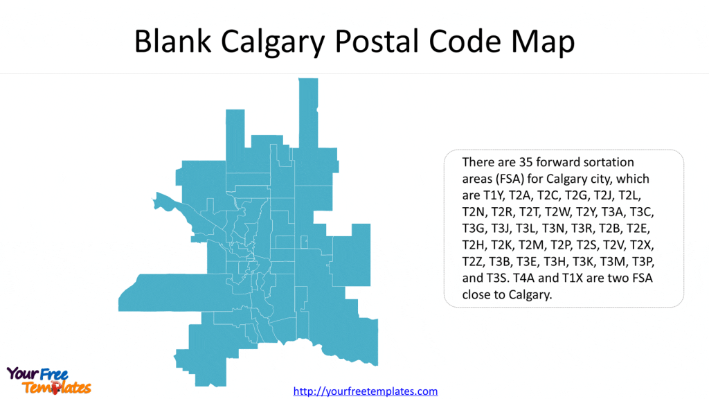
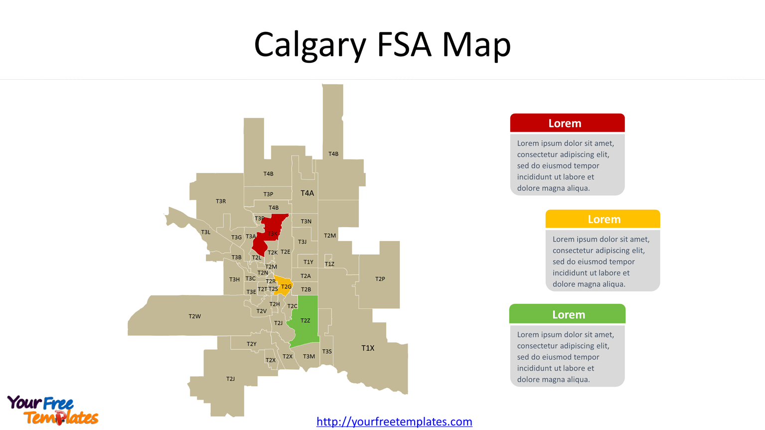
Our Calgary Postal Code Map has two slides, labeling the forward sortation areas of Calgary. Check our other Canadian provinces of British Columbia, Manitoba, New Brunswick, Newfoundland and Labrador, Nova Scotia, Ontario, Prince Edward Island, Quebec, and Saskatchewan. To have the outlines of provinces and the most populated subdivisions.
Slide 1, Blank Calgary Postal Code Map
The Canadian Postal Code is composing of six characters, which the first three characters stands for Forward sortation areas and last three characters for Local delivery units. Meanwhile the first character is the postal district which is usually the province or territory. 
Slide 2, Calgary FSA Map with codes
There are 35 forward sortation areas (FSA) for Calgary city, which are T1Y, T2A, T2C, T2G, T2J, T2L, T2N, T2R, T2T, T2W, T2Y, T3A, T3C, T3G, T3J, T3L, T3N, T3R, T2B, T2E, T2H, T2K, T2M, T2P, T2S, T2V, T2X, T2Z, T3B, T3E, T3H, T3K, T3M, T3P, and T3S. T4A and T1X are two FSA close to Calgary. The data is coming from Canada Post.

You may like to check Calgary ward map with two slides, labeling the numbers of 14 wards and the names of councilors representing each ward.

Calgary downtown map with two slides, labeling 62 communities for the central sector of the city of Calgary.

Size:284K
Type: PPTX
[sociallocker]Aspect Ratio: Standard 4:3
Click the Link below to download it.
Download the 4:3 Template
Aspect Ratio: Widescreen 16:9
Click the Link below to download it.
Download the 16:9 Template[/sociallocker]


