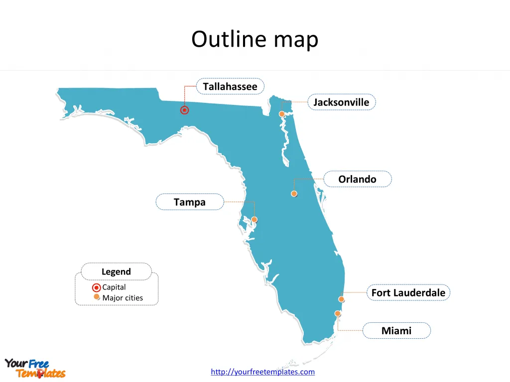
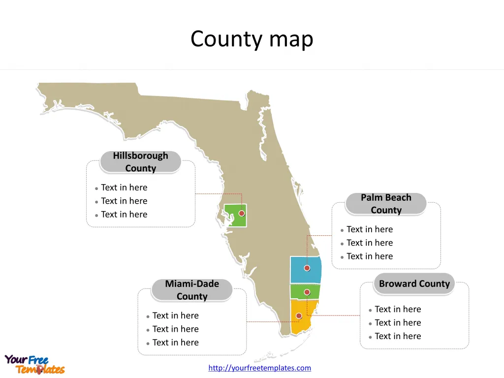
The State of Florida map Template in PowerPoint format includes two slides. Firstly the Florida maps with outline is labeling with capital and major cities. Secondly the Florida maps with outline is labeling with major counties. So our Florida maps PowerPoint templates have capital and major cities on it. They are Tallahassee, Jacksonville, Miami, Fort Lauderdale, Tampa, and Orlando. Finally the most populated counties are Miami-Dade County, Broward County, Palm Beach County, and Hillsborough County.
Our State of Florida map is for the southernmost state in the southeastern region of the United States. Firstly Alabama and Georgia is neighboring from the north. Secondly the Atlantic Ocean is neighboring from the east. Thirdly the Straits of Florida is neighboring from the south. Finally the Gulf of Mexico and Alabama is neighboring from the west.
Slide 1, Florida maps PowerPoint templates labeling with capital and major cities
Its capital and largest city is Tallahassee and Jacksonville respectively, other major cities including Miami, Fort Lauderdale, Tampa, and Orlando. You can found them in our Florida maps PowerPoint templates.
Florida, known for its vibrant culture, stunning beaches, and diverse ecosystems, is home to several major cities each with its unique charm and attractions.
Major cities on Florida map
Tallahassee
The capital city, Tallahassee, is nestled in the Florida Panhandle. It’s known for being a hub of political activity, housing the Florida State Capitol. The city is also home to Florida State University and Florida A&M University, making it a center for education and research.
Jacksonville
Jacksonville, the largest city by area in the contiguous United States, sits in the northeastern part of Florida. It boasts a vast urban park system, beautiful beaches, and a bustling arts scene. The city’s economy is diverse, with strong finance, healthcare, and logistics sectors.

Miami
Miami is synonymous with vibrant nightlife, art deco architecture, and beautiful beaches. Located in southeastern Florida, it’s a melting pot of cultures, primarily influenced by Caribbean and Latin American communities. Miami is also a major hub for international trade and tourism.
Fort Lauderdale
Fort Lauderdale, just north of Miami, is famous for its boating canals and stunning beaches. The city’s waterfront is lined with upscale outdoor restaurants, bars, boutiques, and luxury hotels, making it a popular tourist destination.
Tampa
On the west coast of Florida, Tampa offers a mix of historic architecture, modern landmarks, and a western coast of beautiful Gulf beaches. The city is known for its cultural offerings, including the Tampa Bay History Center, and family-friendly attractions like Busch Gardens.
Orlando
Orlando is globally recognized for its theme parks, including Walt Disney World and Universal Studios. Beyond the parks, it has a vibrant downtown area and is a major center for the entertainment industry, particularly in digital media and aerospace.
Slide 2, Florida map PowerPoint templates labeling with most populated counties
The most populated counties in Florida State are Miami-Dade County, Broward County, Palm Beach County, and Hillsborough County. What is more, Florida is the 22nd-most extensive, the 3rd-most populous, and the 8th-most densely populated of the U.S. states. The labels and shapes are layers of different groups.
Major Counties on Florida map
Miami-Dade County
Miami-Dade County encompasses Miami and is Florida’s most populous county. It’s a leader in finance, commerce, culture, arts, and international trade.
Broward County
Home to Fort Lauderdale, Broward County is known for its tourism, with beautiful beaches, and an extensive network of waterways.

Palm Beach County
Palm Beach County offers a wealth of luxury amenities, including upscale shopping, fine dining, and high-end real estate. It’s known for its affluent communities and beautiful Atlantic coastline.
Hillsborough County
Hillsborough County, where Tampa is located, is a blend of historic buildings, modern attractions, and natural preserves. It’s an economic powerhouse with a diverse population and a vibrant culture.
Each of these cities and counties contributes to Florida’s reputation as a dynamic state with a rich tapestry of cultural, economic, and natural resources.
Looking for Premium maps, please visit our affiliate site: https://editablemaps.com/ or https://ofomaps.com/
Size:95K
Type: PPTX
Aspect Ratio: Standard 4:3
Click the blue button to download it.
Download the 4:3 Template
Aspect Ratio: Widescreen 16:9
Click the green button to download it.
Download the 16:9 Template


