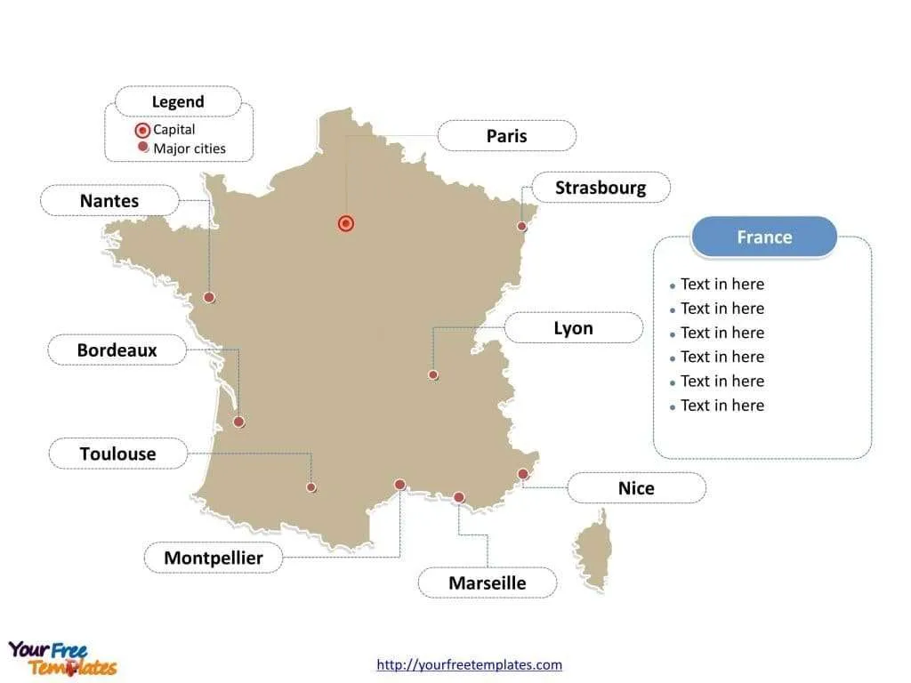
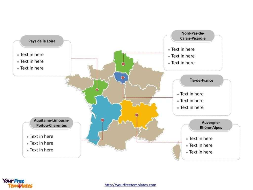
The France Map Template includes three slides. France map with new 13 regions and old 22 regions, highlighting Auvergne-Rhône-Alpes, Île-de-France, Pays de la Loire, Nord-Pas-de-Calais Picardie, and New Aquitaine regions. The France map labeled with Paris, Marseille, Lyon, Toulouse, Nice, Nantes, Strasbourg, and Montpellier cities.
France is a sovereign state located in Western Europe, with 12 overseas regions and territories in the world, which are Guadeloupe, French Guiana, Martinique, Réunion, Mayotte, New Caledonia, French Polynesia, Saint Barthélemy, Saint-Martin, Saint-Pierre and Miquelon, the French Southern and Antarctic Lands, and the Wallis and Futuna islands.
You can find the 8 neighboring countries along with this country in the same continent, which are Andorra, Belgium, Germany, Italy, Luxembourg, Monaco, Spain, and Switzerland.
France has an area of 640 thousand square kilometers and has a total population of 66.7 million.
Slide 1, France map labeled with capital and major cities.
France, a country renowned for its rich history, culture, and diverse landscapes, is dotted with vibrant cities and distinct regions, each contributing to the nation’s unique identity. Its capital is Paris, and other major cities including Marseille, Lyon, Toulouse, Nice, Nantes, Strasbourg, and Montpellier.
Major Cities on France map
Paris
The capital, Paris, is a global center for art, fashion, and gastronomy. The city’s iconic landmarks include the Eiffel Tower, Notre-Dame Cathedral, and the Louvre Museum. Paris’s romantic ambiance and rich cultural heritage make it a world-famous destination.
Marseille
Marseille, a port city in southern France, is known for its vibrant multicultural atmosphere, historic Old Port, and the Calanques National Park. It’s a gateway to the Mediterranean’s azure waters and Provençal cuisine.
Lyon
Lyon, the gastronomic capital of France, boasts a charming blend of ancient and modern architecture. Its historical district, Vieux Lyon, is a UNESCO World Heritage site, reflecting the city’s Roman and Renaissance eras.
Toulouse
Toulouse, the “Pink City,” is famous for its unique terracotta architecture. This aerospace hub is also known for its lively student population, contributing to its vibrant culture and nightlife.
Nice
Nestled on the French Riviera, Nice is beloved for its pebble beaches, Italianate old town, and the Promenade des Anglais. It’s a blend of luxurious charm and natural beauty.
Nantes
Nantes, a dynamic city in western France, is known for its innovative cultural scene, historical Château des Ducs de Bretagne, and the unique Machines of the Isle of Nantes.
Strasbourg
Strasbourg, at the crossroads of France and Germany, offers a captivating mix of cultures. Its gothic cathedral and picturesque “Petite France” district highlight the city’s rich European heritage.
Montpellier
Montpellier is a vibrant, youthful city with a medieval core, known for its lively squares, elegant mansions, and the University of Montpellier, one of the oldest in the world.
Slide 2, old France map labeled with major administration districts.
By the end of 2015, France map shows the country divided into 22 administrative regions, Alsace, Aquitaine, Auvergne, Basse-Normandie, Bourgogne, Brittany, Centre, Champagne-Ardenne, Corsica (Corse), Franche-Comté, Haute-Normandie, Île-de-France, Languedoc-Roussillon, Limousin, Lorraine, Midi-Pyrénées, Nord-Pas-de-Calais, Pays de la Loire, Picardie, Poitou-Charentes, Provence-Alpes-Côte d’Azur, Rhône-Alpes. Every individual political subdivision is an editable shape.
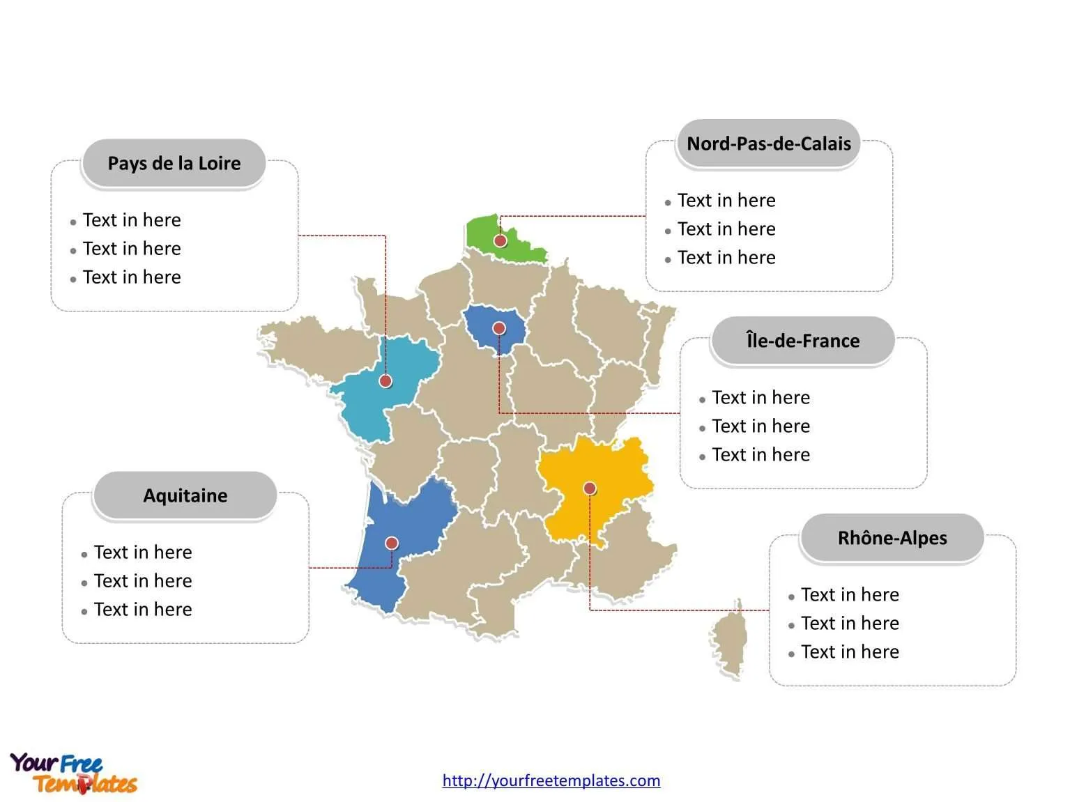
Slide 3, new France map labeled with major administration districts.
As of 1 January 2016, metropolitan France map is composing of 13 regions, including Corsica, they are Grand East, New Aquitaine, Auvergne-Rhône-Alpes, Brittany, Bourgogne Franche-Comté, Centre Val de Loire, Corsica, Occitania, Normandy, Nord-Pas-de-Calais Picardie, Île-de-France, Pays de la Loire, and Provence-Alpes-Côte d’Azur.
Major Regions on France map
Auvergne-Rhône-Alpes
This region combines dramatic alpine scenery with vibrant cities like Lyon and Grenoble. It’s a haven for outdoor enthusiasts and culinary tourists alike.
Île-de-France
Home to Paris and the surrounding area, Île-de-France is the economic and cultural heart of France, boasting unparalleled historical, architectural, and artistic treasures.
Pays de la Loire
Situated in western France, this region is known for its Atlantic coastlines, the Loire Valley châteaux, and the vibrant city of Nantes.
Nord-Pas-de-Calais Picardie
Now part of the Hauts-de-France region, this area is characterized by its rich industrial heritage, World War memorials, and the bustling city of Lille.
New Aquitaine
Spanning the southwest coast, New Aquitaine is famous for its diverse landscapes, from Bordeaux’s vineyards to the surfing beaches of Biarritz and the Pyrenees’ mountain ranges.
France’s cities and regions are a testament to the country’s multifaceted identity, offering everything from historical landmarks and natural wonders to culinary delights and cultural festivities. Each city and region presents a unique perspective on the French way of life, making France a perennially captivating destination for travelers.
Looking for Premium maps, please visit our affiliate site: https://ofomaps.com/
Size: 449K
Type: PPTX
Aspect Ratio: Standard 4:3
Click the blue button to download it.
Download the 4:3 Template
Aspect Ratio: Widescreen 16:9
Click the green button to download it.
Download the 16:9 Template
