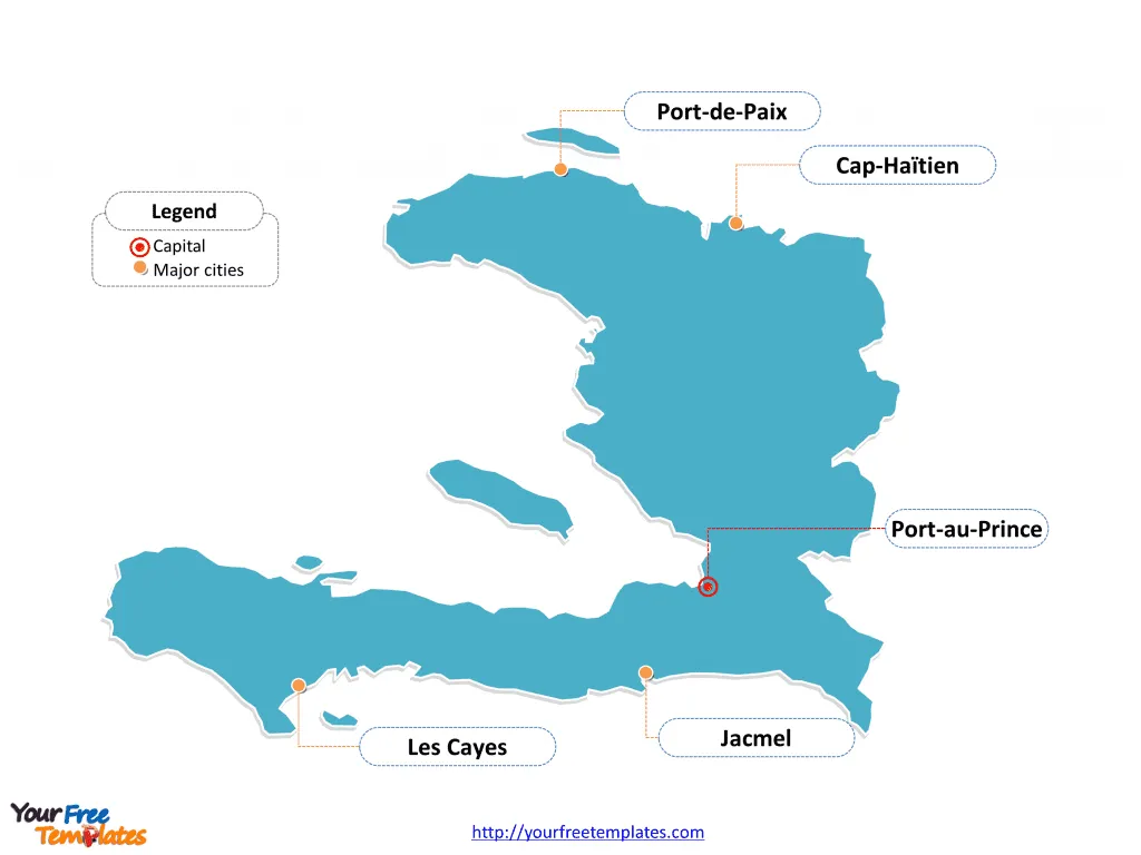
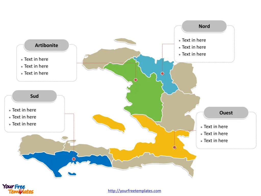
The Haiti Map Template includes two slides. Haiti map with ten departments, labeling with major Departments, Ouest (Port-au-Prince), Artibonite (Gonaïves), Nord (Cap-Haïtien), and Sud (Les Cayes). Haiti map labeling with national capital and major cities, Port-au-Prince, Cap-Haïtien, Les Cayes, Port-de-Paix, and Jacmel.
Haiti, officially known as the Republic of Haiti, is located on the western third of the island of Hispaniola, bordered by the Caribbean Sea to the south and west, the North Atlantic Ocean to the north, and the Dominican Republic to the east. The country has a population of approximately 11,562,675 and its official languages are French and Haitian Creole. Haiti faces significant economic and social challenges, with chronic poverty and vulnerability to natural disasters. The nation is the poorest in the Caribbean and among the most impoverished globally.
Jamaica and Cuba are Haiti’s closest neighbors, with the Dominican Republic, bordering it on the eastern side of the island. The nation’s mountainous terrain and susceptibility to earthquakes have historically posed significant challenges to its development.
Slide 1, Haiti map labeled with capital and major cities.
Its capital and largest city is Port-au-Prince, other major cities including Cap-Haïtien, Les Cayes, Port-de-Paix, and Jacmel.
Capital and major cities on Haiti map
Port-au-Prince: The Dynamic Capital
Port-au-Prince, the capital and largest city of Haiti, stands as a bustling metropolis on the Caribbean coast. With a population of over 1.2 million, Port-au-Prince serves as a significant economic, cultural, and administrative hub, boasting a vibrant arts scene and historical landmarks.

Cap-Haïtien: A Historical Gem
Cap-Haïtien, located in the Nord department, is celebrated for its rich historical heritage and picturesque landscapes. With a population of over 534,000, Cap-Haïtien offers a blend of cultural richness and urban vibrancy, making it a compelling destination for visitors and residents.
Les Cayes: A Coastal City
Les Cayes, situated in the Sud department, stands out for its unique coastal beauty and historical charm. With a population of over 125,000, Les Cayes offers a blend of natural landscapes and cultural attractions, making it an appealing destination for visitors and residents.
Port-de-Paix: A Northern Hub
Port-de-Paix, located in the Nord-Ouest department, is known for its historical significance and vibrant urban atmosphere. With a population of over 250,000, Port-de-Paix plays a pivotal role in shaping the country’s economic and cultural landscape.
Jacmel: A Cultural Hub
Jacmel, in the Sud-Est department, is celebrated for its vibrant arts scene and colonial architecture. With a population of over 137,000, Jacmel stands as a captivating destination for visitors and residents, offering a blend of cultural richness and historical significance.
Slide 2, Haiti map labeled with major Departments.
Haiti is a country divided into ten departments; they are 1. Artibonite (Gonaïves), 2. Centre (Hinche), 3. Grand’Anse (Jérémie), 4. Nippes (Miragoâne), 5. Nord (Cap-Haïtien), 6. Nord-Est (Fort-Liberté), 7. Nord-Ouest (Port-de-Paix), 8. Ouest (Port-au-Prince), 9. Sud-Est (Jacmel), 10. Sud (Les Cayes). The most populated departments are Artibonite, Nord, Ouest and Sud. Every individual political subdivision is an editable shape.
Major Departments on Haiti map
Ouest Department
The Ouest Department, encompassing the capital city of Port-au-Prince, serves as a significant administrative, economic, and cultural hub, playing a pivotal role in shaping Haiti’s national identity and development.

Artibonite Department
The Artibonite Department, with Gonaïves as a notable city, offers a blend of historical significance and economic influence, shaping the region’s urban landscape.
Nord Department
The Nord Department, with Cap-Haïtien as a major city, is known for its historical significance and cultural allure, contributing to Haiti’s diverse urban and rural fabric.
Sud Department
The Sud Department, with Les Cayes as a significant city, stands out for its unique coastal beauty and cultural heritage, adding to Haiti’s coastal allure.
Haiti’s capital, major cities, and significant departments collectively contribute to the country’s cultural, historical, and economic landscape, making it a captivating destination for visitors and a dynamic hub for residents.
The diverse array of urban centers, along with the significant departments, showcases Haiti’s rich tapestry of history and culture, making it a compelling subject for exploration and discovery.
Looking for Premium maps, please visit our affiliate site: https://editablemaps.com/ or https://ofomaps.com/
Size: 105K
Type: PPTX
Aspect Ratio: Standard 4:3
Click the blue button to download it.
Download the 4:3 Template
Aspect Ratio: Widescreen 16:9
Click the green button to download it.
Download the 16:9 Template


