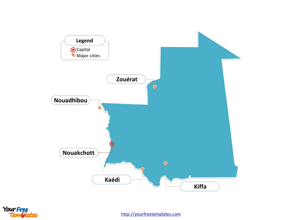
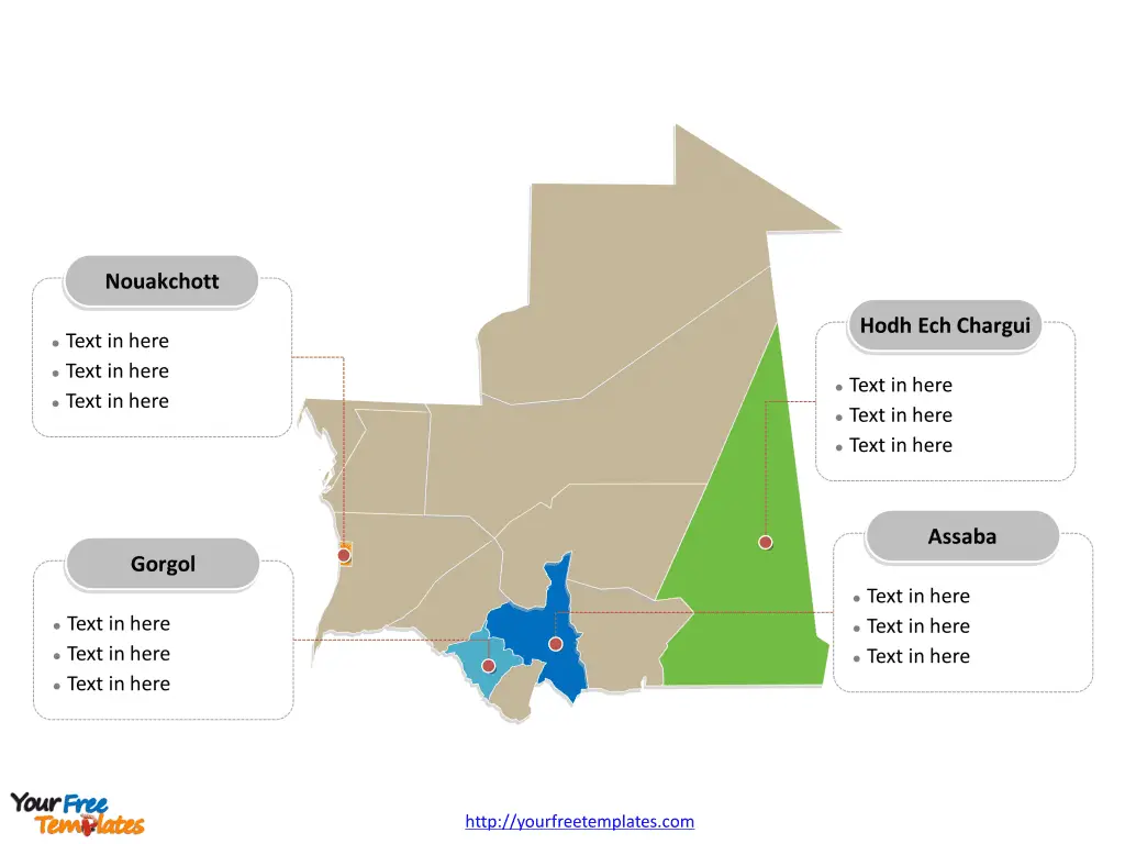
The Mauritania Map Template includes two slides. Mauritania map with 12 provinces and one capital city, labeling major provinces, Hodh Ech Chargui, Nouakchott, Gorgol, and Assaba. Mauritania map labeled with capital and major cities, Nouakchott, Nouadhibou, Kiffa, Kaédi, and Zouérat.
Mauritania, located in western North Africa, is bordered by the Atlantic Ocean to the west, Western Sahara to the northwest, Algeria to the northeast, Mali to the east and southeast, and Senegal to the southwest. The country has a population of about 4.9 million people, with over half living in urban areas. It is one of the least densely populated countries in the world, with vast expanses of pastoral land and limited arable land.
Mauritania’s economy has experienced moderate growth, with real GDP growth estimated at 3.4% in 2023, down from 6.4% in 2022. The fiscal deficit improved to 2.4% of GDP in 2023, and external debt remains sustainable. The country’s political cycle is set to end in mid-2024, with presidential elections due in June 2024. The government is focused on implementing programs to advance education, social justice, and the development of natural resources
Slide 1, Mauritania map labeled with capital and major cities.
Nouakchott is the capital and largest city of Mauritania, other major cities including Nouadhibou, Kiffa, Kaédi, and Zouérat.
Capital and major cities on Mauritania map
Nouakchott, the capital and largest city of Mauritania, serves as the country’s political, administrative, and economic center. This coastal city offers a blend of modern urban developments and traditional Mauritanian culture, making it a vibrant and dynamic hub.

Nouadhibou, located on the Atlantic coast, is Mauritania’s second-largest city and serves as a significant commercial and industrial center. It is known for its bustling port and fishing industry, contributing to the country’s economy and maritime heritage.
Kiffa, a city in the Assaba region, is renowned for its traditional craft industry, particularly its vibrant pottery and colorful hand-painted ceramics. The city’s cultural significance and local craftsmanship make it a notable destination for visitors interested in Mauritania’s artistic traditions.
Kaédi, situated in the Gorgol region, offers a glimpse into Mauritania’s cultural heritage, with its bustling markets, traditional architecture, and local customs. The city’s historical significance and regional charm make it an integral part of the country’s cultural tapestry.
Slide 2, Mauritania map labeled with major provinces.
Mauritania map shows the country divided into 12 regions and one capital district in Nouakchott, the region of Nouakchott was split into three new regions in 2014, not shown in this map; they are Adrar, Assaba, Brakna, Dakhlet Nouadhibou, Gorgol, Guidimaka, Hodh Ech Chargui, Hodh El Gharbi, Inchiri, Nouakchott-Nord, Nouakchott-Ouest, Nouakchott-Sud, Tagant, Tiris Zemmour, and Trarza. Every individual political subdivision is an editable shape.
Major provinces on Mauritania map
Adrar is known for its vast desert landscapes, including the Adrar Plateau, which reaches an elevation of 500 meters. The region features oases and isolated peaks, offering a glimpse of the country’s natural beauty and geological diversity.
The Assaba province is home to the city of Kiffa and is characterized by varying natural vegetation, ranging from tropical forest along the Sénégal River to brush and savanna in the southeast. This region showcases a blend of natural landscapes and is an important part of Mauritania’s cultural and geographical tapestry.

Brakna province, with Aleg as its capital, offers a unique glimpse into the country’s heritage and local traditions. The region’s cultural significance and historical landmarks contribute to Mauritania’s rich diversity.
Dakhlet Nouadhibou is home to the city of Nouadhibou and is known for its coastal plains extending along the Atlantic Ocean. The province’s location and natural features make it a notable part of Mauritania’s geographical and economic landscape.
The Gorgol province, with Kaédi as its capital, offers a blend of natural beauty and cultural heritage. Its regional customs and historical significance contribute to the country’s diverse identity.
These major provinces, with their unique characteristics, play a vital role in shaping the cultural, geographical, and historical landscape of Mauritania. Each region offers a distinct experience, contributing to the country’s rich and diverse tapestry.
Looking for Premium maps, please visit our affiliate site: https://editablemaps.com/ or https://ofomaps.com/
Size:75K
Type: PPTX
Aspect Ratio: Standard 4:3
Click the blue button to download it.
Download the 4:3 Template
Aspect Ratio: Widescreen 16:9
Click the green button to download it.
Download the 16:9 Template


