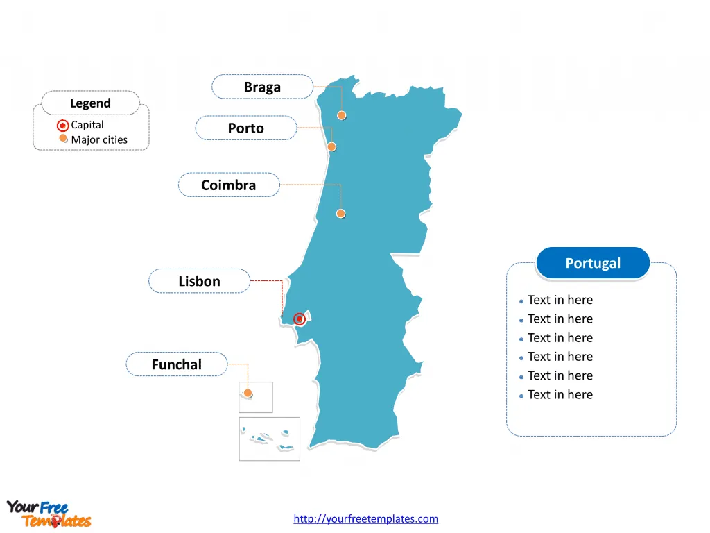
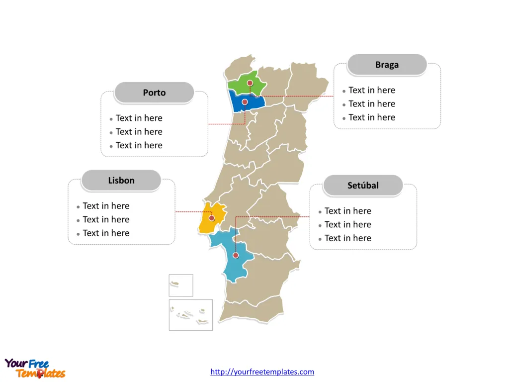
The Portugal Map Template includes two slides. Portugal map with 18 districts and two autonomous regions, highlighting main regions, Lisbon, Porto, Setúbal, Braga, and Aveiro. The country Outline map labeled with capital and major cities, Lisbon, Porto, Vila Nova de Gaia, Amadora, Braga, and Funchal.
Slide 1, Portugal map labeled with capital and major cities.
Portugal is a country on the Iberian Peninsula bordering Atlantic Ocean, in Southwestern Europe. You can find the only neighboring country along with this country in the European continent, which is Spain. Its capital and largest city is Lisbon, other major cities including Porto, Braga, Funchal, and Coimbra.
Portugal, with its rich history, vibrant culture, and scenic beauty, is home to several major cities and districts, each with its unique charm and significance. Among these, Lisbon, Porto, Vila Nova de Gaia, Amadora, Braga, and Funchal stand out as major capitals, while districts like Lisbon, Porto, Setúbal, Braga, and Aveiro play crucial roles in the country’s administration and development.
Major Capitals on Portugal map
Lisbon
Lisbon, the capital city of Portugal, is a historical yet modern metropolis that serves as the political, economic, and cultural heart of the country. With a metropolitan population of over 2.8 million, Lisbon is renowned for its UNESCO World Heritage sites, vibrant nightlife, and the historic Alfama district. Its economy is diverse, excelling in areas such as commerce, finance, media, and tourism.
Porto
Porto, Portugal’s second-largest city, is known for its stately bridges, the production of Port wine, and the historic Ribeira district. The city and its metropolitan area, with over 1.7 million inhabitants, form a significant industrial and financial hub. Porto’s quality of life and cultural offerings make it a favorite among visitors and locals alike.

Vila Nova de Gaia
Located just across the Douro River from Porto, Vila Nova de Gaia is integral to the Porto Metropolitan Area. Famous for its Port wine cellars, Gaia is a city that blends industrial vigor with tourist appeal. Its beaches are among the cleanest in Portugal, contributing to its allure as a major tourist destination.
Amadora
Situated within the Greater Lisbon area, Amadora is noted for its commerce and retail sector. The city is a key residential area for those working in Lisbon, thanks to its excellent transport links. Though historically known for manufacturing, today it is a vibrant community with a population of around 172,000.
Braga
Braga, the capital of the Cávado sub-region in the North, is one of Portugal’s oldest cities, rich in history and religious tradition. It is an important urban center, educational hub, and tourist destination, known for its Baroque churches, splendid homes, and the Bom Jesus do Monte sanctuary.
Funchal
The capital of the Madeira archipelago, Funchal, is a picturesque city known for its harbor, gardens, Madeira wine cellars, and beautiful setting against a backdrop of hills. With a population of around 106,000, it is a vital center for tourism, contributing significantly to the region’s GDP.
Slide 2, Portugal map labeled with major administration districts.
Portugal map shows the country divided into 18 districts and two autonomous regions (the Azores and Madeira) , Aveiro, Beja, Braga, Bragança, Castelo Branco, Coimbra, Évora, Faro, Guarda, Leiria, Lisbon, Portalegre, Porto, Santarém, Setúbal, Viana do Castelo, Vila Real and Viseu. Every individual political subdivision is an editable shape.
Major Districts on Portugal map
Lisbon District
The Lisbon District encompasses the capital city and surrounding areas, acting as a focal point for governance, commerce, and culture. It is the wealthiest and most populous district in Portugal, leading in innovation and quality of life 3.
Porto District
The Porto District includes the city of Porto and surrounding municipalities. It is a key economic region, with a strong focus on industry, finance, and education. The district is celebrated for its cultural heritage and economic vitality 3.

Setúbal District
Located south of Lisbon, the Setúbal District is known for its fishing, industry, and natural beauty, including the Arrábida hills and Sado estuary. The city of Setúbal is a crucial industrial center and port, contributing to the district’s economic diversity 3.
Braga District
The Braga District, with its historical city of Braga, is a blend of ancient tradition and modernity. It is an important agricultural, industrial, and religious center in the North of Portugal, renowned for its cultural festivals and educational institutions 3.
Aveiro District
Aveiro, often referred to as the “Venice of Portugal,” is distinguished by its canals, Art Nouveau buildings, and moliceiro boats. The district is an important agricultural and industrial area, with a strong focus on ceramics, chemicals, and seaweed harvesting, enhancing its economic landscape 3.
In summary, Portugal’s major capitals and districts reflect the country’s diverse cultural heritage, economic strength, and scenic beauty. From the historic streets of Lisbon and Porto to the industrial vigor of Vila Nova de Gaia and the educational prominence of Braga, each city and district contributes uniquely to the mosaic that is Portugal.
Looking for Premium maps, please visit our affiliate site: https://ofomaps.com/
Size: 106K
Type: PPTX
Aspect Ratio: Standard 4:3
Click the blue button to download it.
Download the 4:3 Template
Aspect Ratio: Widescreen 16:9
Click the green button to download it.
Download the 16:9 Template


