The Map of NSW or Australia New South Wales map in PowerPoint format includes 3 slides, covering New South Wales location map, Greater Capital City Statistical Areas (GCCSA) map with greater Sydney outline map, and outline map with major cities.
Slide 1, Map of NSW Location
The New South Wales (NSW) state is the most populated one of Australia, with 7.95 million residents as of 2020. About 65% of the state’s population lives in Greater Sydney. NSW is located in eastern Australia that is bordered by Victoria, Queensland, and South Australia.

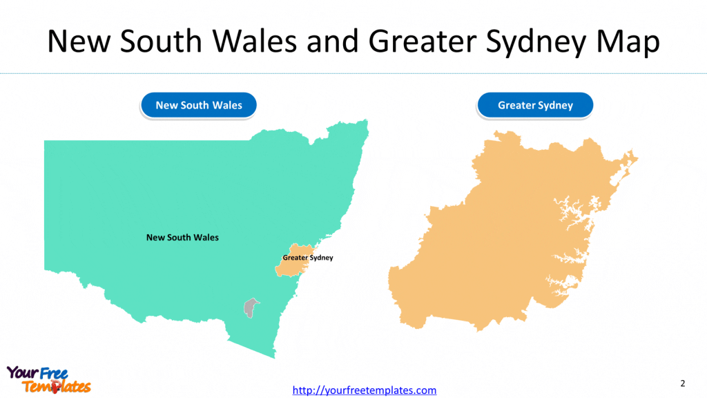
Slide 2, Map of NSW and Greater Sydney Map
Greater Capital City Statistical Areas (GCCSA) are geographical areas built from Statistical Areas Level 4 (SA4) and are designed to represent the functional extent of each of the eight State and Territory capital cities.

Slide 3, Map of NSW with Cities
At the same time you can also refer to the detailed administrative of New South Wales (NSW) state in Wikipedia. Or to purchase our partner’s premium NSW map.

You can
You can try our other Australian maps
- Australia map template
2 slides, covering the outline of the country and the political divisions of six states and one Territory, which are New South Wales, Queensland, South Australia, Tasmania, Victoria, Western Australia and the Australian Capital Territory (ACT), Canberra. - Queensland template
4 slides, covering Queensland location map, Greater Capital City Statistical Areas (GCCSA) map with greater Brisbane outline map, and outline map with major cities. - Australia Melbourne map template
3 slides, covering city of Melbourne municipal boundary, 17 postcodes, and 14 suburbs.
Size:450K
Type: PPTX
[sociallocker]Aspect Ratio: Standard 4:3
Click the blue button to download it.
Download the 4:3 Template
Aspect Ratio: Widescreen 16:9
Click the green button to download it.
Download the 16:9 Template[/sociallocker]


