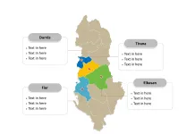
The Armenia Map Template includes two slides. Armenia map with ten provinces, labeling with major provinces Yerevan, Armavir, Ararat, and Kotayk. Armenia map labeling with national capital and major cities, Yerevan, Gyumri, Vanadzor, Kapan, and Hrazdan.
Armenia, a landlocked country in the South Caucasus region of Eurasia, is bordered by Turkey to the west, Georgia to the north, Azerbaijan to the east, and Iran to the south. With a population of approximately 2.9 million, Armenia has a rich cultural heritage and is known for its historical sites and ancient traditions.
The country’s economy is primarily based on agriculture, mining, and tourism, with significant contributions from the technology and diamond processing sectors. Armenia faced economic challenges following the collapse of the Soviet Union but has since focused on developing its technology industry and strengthening its ties with the global market.
Slide 1, Armenia map labeled with capital and major cities.
Yerevan is the capital and largest city of Armenia, other major cities including Gyumri, Vanadzor, Kapan, and Hrazdan.
Capital and Major Cities on Armenia map
Yerevan
Yerevan, the capital and largest city of Armenia, is one of the oldest continuously inhabited cities in the world. With a rich historical heritage dating back to the 8th century BC, it serves as the administrative, cultural, and industrial center of the country. The city has witnessed significant growth, with a population of over 1 million, making it a vital hub for Armenian culture, education, and industrial activities.

Gyumri
Gyumri, the second-largest city in Armenia, is known for its historical significance and cultural heritage. It has been a center of trade, industry, and art, contributing to the country’s cultural landscape. The city has a population of approximately 121,976 and serves as an important urban center in Armenia.
Vanadzor
Vanadzor, situated in the Lori Province, is a significant city known for its industrial activities, educational institutions, and cultural attractions. With a population of around 86,199, it plays a vital role in shaping the regional dynamics of Armenia.
Kapan
Kapan, located in the Syunik Province, is a major city with a population of approximately 43,190. It serves as an essential center for trade, agriculture, and cultural exchange, influencing the dynamics of the southern region of Armenia.
Hrazdan
Hrazdan, situated in the Kotayk Province, is a notable city known for its industrial and agricultural activities. With a population of around 40,795, it contributes to the province’s economic and social development.
Slide 2, Armenia map labeled with major administration districts.
Armenia is a country composed of ten provinces, Aragatsotn, Ararat, Armavir, Gegharkunik , Kotayk, Lori, Shirak, Syunik, Tavush, Vayots Dzor, and Yerevan. Every individual political subdivision is an editable shape.
Major Provinces on Armenia map
Yerevan Province
The Yerevan Province encompasses the capital city and plays a pivotal role in Armenia’s political, economic, and cultural landscape.

Armavir Province
The Armavir Province, with its agricultural productivity and historical significance, is a major center for farming, industry, and cultural heritage.
Ararat Province
The Ararat Province, home to the city of Artashat, is known for its historical sites, agricultural activities, and economic contributions to Armenia.
Kotayk Province
The Kotayk Province, with Hrazdan as a major city, is a key area known for its industrial and agricultural importance, shaping the province’s economic and social dynamics.
In summary, Armenia’s capital, major cities, and provinces contribute uniquely to the country’s cultural heritage, economic activities, and regional development. From the historical allure of Yerevan to the industrial significance of Gyumri and Vanadzor, each location plays a distinctive role in shaping Armenia’s diverse urban and rural landscape.
Looking for Premium maps, please visit our affiliate site: https://editablemaps.com/ or https://ofomaps.com/
Size: 114K
Type: PPTX
Aspect Ratio: Standard 4:3
Click the blue button to download it.
Download the 4:3 Template
Aspect Ratio: Widescreen 16:9
Click the green button to download it.
Download the 16:9 Template


