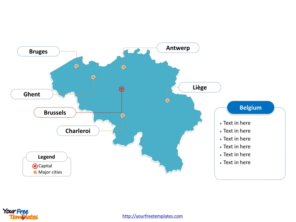
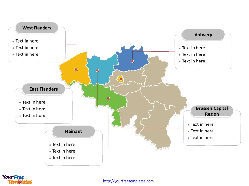
The Belgium Map Template includes two slides. Belgium map with 10 provinces and one region, highlighting Brussels-Capital Region, Antwerp, Hainaut, East Flanders, and West Flanders provinces. Belgium map outline labeled with Brussels, Antwerp, Ghent, Charleroi, Liège, and Bruges cities.
Belgium, a country in Western Europe, is strategically located at the heart of the continent, sharing borders with France, Germany, Netherlands and Luxembourg., and the North Sea. With a population of over 11 million people, Belgium has a well-developed, diversified economy, known for its strong industrial and service sectors. The country is a founding member of the European Union and hosts the headquarters of several international organizations, contributing to its status as a major center for diplomacy and global governance.
Belgium’s key industries include engineering, technology, pharmaceuticals, and food processing, and it is renowned for its chocolate, beer, and waffles. The nation’s central location and efficient transportation infrastructure have made it a crucial hub for international trade and commerce within Europe.
Slide 1, Belgium map labeled with capital and major cities.
Its capital and largest city is Brussels and Antwerp respectively, other major cities including Ghent, Charleroi, Liège, and Bruges.
Major Cities on Belgium Map
Brussels
Brussels, the capital of Belgium and the largest metropolitan region, is renowned for its historical landmarks, diverse cultural scene, and status as a global center for diplomacy. The city’s architectural splendor, vibrant neighborhoods, and multicultural atmosphere make it a significant hub for politics, commerce, and arts.
Antwerp
Antwerp, Belgium’s second-largest city, is a bustling port city known for its thriving diamond industry, rich cultural heritage, and architectural marvels. The city’s vibrant arts scene, historical significance, and dynamic urban landscape contribute to its status as a major economic and cultural center.

Ghent
Ghent, a picturesque city with a rich medieval history, is celebrated for its well-preserved medieval architecture, lively cultural scene, and vibrant student population. The city’s blend of historical charm, modern amenities, and academic heritage makes it a captivating destination for visitors.
Charleroi
Charleroi, situated in the Hainaut province, is an industrial city known for its steel and glass industry, cultural diversity, and urban revitalization efforts. The city’s evolving urban landscape, coupled with its historical sites and cultural offerings, reflects its important role in the region.
Liège
Liège, nestled along the Meuse River, is a dynamic city renowned for its historical monuments, lively festivals, and industrial heritage. The city’s eclectic mix of historical and contemporary attractions, coupled with its strategic location, makes it an intriguing destination for travelers exploring the region.
Bruges
Bruges, often referred to as the “Venice of the North,” is a charming city known for its well-preserved medieval architecture, picturesque canals, and cultural allure. The city’s romantic ambiance, historical significance, and artistic treasures make it a popular tourist destination.
Slide 2, Belgium map labeled with major administration districts.
Belgium is a country composed of 10 provinces and one region: Antwerp, Brussels-Capital Region, East Flanders, Flemish Brabant, Hainaut, Liège, Limburg, Luxembourg, Namur, Walloon Brabant, and West Flanders. Every individual political subdivision is an editable shape.
Major Provinces on Belgium Map
Brussels-Capital Region
The Brussels-Capital Region, home to the de facto capital of Belgium, is a bustling urban area known for its international institutions, cultural diversity, and economic significance. The region’s strategic location, vibrant neighborhoods, and historical landmarks underscore its pivotal role in the country.
Antwerp
Antwerp Province, with its diverse landscapes and thriving port city, is an economic powerhouse known for its cultural heritage, industrial prowess, and artistic legacy. The province’s role as a maritime and economic center contributes to its regional and national significance.

Hainaut
Hainaut Province, characterized by its industrial heritage, scenic landscapes, and historical sites, is an important region known for its cultural diversity and economic activities. The province’s blend of urban centers, natural beauty, and cultural offerings makes it a compelling area to explore.
East Flanders
East Flanders Province, with its historical cities, picturesque countryside, and vibrant cultural scene, offers a rich tapestry of historical, artistic, and natural attractions. The province’s cultural heritage, coupled with its modern developments, makes it an engaging destination for visitors.
West Flanders
West Flanders Province, known for its medieval cities, coastal charm, and historical significance, is a region that highlights Belgium’s rich cultural and natural heritage. The province’s blend of historical landmarks, coastal resorts, and rural landscapes makes it a captivating area to discover.
In summary, Belgium’s major cities and provinces offer a diverse array of historical, cultural, and economic significance, each contributing to the country’s rich heritage and contemporary development.
Looking for Premium maps, please visit our affiliate site: https://editablemaps.com/ or https://ofomaps.com/
Size: 100K
Type: PPTX
Aspect Ratio: Standard 4:3
Click the blue button to download it.
Download the 4:3 Template
Aspect Ratio: Widescreen 16:9
Click the green button to download it.
Download the 16:9 Template


