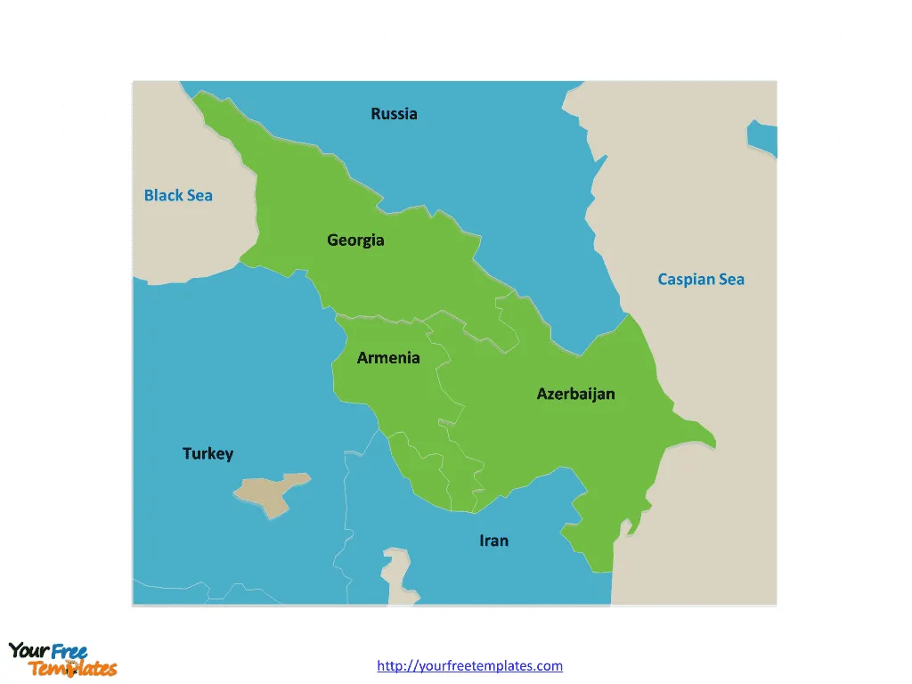
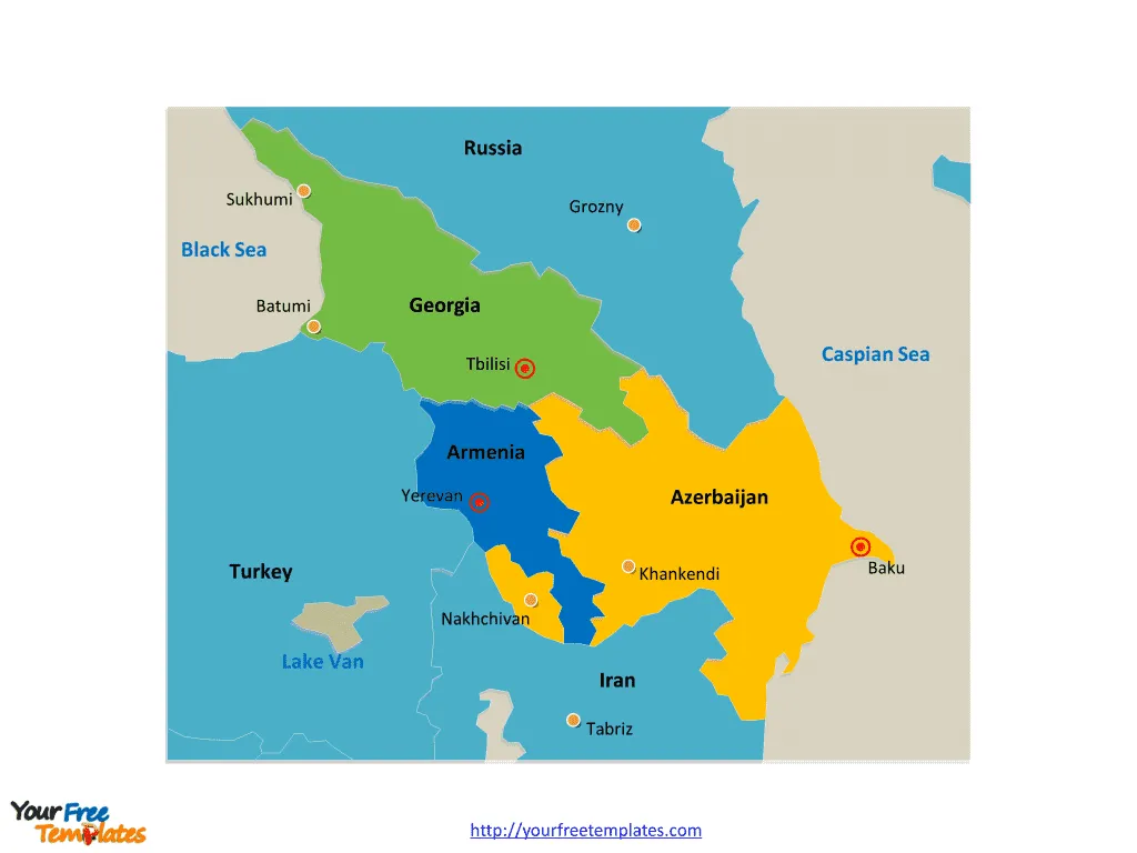
The Caucasus Map Template includes two slides. Caucasus map with 3 countries, they are Georgia, Armenia, and Azerbaijan. Caucasus map labeled with capitals in this region, Yerevan, Baku, Tbilisi, and important cities, like Sukhumi, Batumi, Grozny, Khankendi, and Nakhchivan.
Location The Caucasus is a region located at the crossroads of Eastern Europe and Western Asia, situated between the Black Sea and the Caspian Sea. It encompasses the Caucasus Mountains and is home to a diverse range of ethnic groups and cultures.
History The Caucasus has a rich and complex history, marked by the influence of various empires, including the Persian, Ottoman, and Russian empires. The region has been a melting pot of cultures, traditions, and conflicts, shaping its unique identity.
Population The Caucasus is home to a diverse population, including groups such as the Georgians, Armenians, Azerbaijanis, Chechens, and many others. This diversity contributes to the region’s cultural richness and societal dynamics.
Economy The economy of the Caucasus region is varied, with industries such as agriculture, energy, and tourism playing significant roles. The region is known for its agricultural production, oil and gas reserves, and distinctive landscapes that attract tourists.
Slide 1, Caucasus map labeled with country names.
The Caucasus or Caucasia is a region at the border of Europe and Asia, situated between the Black and the Caspian seas. Politically, the Caucasus region is separated between northern and southern parts. While the northern parts are under the jurisdiction of the Russian Federation, the southern parts consist of independent sovereign states. These include Georgia, Armenia, and Azerbaijan. Every individual political subdivision is an editable shape.
Independent Countries on Caucasus Map
The Caucasus region is home to several independent countries, each with its own unique cultural and historical heritage.
- Georgia
- Capital: Tbilisi
- A country known for its ancient churches, mountainous landscapes, and a blend of European and Asian influences.
- Armenia
- Capital: Yerevan
- A nation celebrated for its ancient monasteries, diverse landscapes, and a rich tradition of art and literature.
- Azerbaijan
- Capital: Baku
- A country with a mix of modernity and tradition, known for its cosmopolitan capital, historical sites, and the UNESCO-listed Old City.

Slide 2, Caucasus map labeled with national capitals and major cities.
Caucasus map is dotted with national capitals, Armenia’s capital Yerevan, Azerbaijan’s capital Baku, Georgia’s capital Tbilisi, and major cities, Sukhumi, Batumi, Grozny, Khankendi, and Nakhchivan.
Major Cities on the Caucasus Map
The Caucasus region is home to several major cities that are emblematic of its diverse cultural, historical, and geopolitical significance.
Yerevan
Yerevan, the capital of Armenia, is one of the oldest continuously inhabited cities in the world. It is known for its rich history, distinctive pink stone architecture, and as a center for arts and culture in the region.
Baku
Baku, the capital of Azerbaijan, is a modern and rapidly developing city that juxtaposes futuristic architecture with ancient historical sites. It is a major hub for the country’s oil industry and a vibrant cultural center.

Tbilisi
Tbilisi, the capital of Georgia, is a city renowned for its charming old town, diverse architectural styles, and scenic location along the banks of the Kura River. It serves as a cultural, economic, and political focal point for the country.
Sukhumi
Sukhumi, located in the disputed region of Abkhazia, is a city with a subtropical climate and a picturesque coastal setting. It has historically been a popular resort destination, although its status remains a subject of international dispute.
Batumi
Batumi, a coastal city in Georgia, is known for its stunning Black Sea coastline, modern architecture, and a thriving tourism industry. It has emerged as a popular destination for both domestic and international travelers.
Grozny
Grozny, the capital of the Chechen Republic in Russia, has undergone significant reconstruction in the aftermath of conflict. It is a city with a complex history and is gradually reemerging as an important urban center in the region.
Khankendi (Stepanakert)
Khankendi, also known as Stepanakert, is the de facto capital of the self-declared Republic of Artsakh (Nagorno-Karabakh). The city has been at the center of the Nagorno-Karabakh conflict and remains a symbol of the region’s unresolved political complexities.
Nakhchivan
Nakhchivan is an exclave of Azerbaijan, bordered by Armenia, Iran, and Turkey. It holds historical significance and is known for its rich cultural heritage and archaeological sites.
Looking for Premium maps, please visit our affiliate site: https://editablemaps.com/ or https://ofomaps.com/
Size:550K
Type: PPTX
Aspect Ratio: Standard 4:3
Click the blue button to download it.
Download the 4:3 Template
Aspect Ratio: Widescreen 16:9
Click the green button to download it.
Download the 16:9 Template


