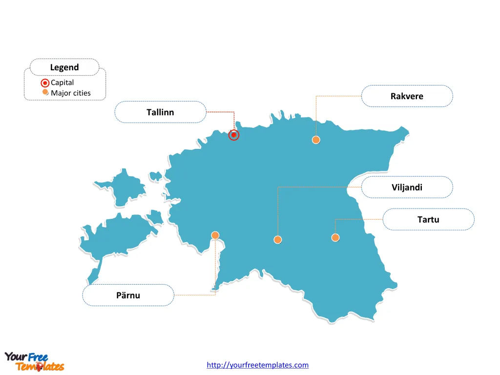
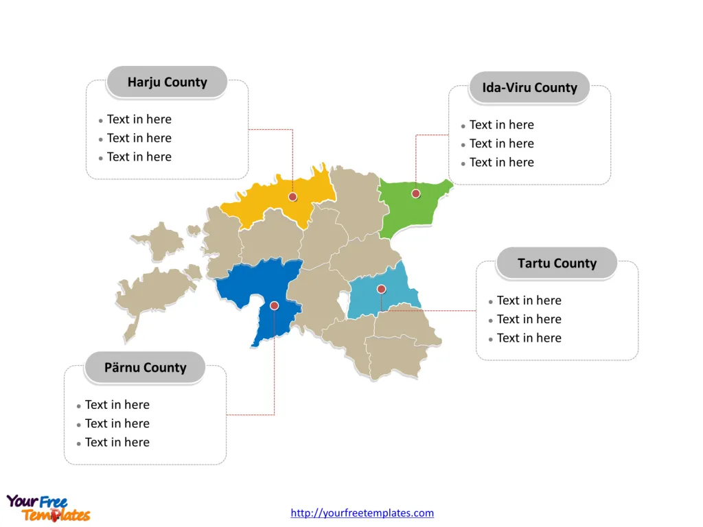
The Estonia Map Template includes two slides. Estonia map with 15 counties, labeling major counties, Harju County, Tartu County, Ida-Viru County, and Pärnu County. The Estonia map labeled with capital and major cities, Tallinn, Tartu, Pärnu, Viljandi, and Rakvere.
Estonia, located in Northern Europe, is bordered by the Baltic Sea, Gulf of Finland, Latvia, and Russia. With a population of approximately 1.2 million, it is a parliamentary republic with Tallinn as its capital.
The country’s economy is considered high-income, with a GDP of 38.10 billion USD and an unemployment rate of 5.85%. Estonia’s major trading partners include the European Union, Russia, Finland, Sweden, and Latvia. The nation’s location, nestled between these neighboring countries, influences its economic ties, political relations, and cultural exchanges, shaping its economic outlook and regional interactions.
Slide 1, Estonia map labeled with capital and major cities.
Tallinn is the capital and largest city of Estonia, other major cities including Tartu, Pärnu, Viljandi, and Rakvere.
Capital and Major Cities on Estonia Map
Tallinn: The Charming Capital
Tallinn, the capital and largest city of Estonia, is situated on the northern coast of the country. This historic city, with a population of over 440,000, is celebrated for its well-preserved medieval Old Town, a UNESCO World Heritage Site, and serves as a significant economic, cultural, and administrative center.

Tartu: The Intellectual Hub
Tartu, Estonia’s second-largest city, is located in the southern part of the country. With a population of over 93,000, Tartu is renowned for its prestigious university, historical significance, and vibrant intellectual community, making it a prominent center for education and culture.
Pärnu: The Coastal Gem
Pärnu, situated on the southwestern coast of Estonia, is known for its picturesque beaches and historical landmarks. With a population of over 50,000, Pärnu is a popular summer destination, offering a blend of natural beauty and cultural attractions.
Viljandi: A Cultural Haven
Viljandi, located in southern Estonia, is celebrated for its rich cultural heritage and scenic surroundings. The city’s population of over 17,000 and its historical significance make it a notable destination for cultural events and historical exploration.
Rakvere: A Blend of History and Modernity
Rakvere, situated in northern Estonia, is known for its historical sites and modern developments. With a population of over 15,000, Rakvere offers a unique blend of historical charm and contemporary urban amenities.
Slide 2, Estonia map labeled with major administration districts.
Estonia map shows the country divided into fifteen counties: Harjumaa, Hiiumaa, Ida-Virumaa, Jõgevamaa, Järvamaa, Läänemaa, Lääne-Virumaa, Põlvamaa, Pärnumaa, Raplamaa, Saaremaa, Tartumaa, Valgamaa, Viljandimaa, and Võrumaa. The most populated counties are Ida-Virumaa, Tartumaa, Harjumaa and Pärnumaa. Every individual political subdivision is an editable shape.
Major Counties on Estonia Map
The Harju County, encompassing Tallinn, serves as a significant administrative, economic, and cultural hub, playing a pivotal role in shaping Estonia’s national identity and development.

The Tartu County, with Tartu as its largest city, offers a blend of intellectual vibrancy and historical significance, contributing to the region’s importance within Estonia’s landscape.
The Ida-Viru County covers the northeastern part of Estonia, with a focus on industrial and cultural significance, contributing to the region’s unique identity and economic landscape.
The Pärnu County, with Pärnu as a notable city, is known for its coastal beauty and cultural heritage, adding to the region’s significance within Estonia’s cultural and natural landscape.
Estonia’s capital, major cities, and significant counties collectively contribute to the country’s cultural, historical, and economic landscape, making it a captivating destination for visitors and a dynamic hub for residents.
Looking for Premium maps, please visit our affiliate site: https://editablemaps.com/ or https://ofomaps.com/
Size: 106K
Type: PPTX
Aspect Ratio: Standard 4:3
Click the blue button to download it.
Download the 4:3 Template
Aspect Ratio: Widescreen 16:9
Click the green button to download it.
Download the 16:9 Template


