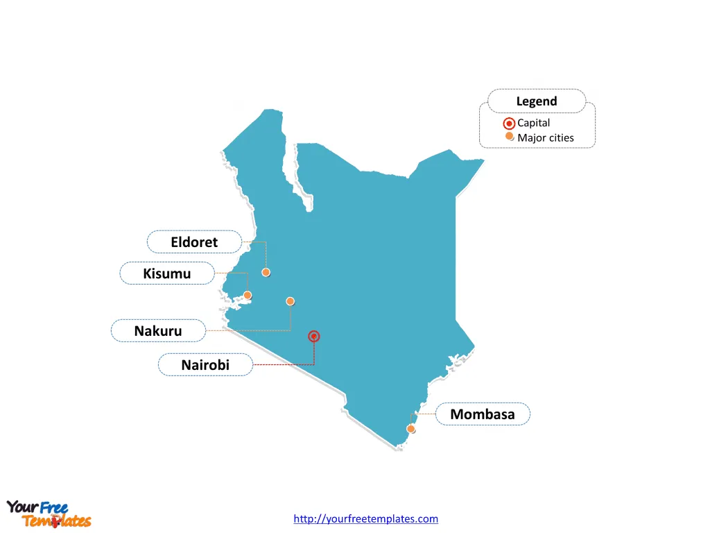
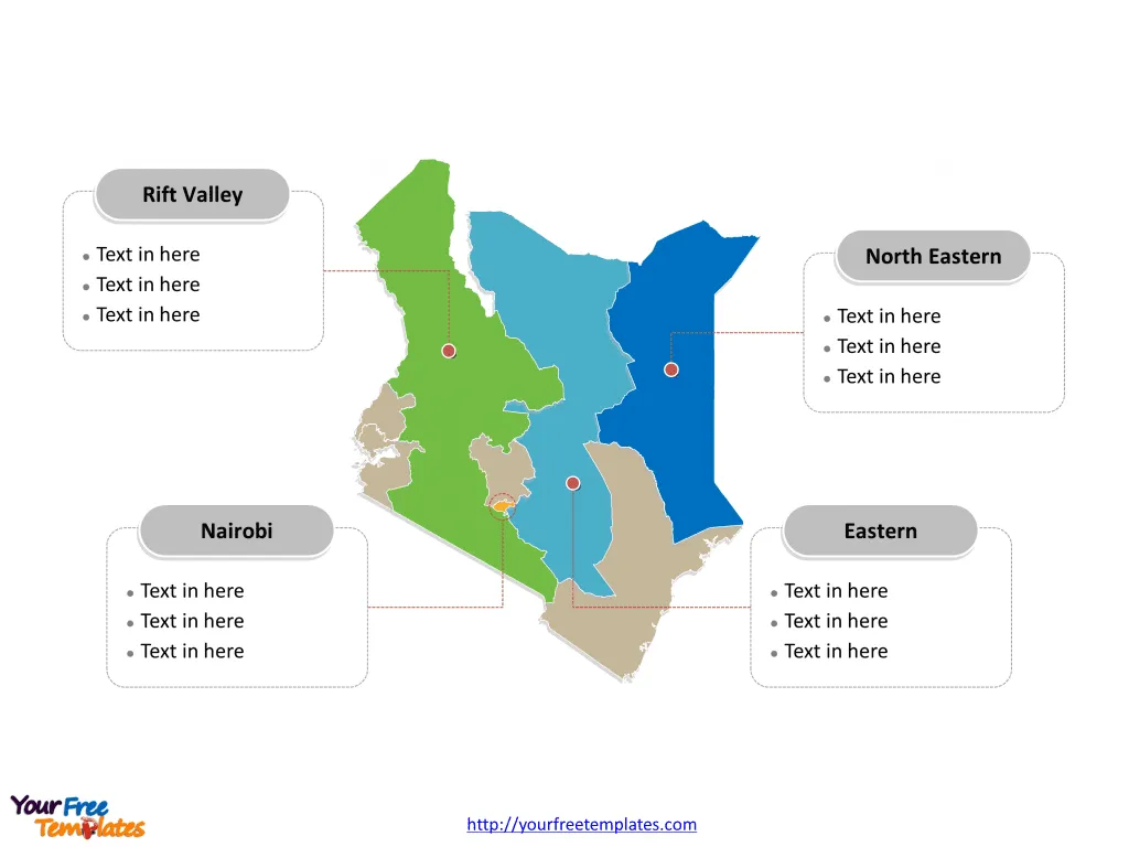
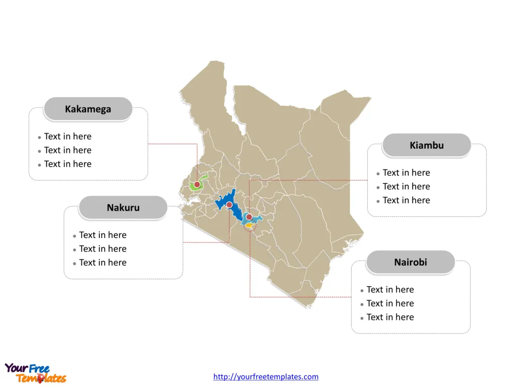
The Kenya Map Template includes three slides. Kenya map with 47 counties, labeling major counties, Nairobi (County), Kakamega, Kiambu, and Nakuru. Kenya map labeled with capital and major cities, Nairobi, Mombasa, Kisumu, Nakuru, and Eldoret.
Kenya is located in East Africa, lying astride the equator, and is characterized by its varied landscapes that range from the Indian Ocean coastline to the eastern edge of the Great Rift Valley and the expansive savannahs. Its geographical coordinates are approximately 1°N latitude and 38°E longitude.
Kenya shares its borders with five countries: Tanzania to the south, Uganda to the west, South Sudan to the NW, Ethiopia to the north, and Somalia to the east. Additionally, its southeastern border lies along the Indian Ocean, providing it with a significant coastline that contributes to its cultural and economic activities.
Slide 1, Kenya map labeled with capital and major cities.
Kenya, a country renowned for its breathtaking landscapes, wildlife, and cultural heritage, is also home to vibrant cities and significant counties. Its capital and largest city is Nairobi, other major cities including Mombasa, Kisumu, Nakuru, and Eldoret. This overview delves into the major cities including Nairobi, Mombasa, Kisumu, Nakuru, and Eldoret, as well as notable counties such as Nairobi County, Kakamega, Kiambu, and Nakuru.
Major Cities
Nairobi Nairobi, not only the capital city but also the largest urban center in Kenya, is a bustling metropolis that serves as the economic, political, and cultural heart of the country. With a population of approximately 5,454,000, Nairobi is a city of contrasts, where modern skyscrapers and upscale shopping malls coexist with informal settlements. It’s a hub for international businesses, NGOs, and also the gateway to the world-famous safari parks of Kenya.
Mombasa Mombasa, Kenya’s oldest and second-largest city, is a coastal gem with a population of 1,208,333. Known for its historical significance, Mombasa is a melting pot of cultures and traditions, evident in its architecture, cuisine, and festivals. Its beautiful beaches, like Diani and Nyali, make it a popular tourist destination.

Kisumu Kisumu, the third-largest city in Kenya, is a key port city on the shores of Lake Victoria with a population of 397,957. It is an important link for trade and transport in the Great Lakes region and has a vibrant fishing industry. Kisumu is also known for its beautiful sunsets over the lake, cultural festivals, and bird watching opportunities.
Nakuru Nakuru, elevated to city status by President Uhuru Kenyatta on 1 December 2021, is now the fourth-largest city in Kenya with a population of 570,674. It’s renowned for Lake Nakuru, famous for its flamingo populations, and Nakuru National Park, a sanctuary for rhinos and giraffes. The city is an agricultural hub in the region.
Eldoret Eldoret, the fifth-largest city and the largest in the North Region of Kenya, has a population of 475,716. It is known as the “Home of Champions” due to its high altitude, favorable for training long-distance runners. Eldoret is also a significant commercial and agricultural center.
Slide 2, map of Kenya labeled with major provinces.
Kenya is a country divided into 8 provinces before 2013: they are Central, Coast, Eastern, Nairobi, North Eastern, Nyanza, Rift Valley, and Western. Every individual political subdivision is an editable shape.

Slide 3, Kenya map labeled with major counties.
Kenya is a country divided into 47 counties in 2013: they are Baringo, Bomet, Bungoma, Busia, Elgeyo-Marakwet, Embu, Garissa, Homa Bay, Isiolo, Kajiado, Kakamega, Kericho, Kiambu, Kilifi, Kirinyaga, Kisii, Kisumu, Kitui, Kwale, Laikipia, Lamu, Machakos, Makueni, Mandera, Marsabit, Meru, Migori, Mombasa (County), Murang’a, Nairobi (County), Nakuru, Nandi, Narok, Nyamira, Nyandarua, Nyeri, Samburu, Siaya, Taita–Taveta, Tana River, Tharaka-Nithi, Trans-Nzoia, Turkana, Uasin Gishu, Vihiga, Wajir, and West Pokot. Every individual political subdivision is an editable shape.
Major Counties on Kenya map
Nairobi County Nairobi County, encompassing the capital city, is unique as its boundaries coincide with those of the city, making it a city-county. It is the most populous and economically significant region, hosting the national government, multinational corporations, and numerous educational institutions.
Kakamega Kakamega County, located in western Kenya, is known for its lush rainforests, including the Kakamega Forest Reserve, a remnant of the ancient Guineo-Congolian rainforest. The county has a rich cultural heritage and is famous for bullfighting and traditional Luhya music and dances.
Kiambu Kiambu County, bordering Nairobi to the north, is one of the most populous counties. It boasts a mix of urban and rural landscapes, with notable towns like Ruiru, Kikuyu, and Thika. The county is a significant contributor to Kenya’s economy, especially in agriculture, real estate, and manufacturing.
Nakuru County Nakuru County, home to the newly anointed city of Nakuru, is a pivotal agricultural region, thanks to its fertile lands and favorable climate. The county is also a tourist magnet, with attractions such as Lake Nakuru, Hell’s Gate National Park, and Menengai Crater offering stunning natural beauty and wildlife.

In conclusion, Kenya’s major cities and counties are not just administrative entities but are vibrant centers of culture, economy, and natural beauty. From the urban hustle and bustle of Nairobi to the tranquil landscapes of Kakamega, these regions reflect the diverse and dynamic spirit of Kenya.
Please check our premium maps in ofomaps.com.
Size: 456K
Type: PPTX
Aspect Ratio: Standard 4:3
Click the blue button to download it.
Download the 4:3 Template
Aspect Ratio: Widescreen 16:9
Click the green button to download it.
Download the 16:9 Template


