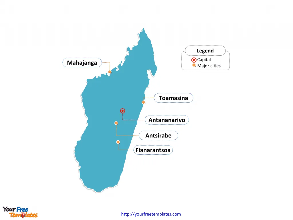
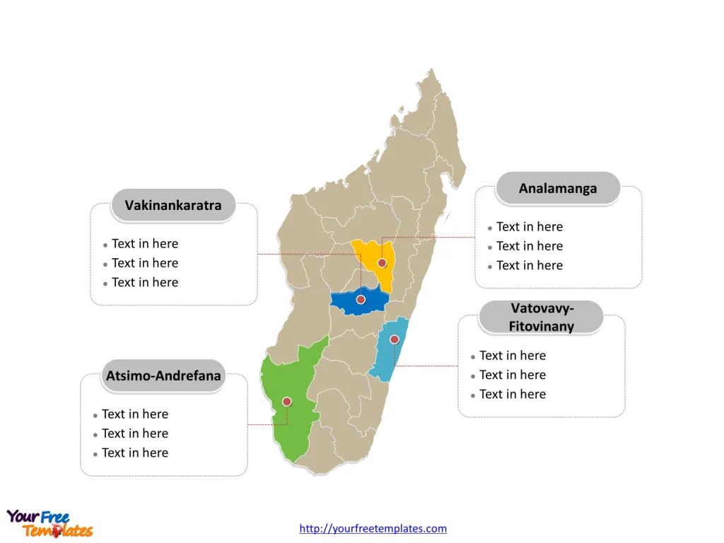
The Madagascar Map Template includes three slides. Madagascar map with 22 regions, labeling major regions, Analamanga, Vakinankaratra, Vatovavy-Fitovinany, and Atsimo-Andrefana. Madagascar map labeled with capital and major cities, Antananarivo, Toamasina, Antsirabe, Mahajanga, and Fianarantsoa.
Location Madagascar, the fourth largest island in the world, is located in the Indian Ocean off the southeastern coast of Africa. It is separated from the African continent by the Mozambique Channel.
Population As of my last knowledge update in September 2021, Madagascar had an estimated population of over 27 million people. The population is predominantly of Malayo-Indonesian and African descent, with a rich tapestry of cultural diversity and traditions.
Economy Madagascar’s economy is primarily based on agriculture, with the majority of the population engaged in subsistence farming. The country is known for its unique biodiversity and natural resources, which contribute to its economy. Additionally, the tourism industry has been growing, attracting visitors to its stunning landscapes and diverse wildlife.
Neighboring Countries Madagascar is neighbored by the African mainland, with Mozambique lying to the west across the Mozambique Channel. The proximity to the African coast has historical and economic significance, influencing trade and cultural exchange between Madagascar and its neighboring countries.
Slide 1, Madagascar map labeled with capital and major cities.
Madagascar is a captivating island country in the Indian Ocean, renowned for its unique biodiversity and rich cultural heritage. The country boasts several major cities, each contributing to its vibrant tapestry. Antananarivo is the capital and largest city of Madagascar, other major cities including Toamasina, Antsirabe, Mahajanga, and Fianarantsoa.
Antananarivo
Antananarivo is the capital and largest city of Madagascar, located in the Analamanga region. This bustling city, situated in the highlands region, is a hub of history, culture, and commerce.

Toamasina
Toamasina, also known as Tamatave, is the second largest city in Madagascar and a key port town located in the Atsinanana region. It serves as a vital center for trade and transportation, particularly due to its strategic coastal location.
Antsirabe
Antsirabe is a charming city nestled in the Vakinankaratra region. Known for its pleasant climate and thermal springs, it is a popular destination for relaxation and rejuvenation.
Mahajanga
Mahajanga, situated in the Boeny region, is a vibrant coastal city with a rich blend of cultures. It serves as an important port and gateway to Madagascar’s northwest region.
Fianarantsoa
Fianarantsoa, located in the Haute Matsiatra region, is a city renowned for its cultural significance and historical architecture. It is also a major center for education and arts.
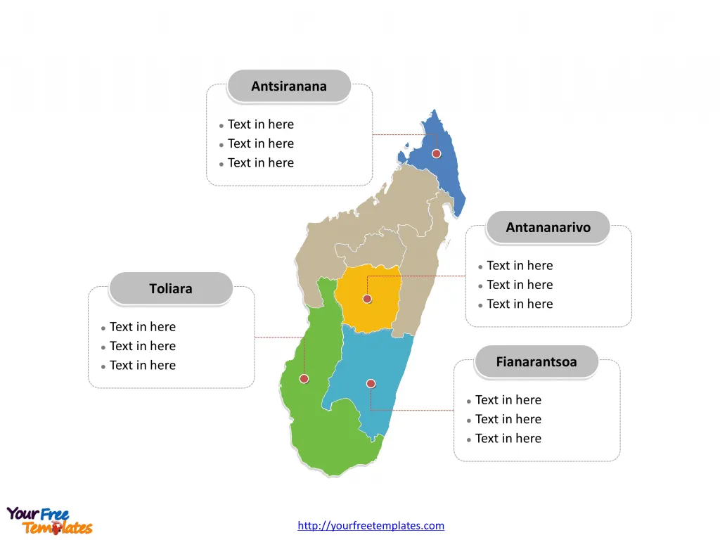
Slide 2, Madagascar map labeled with six provinces.
Madagascar is a country divided into six provinces; they are 1. Antananarivo Province, 2. Antsiranana Province, 3. Fianarantsoa Province, 4. Mahajanga Province, 5. Toamasina Province, and 6. Toliara Province. Every individual political subdivision is an editable shape.

Slide 3, Madagascar map labeled with major regions.
Madagascar is a country divided into 22 regions; they are Alaotra-Mangoro, Amoron’i Mania, Analamanga, Analanjirofo, Androy, Anosy, Atsimo-Andrefana (South-West), Atsimo-Atsinanana (South-East), Atsinanana (East), Betsiboka, Boeny, Bongolava, Diana, Haute Matsiatra (Upper Matsiatra), Ihorombe, Itasy, Melaky, Menabe, Sava, Sofia, Vakinankaratra, and Vatovavy-Fitovinany. Every individual political subdivision is an editable shape.
Analamanga
Analamanga is one of Madagascar’s key regions, encompassing the capital city, Antananarivo. This region is a focal point for political, economic, and cultural activities.

Vakinankaratra
Vakinankaratra, home to the city of Antsirabe, is known for its picturesque landscapes and agricultural significance. The region’s temperate climate and fertile lands contribute to its agricultural productivity.
Vatovavy-Fitovinany
Vatovavy-Fitovinany is a region characterized by its diverse ecosystems and natural beauty. It is located in the southeastern part of Madagascar, known for its stunning coastal areas and unique flora and fauna.
Atsimo-Andrefana
Atsimo-Andrefana, where the city of Toliara is situated, is a region with a rich cultural heritage and significant economic activities. It is known for its coastal beauty and contributions to Madagascar’s agricultural and industrial sectors.
Madagascar’s major cities and regions each offer a distinctive experience, contributing to the country’s cultural, economic, and geographical diversity.
Looking for Premium maps, please visit our affiliate site: https://editablemaps.com/ or https://ofomaps.com/
Size:143K
Type: PPTX
Aspect Ratio: Standard 4:3
Click the blue button to download it.
Download the 4:3 Template
Aspect Ratio: Widescreen 16:9
Click the green button to download it.
Download the 16:9 Template


