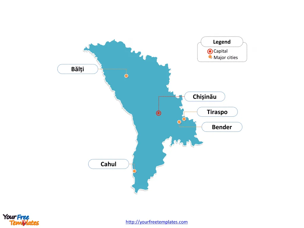
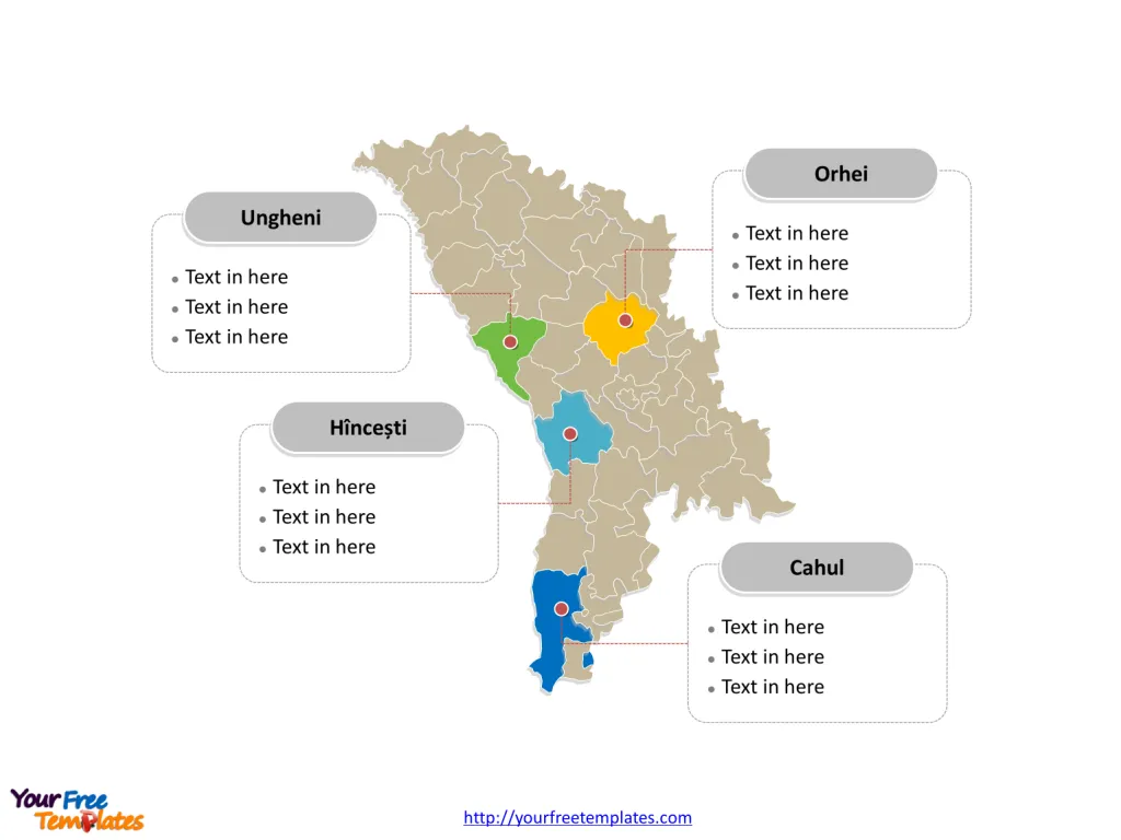
The Moldova Map Template includes two slides. Moldova map with thirty-two districts, three municipalities and two autonomous regions, labeling major districts, Orhei, Cahul, Hîncești, and Ungheni. Moldova map labeled with capital and major cities, Chișinău, Tiraspo, Bălți, Bender, and Cahul.
Moldova is located in Eastern Europe, bordered by Romania to the west and Ukraine to the north, east, and south. With a population of around 2.6 million people, Moldova has an economy largely based on agriculture, viticulture, and food processing. The country also has significant mineral resources, including deposits of limestone, gypsum, and arable land suitable for wheat cultivation.
Moldova’s strategic location between Romania and Ukraine has influenced its historical and cultural development, as well as its economic ties with neighboring countries and the wider European region. Despite facing economic challenges, Moldova continues to work towards strengthening its economy and enhancing its regional partnerships.
Slide 1, Moldova map labeled with capital and major cities.
Chișinău is the capital and largest city of Moldova, other major cities including Tiraspo, Bălți, Bender, and Cahul.
Capital and major cities on Moldova map
Chișinău: The Vibrant Capital
Chișinău, the capital and largest city of Moldova, is a bustling metropolis located in the heart of the country. With a population of over 660,000, Chișinău serves as a significant economic, cultural, and administrative hub. The city’s historical landmarks, dynamic arts scene, and modern urban developments make it a prominent center of Moldovan life.

Tiraspol: A Cultural Gem
Tiraspol, the second-largest city and administrative center of the breakaway region of Transnistria, is known for its rich historical heritage and vibrant cultural scene. With a population of over 130,000, Tiraspol offers a blend of cultural richness and historical significance, making it a captivating destination for visitors and residents alike.
Bălți: A Hub of Northern Moldova
Bălți, situated in the northern part of the country, is celebrated for its historical significance and vibrant urban atmosphere. With a population of over 100,000, Bălți plays a pivotal role in shaping the cultural and economic landscape of northern Moldova.
Bender: A City of Historical Significance
Bender, located in the Transnistria region, is renowned for its historical heritage and strategic location. With a population of over 97,000, Bender’s historical significance and architectural landmarks add to its allure as a destination for visitors and residents.
Cahul: A Southern Gem
Cahul, situated in the southern part of Moldova, is known for its picturesque landscapes and historical charm. With a population of over 39,000, Cahul offers a unique blend of natural beauty and cultural attractions, making it an appealing destination.
Slide 2, Moldova map labeled with major administration districts.
Moldova map shows the country divided into thirty-two districts, three municipalities and two autonomous regions: thirty-two districts: Anenii Noi, Basarabeasca, Briceni, Cahul, Cantemir, Călărași, Căușeni, Cimișlia, Criuleni, Dondușeni, Drochia, Dubăsari, Edineț, Fălești, Florești, Glodeni, Hîncești, Ialoveni, Leova, Nisporeni, Ocnița, Orhei, Rezina, Rîșcani, Sîngerei, Soroca, Strășeni, Șoldănești, Ștefan Vodă, Taraclia, Telenești, Ungheni, three municipalities: Chișinău, Bălți and Bender and two autonomous regions: Gagauzia and Transnistria. Every individual political subdivision is an editable shape.
Major districts on Moldova map
The Orhei District is known for its diverse landscapes and cultural significance, contributing to the region’s importance within Moldova’s rural fabric.

The Cahul District, located in southern Moldova, offers a blend of natural beauty and historical heritage, shaping the region’s identity within the country’s urban and rural landscape.
The Hîncești District, with its diverse rural landscapes and cultural offerings, adds to the country’s economic, administrative, and cultural diversity.
The Ungheni District is celebrated for its historical significance and economic influence, contributing to Moldova’s diverse and vibrant landscape.
Moldova’s capital, major cities, and significant districts collectively contribute to the country’s cultural, historical, and economic landscape, making it a captivating destination for visitors and a dynamic hub for residents.
Looking for Premium maps, please visit our affiliate site: https://editablemaps.com/ or https://ofomaps.com/
Size: 133K
Type: PPTX
Aspect Ratio: Standard 4:3
Click the blue button to download it.
Download the 4:3 Template
Aspect Ratio: Widescreen 16:9
Click the green button to download it.
Download the 16:9 Template


