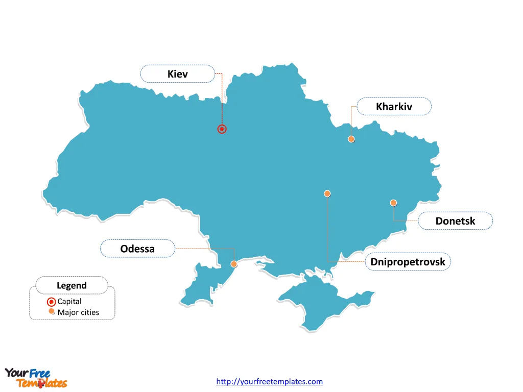
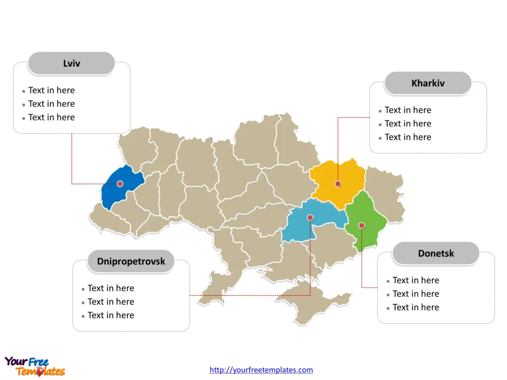
The Ukraine Map Template includes two slides. Ukraine map with 27 regions, labeling with major regions, Donetsk, Dnipropetrovsk, Kharkiv, and Kiev. Ukraine map labeling with national capital and major cities, Kiev, Kharkiv, Odessa, Dnipropetrovsk, and Donetsk.
Location: Ukraine, the largest country in Europe, is situated in Eastern Europe. It shares borders with Belarus to the north, Russia to the east, Moldova and Romania to the southwest, Hungary, Slovakia, and Poland to the west, and the Black Sea to the south.
Population: Ukraine has a population of approximately 41 million people, making it the 8th most populous country in Europe. The capital city, Kyiv, is the largest urban area with over 2.8 million residents.
Economy: Ukraine has a mixed economy with a diverse industrial base, including heavy machinery, aerospace, and energy production. It is also known for its rich agricultural resources, particularly in grain production. The country has been working to modernize its economy and strengthen its ties with the European Union.
Neighboring Countries: Ukraine shares its borders with several countries, including Belarus, Russia, Moldova, Romania, Hungary, Slovakia, and Poland. Its location at the crossroads of Eastern Europe has historically made it a key player in regional geopolitics and trade.
Slide 1, Ukraine map labeled with capital and major cities.
Its capital and largest city is Kiev, other major cities including Kharkiv, Odessa, Dnipropetrovsk, and Donetsk.
Capital and Major Cities on Ukraine map
Kyiv: The Capital Kyiv, the capital and largest city of Ukraine, is a historical and cultural center with a population of over 2.9 million. It is renowned for its architectural landmarks, including the golden-domed St. Sophia’s Cathedral and the UNESCO-listed Kyiv Pechersk Lavra.

Kharkiv: The Industrial Hub Kharkiv, the second-largest city in Ukraine, is an important industrial and educational center with a population of over 1.4 million. It is known for its engineering and IT industries, as well as its vibrant cultural scene.
Odessa: A Maritime Gem Odessa, a major port city on the Black Sea, has a population of over 1 million. It is a significant commercial and cultural center known for its diverse architecture, vibrant nightlife, and beautiful seaside.
Dnipropetrovsk: Industrial and Scientific Hub Dnipropetrovsk, also known as Dnipro, is a major industrial and scientific center with a population of over 968,000. It is recognized for its aerospace and metallurgical industries, as well as its scientific research institutions.
Donetsk: Historical and Cultural Center Donetsk, with a population of over 900,000, is a city with a rich historical and cultural heritage, though it has faced challenges due to regional conflicts.
Slide 2, Ukraine map labeled with major administration districts.
Ukraine is a country with 27 regions, 24 oblasts, one autonomous republic, and two “cities with special status”, Cherkasy, Chernihiv, Chernivtsi, Dnipropetrovsk, Donetsk, Ivano-Frankivsk, Kharkiv, Kherson, Khmelnytskyi, Kiev, Kirovohrad, Luhansk, Lviv, Mykolaiv, Odessa, Poltava, Rivne, Sumy, Ternopil, Vinnytsia, Volyn, Zakarpattia, Zaporizhia, and Zhytomyr, Autonomous Republic of Crimea, Kiev and Sevastopol cities. Every individual political subdivision is an editable shape.
Major Regions on Ukraine map
Donetsk The Donetsk region, located in eastern Ukraine, is historically known for its coal mining and heavy industry. However, it has been significantly affected by the ongoing regional conflicts.

Dnipropetrovsk Dnipropetrovsk, now known as Dnipro, is a region known for its industrial and scientific significance, contributing to Ukraine’s economic and technological development.
Kharkiv Kharkiv, a region in northeastern Ukraine, is an important center for education, technology, and industry, playing a pivotal role in the country’s economic growth.
Kiev The Kiev region, surrounding the capital city, is not only the political and administrative center but also a significant economic and cultural hub, driving Ukraine’s development and progress.
Looking for Premium maps, please visit our affiliate site: https://editablemaps.com/ or https://ofomaps.com/
Size: 108K
Type: PPTX
Aspect Ratio: Standard 4:3
Click the blue button to download it.
Download the 4:3 Template
Aspect Ratio: Widescreen 16:9
Click the green button to download it.
Download the 16:9 Template


