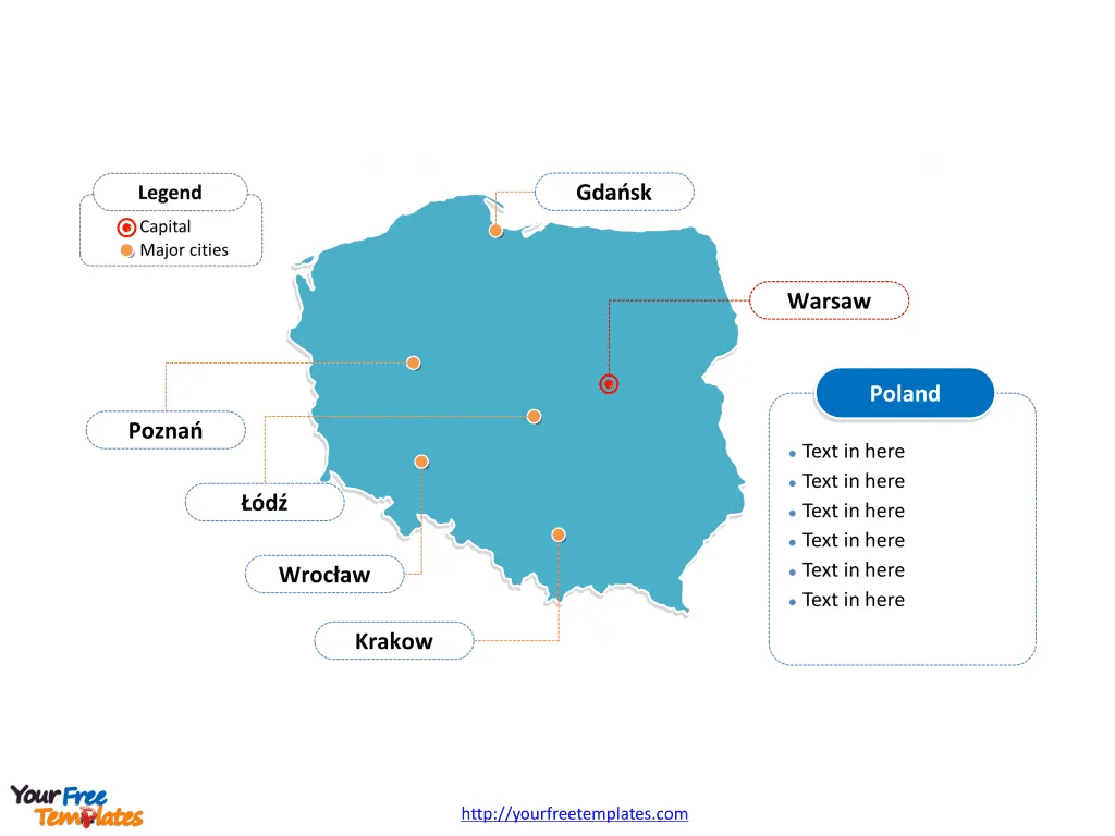
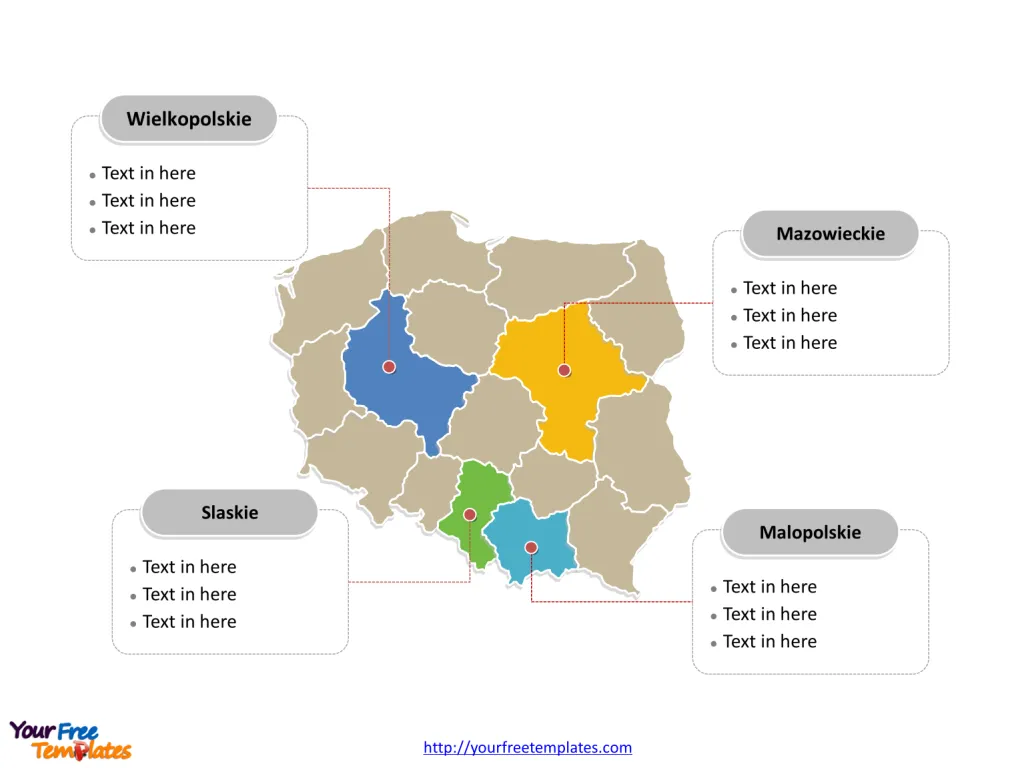
The Poland Map Template includes two slides. Poland map with 16 voivodeships, highlighting Mazowieckie, Wielkopolskie, Małopolskie and Śląskie voivodeships. Poland map labeled with Warsaw, Łódź, Krakow, Wrocław, Poznań, and Gdańsk cities.
Poland, located in Central Europe, is bordered by Germany to the west, the Czech Republic and Slovakia to the south, Ukraine and Belarus to the east, and Lithuania and Russia (Kaliningrad Oblast) to the northeast. As of 2021, Poland’s population was estimated to be around 38 million people, making it one of the most populous countries in the European Union.
Poland has a diverse and growing economy, with key sectors including manufacturing, agriculture, and services. The country has seen significant economic development since joining the European Union in 2004, attracting foreign investment and experiencing steady GDP growth. Its strategic location and well-developed infrastructure have contributed to its position as a regional economic powerhouse in Central Europe.
Slide 1, Poland map labeled with capital and major cities.
Its capital and largest city is Warsaw, other major cities including Łódź, Krakow, Wrocław, Poznań, and Gdańsk. Warsaw has been the largest city in this country with 1.7 million people, while population of other cities are less than 1 million.
Capital and major cities on Poland map
Warsaw: The Cultural and Economic Hub
Warsaw, the capital and largest city of Poland, stands on the Vistula River, serving as a significant cultural, political, and economic center. Boasting a population of 1.74 million residents within its city limits, Warsaw is an “Alpha–” global city and a major international tourist destination. It is a thriving metropolis and the 9th most-populous capital city in the European Union.
Krakow: The Ancient Cultural Capital
Krakow, the second-largest city and the ancient capital of Poland, is a top tourist destination known for its long history and cultural significance. With seven universities and a vibrant service sector, Krakow is the leading center of science and education in Poland.

Wrocław: Historical Capital of Silesia
Wrocław, the historical capital of Silesia, is the largest city in western Poland. It is a major cultural and business center, boasting a rich history and a growing population of 672,929.
Łódź: The Thriving Academic Center
Łódź, the third-largest city in Poland, is a thriving center of academic life, hosting three major state-owned universities and a number of smaller schools of higher education. It is a vibrant and culturally rich city with a population of 715,360.
Poznań and Gdańsk: Cultural and Commercial Centers
Poznań, located in the Greater Poland region, is an important cultural and business center, known for its renaissance old town and the Ostrów Tumski cathedral. Gdańsk, the principal seaport of Poland, is a maritime city that forms the metropolitan area known as the Tricity, with a population approaching 1.4 million.
Slide 2, Poland map labeled with major administration districts.
Poland map shows the country composed of 16 voivodeships, Dolnośląskie, Kujawsko-Pomorskie, Łódzkie, Lubelskie, Lubuskie, Małopolskie, Mazowieckie, Opolskie, Podkarpackie, Podlaskie, Pomorskie, Śląskie, Świętokrzyskie, Warmińsko-Mazurskie, Wielkopolskie, and Zachodniopomorskie. The most populated voivodeships are Śląskie, Małopolskie, Wielkopolskie and Mazowieckie. Every individual political subdivision is an editable shape.
Major Voivodeships on Poland map
Voivodeships
- Mazowieckie: Centered around Warsaw, this voivodeship is the most populous and economically significant region in Poland.
- Wielkopolskie: Home to Poznań, it is known for its regional customs and rich cultural heritage.
- Małopolskie: Krakow serves as the capital of this voivodeship, which is a hub of science, education, and cultural significance.
- Śląskie: Wrocław is the historical capital of Silesia and the largest city in this voivodeship, contributing to its rich historical and economic significance.

Poland’s cities and voivodeships collectively offer a blend of historical, cultural, and economic significance, making it a captivating destination for travelers and a dynamic hub for residents.
Looking for Premium maps, please visit our affiliate site: https://editablemaps.com/ or https://ofomaps.com/
Size: 125K
Type: PPTX
Aspect Ratio: Standard 4:3
Click the blue button to download it.
Download the 4:3 Template
Aspect Ratio: Widescreen 16:9
Click the green button to download it.
Download the 16:9 Template


