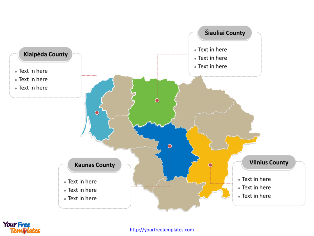
The Lithuania Map Template includes two slides. Lithuania map with 10 counties, labeling major counties, Vilnius County, Kaunas County, Klaipėda County, and Šiauliai County. Lithuania map labeled with capital and major cities, Vilnius, Kaunas, Klaipėda, Šiauliai, Panevėžys, and Alytus.
Lithuania, the largest of the Baltic nations, is located along the southeastern shore of the Baltic Sea and shares borders with Latvia, Belarus, Poland, and the Russia enclave of Kaliningrad. With a population of 2,655,755, Lithuania boasts an area of about 65,300 sq km.
The country’s economy is classified as high-income, with a GDP of $70.3 billion and a GDP per capita of $48,397. Services dominate the economy, while industry and agriculture are also significant sectors, with a growing information technology sector. Lithuania’s population is predominantly ethnic Lithuanian, with sizeable minorities of Poles, Russians, Belarusians, and Ukrainians. The country is heavily urbanized, and more than three-fourths of the population identifies as Roman Catholic. Lithuania is a member of major international organizations, including the U.N., the European Union, NATO, and the Organization for Economic Cooperation and Development.
Slide 1, Lithuania map labeled with capital and major cities.
Vilnius is the capital and largest city of Lithuania, other major cities including Kaunas, Klaipėda, Šiauliai, Panevėžys, and Alytus.
Vilnius, the capital and largest city, serves as a bustling hub of economic and cultural activity. Kaunas, the second-largest city, is a significant center of commerce and cultural heritage, while Klaipėda, a major seaport, plays a vital role in the country’s maritime industry. Šiauliai and Panevėžys are notable for their historical significance and urban vibrancy, while Alytus offers a blend of cultural charm and modern development, contributing to Lithuania’s diverse urban fabric.

Slide 2, Lithuania map labeled with major administration districts.
Lithuania map shows the country divided into 10 counties: Alytus County, Kaunas County, Klaipėda County, Marijampolė County, Panevėžys County, Šiauliai County, Tauragė County, Telšiai County, Utena County, and Vilnius County. The most populated counties are Vilnius, Šiauliai, Kaunas and Klaipėda. Every individual political subdivision is an editable shape.
The major counties, including Vilnius County, Kaunas County, Klaipėda County, and Šiauliai County, play pivotal roles in shaping Lithuania’s administrative, economic, and cultural landscape. These counties are not only centers of regional governance but also contribute significantly to the country’s economic and social development.

Lithuania’s capital and major cities, along with the significant counties, collectively showcase the country’s unique blend of historical heritage, urban vibrancy, and economic significance. These urban centers and administrative regions make Lithuania a compelling subject for exploration and discovery. The country’s diverse array of urban centers and significant counties highlights Lithuania’s rich cultural heritage, economic vitality, and urban development, making it a captivating destination for visitors and a dynamic hub for residents.
Looking for Premium maps, please visit our affiliate site: https://editablemaps.com/ or https://ofomaps.com/
Size: 101K
Type: PPTX
Aspect Ratio: Standard 4:3
Click the blue button to download it.
Download the 4:3 Template
Aspect Ratio: Widescreen 16:9
Click the green button to download it.
Download the 16:9 Template


