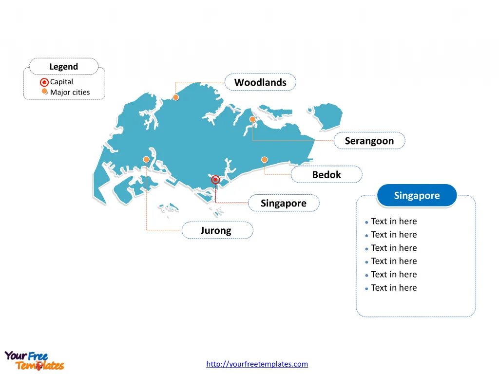
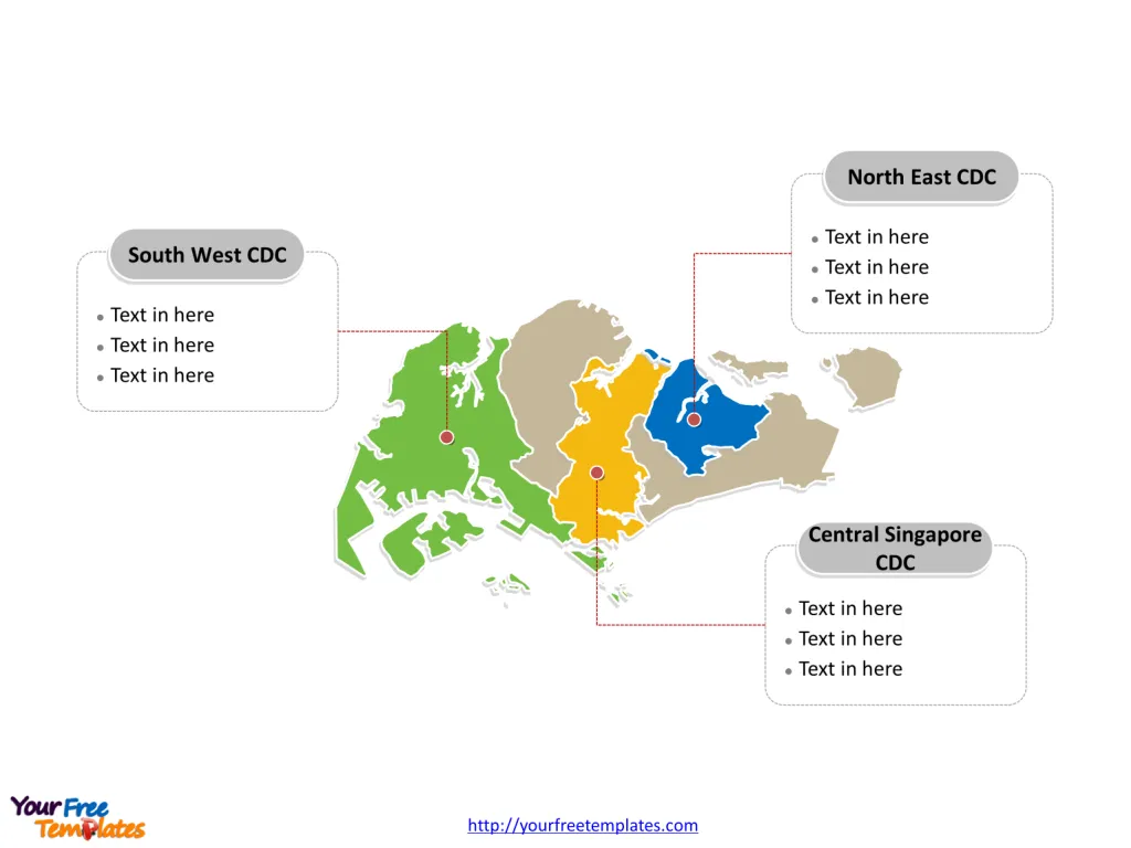
The Singapore Map Template includes two slides. Singapore map with 5 Community Development Councils (CDCs), labeling with major CDCs, North East CDC, South West CDC and Central Singapore CDC. Singapore map labeling with national capital and major planning areas, Singapore, Bedok, Jurong, Woodlands, and Serangoon.
Singapore is a sovereign city-state and island country located in Southeast Asia, known for its strategic position at the southern tip of the Malay Peninsula. It lies just 137 kilometers north of the equator and is separated from Malaysia by the Straits of Johor to its north, and from Indonesia‘s Riau Islands by the Singapore Strait to its south.
This geographical location positions Singapore as a pivotal maritime hub, facilitating significant international shipping routes through the busy Strait of Malacca. Its proximity to these neighboring countries, Malaysia and Indonesia, has profoundly influenced Singapore’s culture, economy, and demographics, making it a vibrant melting pot of diverse influences.
Slide 1, Singapore map labeled with capital and major planning areas.
Singapore’s territory consists of a diamond-shaped main island along with 62 other islets. Its capital and largest planning area is Singapore and Bedok respectively, other major planning areas including Bedok, Jurong, Woodlands, and Serangoon.
Major Planning Areas on Singapore map
Singapore
As the focal point, the Singapore planning area encompasses the central business district and key urban zones. It’s a melting pot of cultural, economic, and social activities, driving the nation’s growth and dynamism.
Bedok
Bedok, located in the East Region, is one of Singapore’s largest residential areas, known for its well-developed amenities, parks, and recreational facilities. It reflects Singapore’s emphasis on livable, sustainable urban planning.

Jurong
Jurong stands out as a major industrial estate and residential area in the West Region. It’s undergoing transformation into a second CBD, with plans for more commercial, leisure, and residential developments, embodying Singapore’s forward-looking urban design.
Woodlands
Woodlands, in the North Region, is a key gateway to Malaysia and is set to become a regional centre. It exemplifies Singapore’s strategic geographical planning, fostering economic ties and providing a vibrant community space.
Serangoon
Serangoon, known for its harmonious mix of residential, commercial, and industrial areas, is part of the North-East Region. It’s home to a diverse community, offering a variety of lifestyles and cultural experiences.
Slide 2, Singapore map labeled with major administration districts.
Singapore is a country consists of 5 Community Development Councils (CDCs), namely the North East CDC, North West CDC, South East CDC, South West CDC and Central Singapore CDC. Every individual political subdivision is an editable shape.
Community Development Councils (CDCs) on Singapore map
North East CDC
Established as part of a restructuring in 2001, the North East CDC covers a significant portion of Singapore, including densely populated and dynamic areas. It aims to foster community spirit and social cohesion among residents through various programs and initiatives. The North East CDC works closely with local government agencies, schools, and social service agencies to support the vulnerable and strengthen the community fabric 13.
South West CDC
The South West CDC is another key region, focusing on community growth and environmental sustainability. It has been actively involved in initiatives like the Clean and Green Singapore movement since 2003, promoting a sustainable lifestyle among its residents. The South West CDC’s programs encourage community involvement in maintaining cleanliness and greenery, reflecting Singapore’s commitment to environmental consciousness 3.
Central Singapore CDC
The Central Singapore CDC serves the heartland of Singapore, including the bustling central and surrounding areas. It plays a crucial role in building a caring, cohesive community by facilitating volunteerism and social programs. This CDC also focuses on aiding residents in achieving upward social mobility through various assistance schemes 3.

Singapore’s CDCs and major planning areas are instrumental in the city-state’s world-renowned urban management and community development, ensuring a high quality of life, sustainability, and social harmony among its residents.
Looking for Premium maps, please visit our affiliate site: https://ofomaps.com/
Size: 116K
Type: PPTX
Aspect Ratio: Standard 4:3
Click the blue button to download it.
Download the 4:3 Template
Aspect Ratio: Widescreen 16:9
Click the green button to download it.
Download the 16:9 Template


