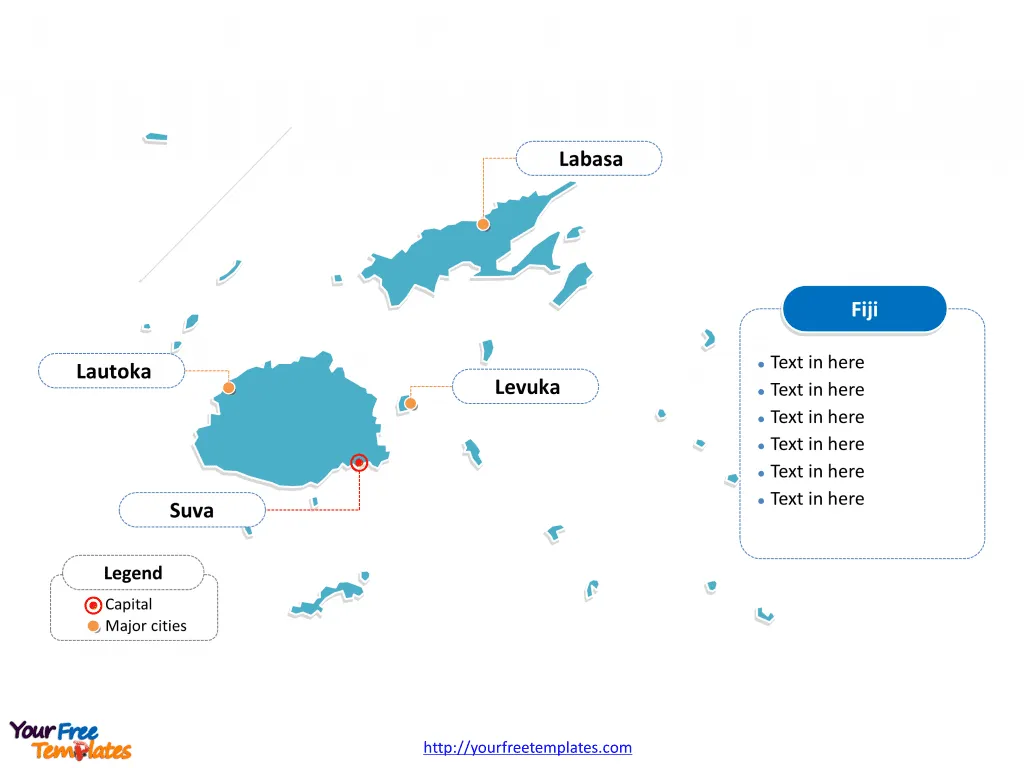
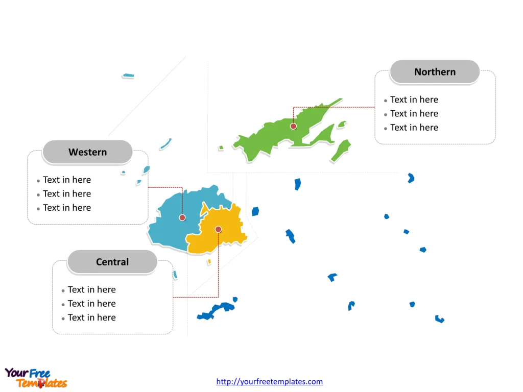
The Fiji Map Template includes two slides. Fiji map with four major divisions, highlighting main regions, Central Division, Northern Division, and Western Division. Fiji map labeled with capital and major cities, Labasa, Suva, Levuka, and Lautoka.
Location: Fiji is an archipelago in the South Pacific Ocean, situated about 1,100 nautical miles northeast of New Zealand‘s North Island. It is comprised of 300 islands, of which approximately 110 are inhabited.
Population: Fiji has a diverse population of around 900,000 people, consisting of indigenous Fijians, Indo-Fijians, and people of other ethnicities. The capital and largest city, Suva, is located on the island of Viti Levu.
Economy: Fiji’s economy is primarily based on tourism, sugar, and clothing exports. The country’s tropical climate, pristine beaches, and vibrant culture make it a popular destination for tourists from around the world.
Neighboring Countries: Fiji’s nearest neighbors are Vanuatu to the west, Tonga to the east, and New Caledonia to the southwest. These island nations, along with others in the region, form the unique and diverse tapestry of the South Pacific.
Slide 1, Fiji map labeled with capital and major cities.
Its capital and largest city is Suva, other major cities including Labasa, Levuka, and Lautoka.
Capital and Major Cities on Fiji map
Suva: The Capital Suva, the capital and largest city of Fiji, is situated on the southeast coast of the island of Viti Levu. As the political and administrative center, Suva is a vibrant urban hub with a diverse population and a rich blend of cultures. It is also the main port and commercial center of Fiji.

Lautoka: The Sugar City Lautoka, the second largest city in Fiji, is located on the western side of Viti Levu. Known as the “Sugar City” due to its sugar cane industry, Lautoka is a major port and the center of the country’s sugar and timber processing.
Labasa: The Northern Hub Labasa, situated on the island of Vanua Levu, is the largest town in the Northern Division of Fiji. It serves as the commercial and administrative center for the northern region and is known for its sugarcane and tourism industries.
Levuka: Historic Significance Levuka, located on the island of Ovalau, was the first capital of Fiji and was the center of European and American influence in the 19th century. It is recognized for its historical significance and was designated a UNESCO World Heritage Site in 2013.
Slide 2, Fiji map labeled with major administration districts.
Fiji is a country composed of four major divisions, Central Division, Eastern Division, Northern Division, and Western Division. The most populated divisions are Central Division and Western Division. Every individual political subdivision is an editable shape.
Major Regions on Fiji map
Central Division The Central Division, with Suva as its capital, encompasses the urban and industrial heart of Fiji. It is the most developed and populous division, housing the majority of the country’s population and economic activity. This division is known for its diverse cultural and commercial significance.

Northern Division The Northern Division, with Labasa as its main town, is characterized by its lush landscapes and agricultural activities. It is an important region for sugar cane production and is known for its natural beauty and cultural heritage.
Western Division The Western Division, with Lautoka as its major city, is renowned for its sugar cane and timber industries. It is a significant hub for trade and commerce, with a focus on agricultural and industrial development. This division is also home to some of Fiji’s most popular tourist destinations, particularly the Mamanuca and Yasawa island groups.
Looking for Premium maps, please visit our affiliate site: https://editablemaps.com/ or https://ofomaps.com/
Size: 105K
Type: PPTX
Aspect Ratio: Standard 4:3
Click the blue button to download it.
Download the 4:3 Template
Aspect Ratio: Widescreen 16:9
Click the green button to download it.
Download the 16:9 Template


