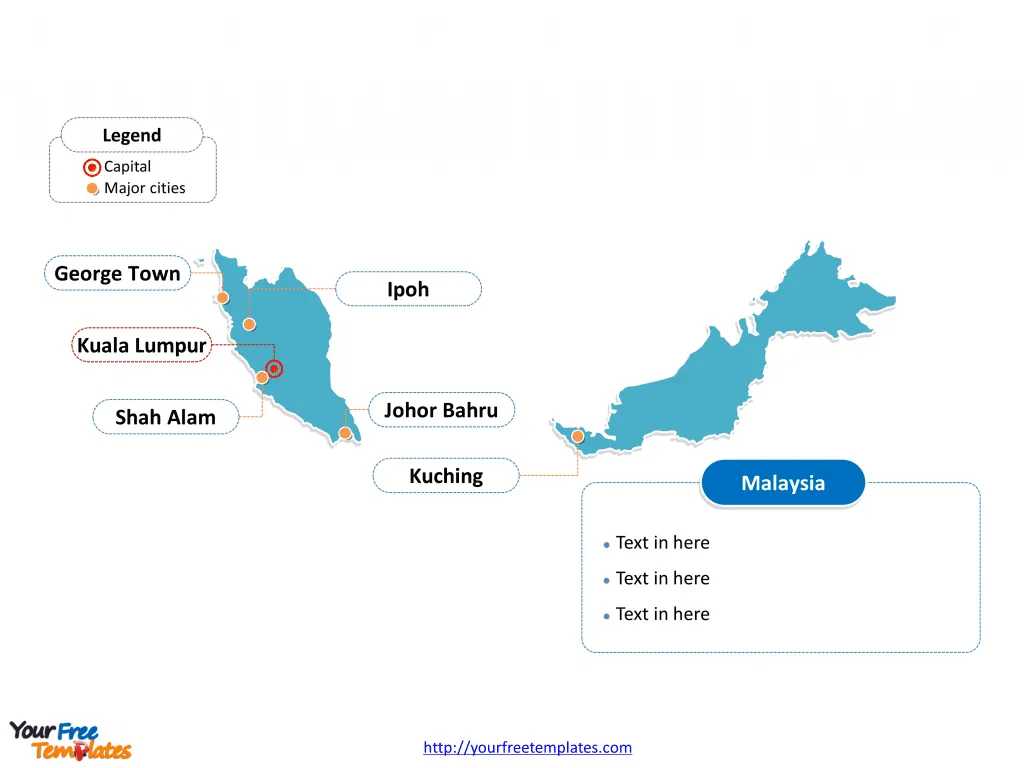
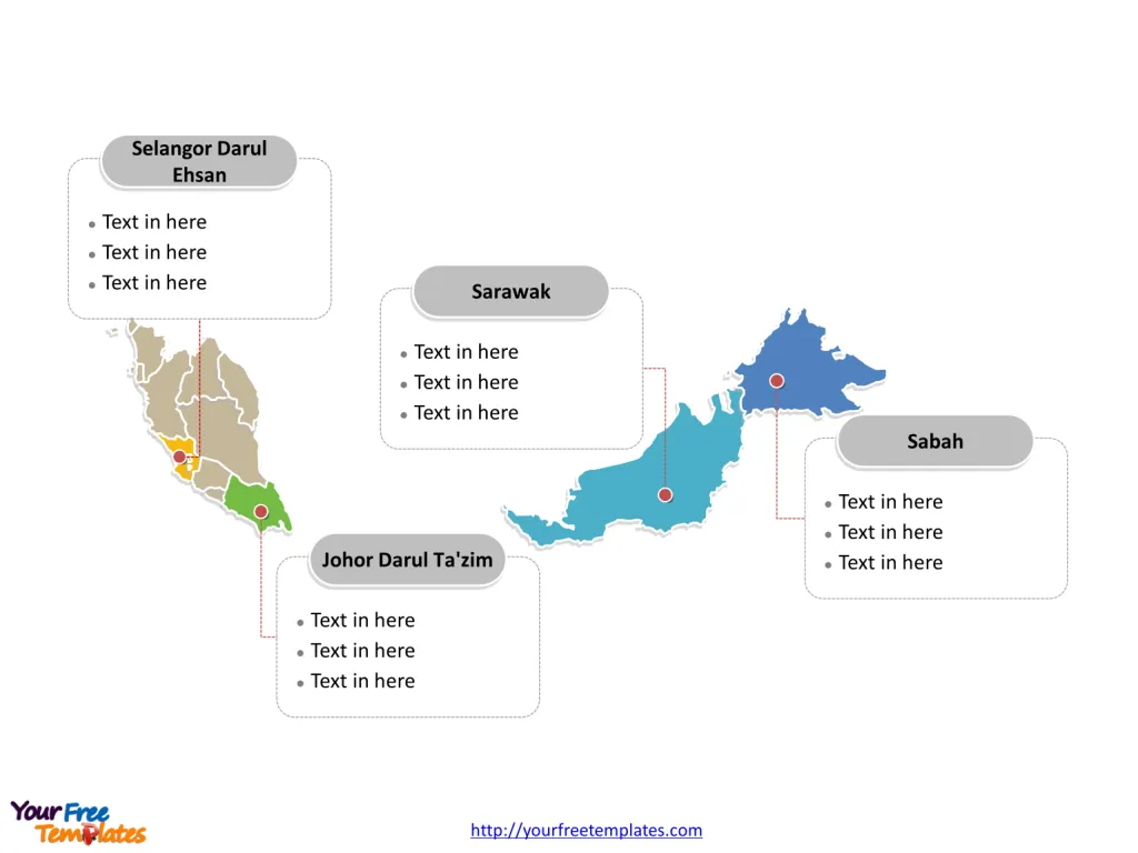
The Malaysia Map PowerPoint Template includes two slides, that is, the Malaysia map with outline and Malaysia map with states. Firstly, our Malaysia Editable Map blank templates have capital and major cities on it. Secondly, there are 13 states and three federal territories in our Malaysia map PowerPoint templates, in our Malaysia map template of divisions.
Malaysia, a country that embodies the essence of Asia, is a melting pot of cultural diversity and natural beauty. Strategically positioned in Southeast Asia, it consists of 13 states and 3 federal territories, spread across two main landmasses – Peninsular Malaysia and East Malaysia. This vibrant nation offers a unique blend of modernity and tradition, reflected in its bustling cities, serene landscapes, and rich heritage.
Slide 1, Malaysia Map labeled with capital and major cities
Our Map of Malaysia is for the federal contry in Southeast Asia.
Malaysia’s Location and Geographical Splendour
Malaysia is divided into two distinct parts: Peninsular Malaysia, which borders Thailand to the north and Singapore to the south, and East Malaysia, located on the island of Borneo, sharing borders with Indonesia and Brunei. The South China Sea separates these two regions. Its strategic location along the Strait of Malacca has made it a historical crossroads for trade routes and cultural exchanges.

Major Cities of on Malaysia map
Kuala Lumpur
The heart of Malaysia beats in Kuala Lumpur, its capital city. This bustling metropolis is a showcase of towering skyscrapers, including the iconic Petronas Twin Towers, and colonial architecture. The city is a hub of economic and cultural activities, offering endless shopping opportunities, culinary delights, and vibrant nightlife.
George Town (Penang)
A city steeped in history, George Town is the capital of Penang State and a UNESCO World Heritage site. Its well-preserved buildings and multicultural heritage, along with its renowned street food, make it a must-visit destination.
Johor Bahru
Situated at the southern tip of Peninsular Malaysia, Johor Bahru is the gateway to Singapore, acting as a commercial and tourism nexus. It’s known for its historic temples and grand palaces.
Kota Kinabalu (Sabah)
On the island of Borneo, Kota Kinabalu is the capital of Sabah State. It is the gateway to Kinabalu National Park and the majestic Mount Kinabalu. The city itself offers beautiful waterfronts and a diverse cultural scene.
Kuching (Sarawak)
Kuching, the capital of Sarawak, is renowned for its riverfront promenade, diverse museums, and traditional longhouses. It serves as an ideal starting point for exploring the wonders of Borneo.
Slide 2, Malaysia Map labeled with major States.
Malaysia has been ranked as the world’s 44th most populous country, with a population of more than 30 million. Firstly, there are 13 states and three federal territories.
- They are Selangor Darul Ehsan, Johor Darul Ta’zim, Sabah, Sarawak, Perak Darul Ridzuan, Kedah Darul Aman, Kelantan Darul Naim, Penang, Pahang Darul Makmur, Terengganu Darul Iman, Negeri Sembilan Darul Khusus, Malacca, and Perlis Indera Kayangan.
- And three federal territories are Kuala Lumpur, Labuan, and Putrajaya

Major States and Federal Territories
Selangor
Surrounding Kuala Lumpur, Selangor is the most populous and economically significant state in Malaysia. It boasts a blend of urban development and natural attractions, such as the Batu Caves and the National Zoo.
Penang
An island state renowned for its cultural heritage and cuisine, Penang is often referred to as the “Pearl of the Orient”. Its capital, George Town, is a vibrant tapestry of cultures and flavors.
Sabah and Sarawak
On Borneo, Sabah and Sarawak are known for their lush rainforests, diverse wildlife, and indigenous cultures. They offer some of the most stunning natural landscapes in Malaysia, including Mount Kinabalu and the Mulu Caves.
Pahang
The largest state on Peninsular Malaysia, Pahang is home to the Taman Negara, Malaysia’s premier national park and the Cameron Highlands, with its tea plantations and cool climate.
Johor
Johor is a flourishing state with a mix of industrial regions and natural beauty, including pristine beaches and tropical rainforests.
Federal Territories: Kuala Lumpur, Putrajaya, and Labuan
Besides Kuala Lumpur, the federal territories include Putrajaya, the administrative capital with its impressive government buildings and green spaces, and Labuan, an offshore financial center and free trade zone located off the coast of Borneo.
Looking for Premium maps, please visit our affiliate site: https://editablemaps.com/ or https://ofomaps.com/
Size: 107K
Type: PPTX
Aspect Ratio: Standard 4:3
Click the blue button to download it.
Download the 4:3 Template
Aspect Ratio: Widescreen 16:9
Click the green button to download it.
Download the 16:9 Template


