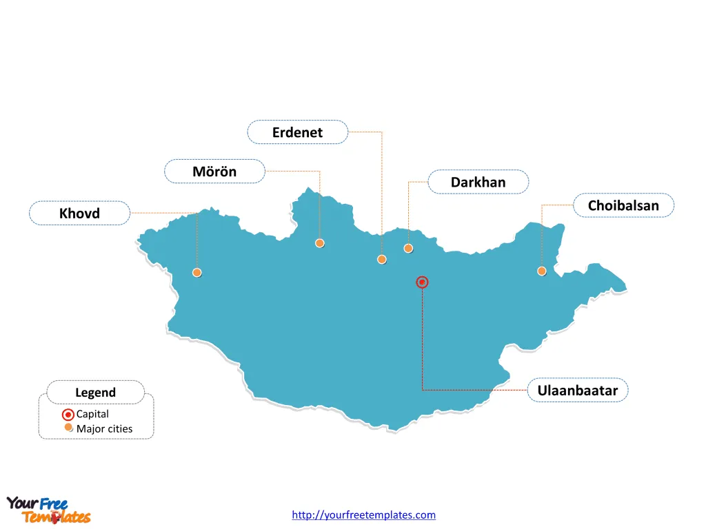
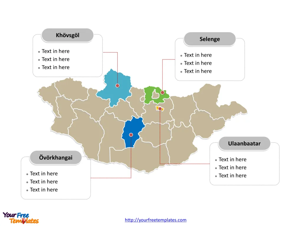
The Mongolia Map Template includes two slides. Mongolia map with 21 Provinces and one provincial municipality, labeling with major provinces, Ulaanbaatar, Khövsgöl, Övörkhangai, and Selenge. Mongolia map labeling with national capital and major cities, Ulaanbaatar, Darkhan, Erdenet, Choibalsan, Mörön, and Khovd.
Mongolia, situated in East Asia, is a landlocked country bordered by Russia to the north and China to the south, east, and west. With a population of approximately 3.3 million people, Mongolia is known for its vast, sparsely populated landscapes and nomadic way of life.
The country’s economy is heavily reliant on agriculture, mining, and animal husbandry, with minerals such as copper, gold, and coal being major exports. Mongolia’s strategic location between two major global powers, Russia and China, influences its economic and geopolitical dynamics. The country also faces challenges related to its harsh climate and limited infrastructure, which impact its economic development and the livelihoods of its people.
Slide 1, Mongolia map labeled with capital and major cities.
Ulaanbaatar is both the nation’s capital as well as its largest city, other major cities including Darkhan, Erdenet, Choibalsan, Mörön, and Khovd.
Capital and Major Cities on Mongolia map
Ulaanbaatar
Ulaanbaatar, the capital and largest city of Mongolia, serves as the political, economic, and cultural center of the country. With a population of over 1.4 million, it is a bustling metropolis known for its vibrant markets, historical sites, and diverse cultural heritage. Ulaanbaatar plays a pivotal role in shaping Mongolia’s urban landscape, economic activities, and governance.

Darkhan
Darkhan, located in the Darkhan-Uul Province, is the second-largest city in Mongolia, with a population of approximately 83,000. It is an essential industrial and commercial center, contributing to the region’s economic development and urban dynamics.
Erdenet
Erdenet, situated in the Orkhon Province, is a significant city known for its copper mining industry and industrial activities. With a population of around 101,000, it plays a crucial role in Mongolia’s mining sector and urban development.
Choibalsan
Choibalsan, located in the Dornod Province, is a major city with a population of approximately 46,000. It serves as an important hub for trade, agriculture, and cultural exchange, influencing the dynamics of the eastern region of Mongolia.
Mörön
Mörön, situated in the Khövsgöl Province, is a notable city with a population of around 41,000. It is renowned for its historical significance, traditional craftsmanship, and agricultural activities, contributing to the province’s cultural and economic landscape.
Khovd
Khovd, located in the Khovd Province, is a historic city with a population of approximately 31,000. It serves as a vital center for trade, agriculture, and cultural heritage, shaping the economic and social dynamics of the western region of Mongolia.
Slide 2, Mongolia map labeled with major administration districts.
Mongolia map shows the country divided into 21 Provinces and one provincial municipality; they are Arkhangai, Bayankhongor, Bayan-Ölgii, Bulgan, Darkhan-Uul, Dornod, Dornogovi, Dundgovi, Govi-Altai, Govisümber, Khentii, Khovd, Khövsgöl, Orkhon, Selenge, Sükhbaatar, Töv, Ömnögovi, Uvs, Övörkhangai, Zavkhan, and Ulaanbaatar. The most populated provinces are Khövsgöl, Övörkhangai, Selenge, Ulaanbaatar. Every individual political subdivision is an editable shape.
Major Provinces on Mongolia map
Ulaanbaatar Province
The Ulaanbaatar Province, home to the capital city, encompasses key urban and rural areas, serving as the political and economic heart of Mongolia.

Khövsgöl Province
The Khövsgöl Province, with Mörön as a major city, is known for its natural beauty, rich cultural heritage, and significant role in Mongolia’s tourism and agriculture.
Övörkhangai Province
The Övörkhangai Province, with Arvaikheer as its capital, is an important center for agriculture, traditional craftsmanship, and cultural exchange, contributing to the province’s economic and social development.
Selenge Province
The Selenge Province, with Sükhbaatar as a prominent city, is a major region known for its agricultural productivity, historical significance, and trade, shaping the province’s economic and cultural dynamics.
In summary, Mongolia’s capital, major cities, and provinces contribute uniquely to the country’s cultural heritage, economic activities, and regional development. From the vibrant urban center of Ulaanbaatar to the historical allure of Darkhan and Mörön, each location plays a distinctive role in shaping Mongolia’s diverse urban and rural landscape.
Looking for Premium maps, please visit our affiliate site: https://editablemaps.com/ or https://ofomaps.com/
Size: 119K
Type: PPTX
Aspect Ratio: Standard 4:3
Click the blue button to download it.
Download the 4:3 Template
Aspect Ratio: Widescreen 16:9
Click the green button to download it.
Download the 16:9 Template


