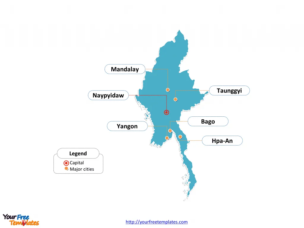
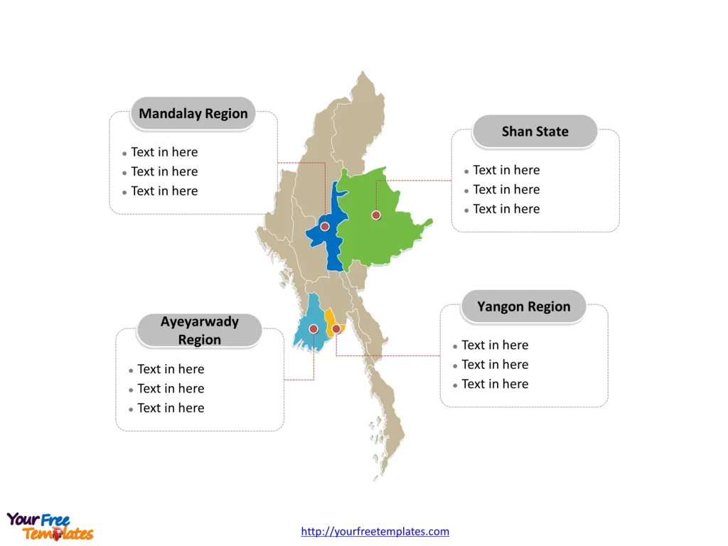
The Myanmar Map Template includes two slides. Myanmar map with 14 divisions, labeling major regions and states, Yangon Region, Ayeyarwady Region, Mandalay Region, and Shan State. Myanmar Outline map labeled with capital and major cities, Yangon, Naypyidaw, Mandalay, Bago, Hpa-An, and Taunggyi.
Myanmar, formerly known as Burma, is located in Southeast Asia and is the largest country in mainland Southeast Asia. It shares borders with Bangladesh and India to the northwest, China to the northeast, Laos to the east, and Thailand to the southeast. The Bay of Bengal touches its southwest coast. Myanmar’s strategic geographic position has contributed to a rich history of trade, cultural exchange, and diverse influences from its neighboring countries.
Slide 1, Myanmar Map labeled with capital and major cities.
Myanmar, also known as Burma, is a sovereign state in South East Asia. You can find the 5 neighboring countries closest to this country in the Asian continent, which are Bangladesh, China, India, Laos, and Thailand. Naypyidaw and Yangon (Rangoon) are its capital and largest city respectively, other major cities including Mandalay, Bago, Hpa-An, and Taunggyi.
Major Cities on Myanmar Map
Yangon: Formerly the capital and the largest city, Yangon serves as the country’s most important commercial center. It is renowned for its colonial architecture and landmark religious sites, particularly the Shwedagon Pagoda, which dominates the city’s skyline.
Naypyidaw: Established in 2005, Naypyidaw is the current capital of Myanmar. It is a planned city, notable for its wide boulevards and large government buildings. Despite its status as the administrative center, it is quieter compared to other cities in the country.

Mandalay: Considered the cultural heart of Myanmar, Mandalay is the second-largest city and was the last royal capital of the country. It is known for its monasteries, traditional arts and crafts, and the Mandalay Palace.
Bago: Located in the Bago Region, this city is steeped in history with numerous pagodas, such as the Shwemawdaw Pagoda. Bago was once the capital of a powerful Mon kingdom.
Hpa-An: The capital of Kayin State, Hpa-An is a picturesque town surrounded by limestone cliffs, caves, and green rice fields. It’s increasingly popular with travelers due to its natural attractions and laid-back atmosphere.
Taunggyi: As the capital of Shan State, Taunggyi is known for its scenic beauty and pleasant climate. It hosts the annual Fire Balloon Festival, which attracts visitors from across the globe.
Slide 2, Myanmar Map labeled with major administration districts.
Myanmar map shows the country divided into seven states and seven regions: Kachin State, Kayah State, Kayin State, Chin State, Sagaing Region, Tanintharyi Region, Bago Region, Magway Region, Mandalay Region, Mon State, Rakhine State, Yangon Region, Shan State, and Ayeyarwady Region. The most populated states and regions are Yangon Region, Shan State and Mandalay Region. Every individual political subdivision is an editable shape.
Major Regions and States on Myanmar Map
Yangon Region: This region is the most developed in Myanmar and includes Yangon, the country’s main center for trade, industry, and tourism.
Ayeyarwady Region: Situated in the delta of the Ayeyarwady River, this region is known as the “Rice Bowl of Myanmar,” given its vital role in agriculture.
Mandalay Region: This region is not only a cultural and religious hub but also a significant economic center for Upper Myanmar, with Mandalay as its focal point.
Shan State: The largest state by area, Shan State boasts a diverse landscape that includes mountains, valleys, and a part of the infamous Golden Triangle. It is home to many ethnic groups and is rich in natural resources.

Myanmar’s wealth of cultural heritage and natural beauty is reflected in its major cities and regions, each contributing a distinct piece to the country’s mosaic. Despite its challenges, Myanmar continues to be a country of great interest due to its archaeological sites, tourist attractions, and economic potential.
Looking for Premium maps, please visit our affiliate site: https://editablemaps.com/ or https://ofomaps.com/
Size: 102K
Type: PPTX
Aspect Ratio: Standard 4:3
Click the blue button to download it.
Download the 4:3 Template
Aspect Ratio: Widescreen 16:9
Click the green button to download it.
Download the 16:9 Template


