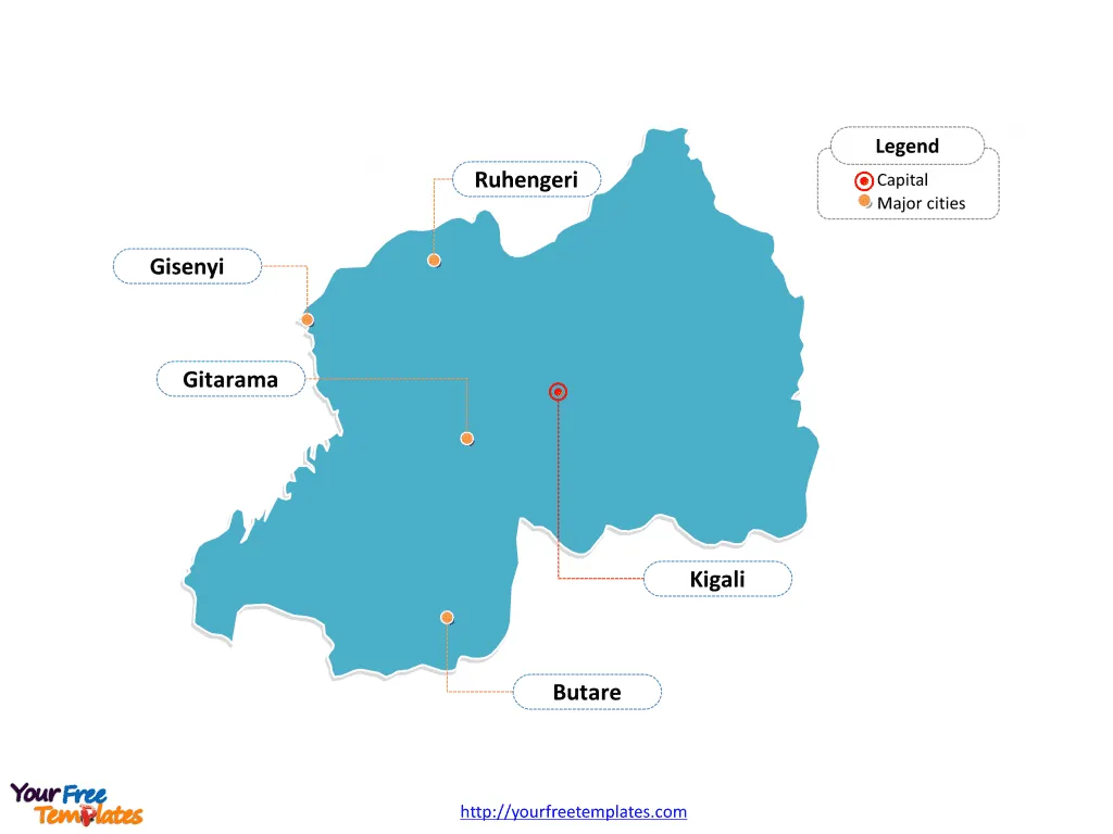
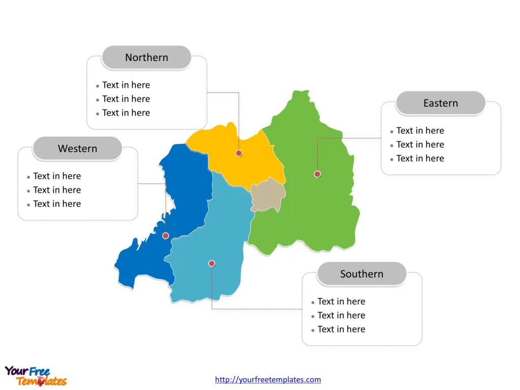
The Rwanda Map Template includes two slides. Rwanda map with five provinces, labeling major provinces, Eastern, Southern, Western, and Northern. Rwanda map labeled with capital and major cities, Kigali, Butare, Gitarama, Ruhengeri, and Gisenyi.
Location of Rwanda Rwanda is a landlocked country located in the Great Lakes region of East Africa. It is bordered by Uganda to the north, Tanzania to the east, Burundi to the south, and the Democratic Republic of the Congo to the west.
Population of Rwanda As of September 2021, Rwanda had a population of approximately 12 million people. The country is known for its relatively high population density, with a majority of the population residing in rural areas.
Economy of Rwanda Rwanda’s economy is primarily agrarian, with the majority of the population engaged in subsistence agriculture. The country has made significant strides in economic development, particularly in the areas of tourism, mining, and information and communication technology (ICT). Additionally, Rwanda has focused on developing its service and manufacturing sectors to diversify its economy.
Neighboring Countries Rwanda shares its borders with several East African countries, including Uganda to the north, Tanzania to the east, Burundi to the south, and the Democratic Republic of the Congo to the west. These neighboring countries play a significant role in Rwanda’s regional trade and diplomatic relations.
Slide 1, Rwanda map labeled with capital and major cities.
The capital and largest city is Kigali, other major cities including Butare, Gitarama, Ruhengeri, and Gisenyi.
Major Cities on Rwanda Map
Kigali
- Population: As of the latest data, Kigali, the capital city of Rwanda, has a population of approximately 1,132,686.
- Significance: Kigali is the largest city in Rwanda and serves as the country’s political, economic, and cultural center. It is a rapidly growing urban hub with increasing population and infrastructural development challenges.

Butare
- Population: Butare, located in the Southern Province, has a population of around 89,600.
- Significance: Butare is a major city known for its educational institutions, including the renowned National University of Rwanda. It is an important center for education and culture in the country.
Gitarama
- Population: With a population of about 87,613, Gitarama is a significant city in the Southern Province of Rwanda.
- Significance: Gitarama is an important urban center with a growing population and economic activities, contributing to the development of the Southern Province.
Ruhengeri
- Population: Ruhengeri, situated in the Northern Province, has a population of approximately 86,685 people.
- Significance: Ruhengeri is known for its proximity to the Volcanoes National Park, making it a popular tourist destination. The city serves as a gateway for visitors exploring the park and its famous mountain gorillas.
Gisenyi
- Population: Gisenyi, located in the Western Province, has a population of around 172,357.
- Significance: Gisenyi is a major city situated on the shores of Lake Kivu, offering picturesque views and serving as a vital commercial and tourism center in the Western Province.
Slide 2, Rwanda map labeled with major administration districts.
Rwanda is a country divided into five provinces: these are Northern Province, Southern Province, Eastern Province, Western Province, and the Municipality of Kigali in the centre.. Every individual political subdivision is an editable shape.
Major Provinces on Rwanda Map
Eastern Province
- Capital: The provincial capital of the Eastern Province is Rwamagana.
- Significance: The Eastern Province is known for its agricultural activities and is home to important urban centers contributing to the region’s economic development.

Southern Province
- Capital: Nyanza serves as the provincial capital of the Southern Province.
- Significance: The Southern Province is notable for its historical and cultural significance, with cities like Nyanza and Butare playing key roles in education and heritage preservation.
Western Province
- Capital: Kibuye is the provincial capital of the Western Province.
- Significance: The Western Province, with cities like Gisenyi and Kibuye, boasts stunning natural landscapes and plays a crucial role in the country’s tourism and economic activities.
Northern Province
- Capital: Byumba serves as the provincial capital of the Northern Province.
- Significance: The Northern Province, with Ruhengeri as one of its major cities, is known for its natural beauty, including its proximity to the Volcanoes National Park and diverse wildlife.
These major cities and provinces collectively contribute to Rwanda’s cultural, economic, and natural wealth, making them integral to the country’s identity and development.
Looking for Premium maps, please visit our affiliate site: https://editablemaps.com/ or https://ofomaps.com/
Size:86K
Type: PPTX
Aspect Ratio: Standard 4:3
Click the blue button to download it.
Download the 4:3 Template
Aspect Ratio: Widescreen 16:9
Click the green button to download it.
Download the 16:9 Template


