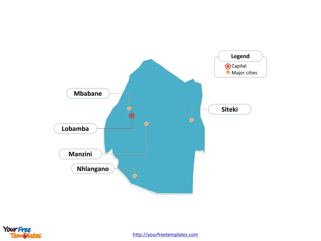
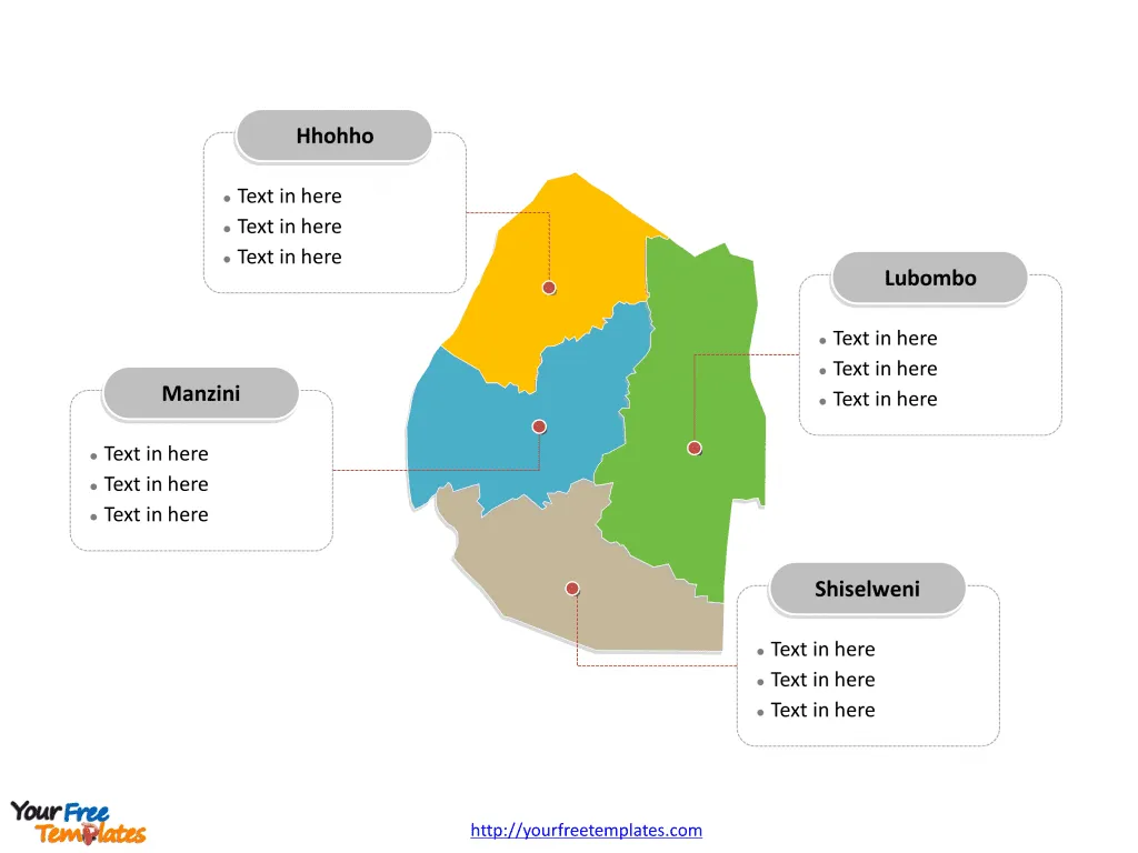
The Swaziland Map Template in PowerPoint format includes two slides. Firstly, our Swaziland outline map template has capital and major cities on it, which are Lobamba, Mbabane, Manzini, Nhlangano, and Siteki. Secondly, there are 4 regions in our Swaziland political map of political divisions, labeling the four divisions that are Hhohho, Lubombo, Manzini and Shiselweni.
Swaziland, now known as Eswatini, is a landlocked country in Southern Africa, bordered by South Africa to the north, west, and south, and by Mozambique to the east. The country has a population of approximately 1,138,089 people, with predominantly Swazi ethnic groups and English and siSwati as the official languages.
Eswatini’s economy is characterized by its dependency on South African trade, with a significant focus on agricultural products such as sugar cane, maize, and forestry. The country also engages in industries including soft drink concentrates, coal, sugar processing, textiles, and apparel. However, persistent poverty, high unemployment, and the impact of HIV/AIDS on the labor force are significant challenges for the nation’s economic development. Eswatini’s real GDP per capita is approximately $9,100, and it heavily relies on South Africa for both imports and exports, with a significant portion of its trade being with its neighbor.
Slide 1, Swaziland map labeled with capital and major cities.
Since Lobamba and Mbabane is the capital and largest city of Swaziland respectively, furthermore, other major cities including Manzini, Nhlangano, and Siteki. So our Swaziland map slide has the capital and major cities on the outline. Consequently users can remove cities or include new ones to create their unique Swaziland maps and suit their specific applications.
Major Cities
- Mbabane: Serving as the capital and with a population of approximately 60,000, Mbabane is the administrative center of Eswatini. It is known for its picturesque landscapes and vibrant cultural scene.
- Lobamba: This city holds the royal and legislative capital of Eswatini, playing a significant role in the country’s cultural and historical heritage.
- Manzini: As the principal commercial city, Manzini is a bustling urban center that contributes significantly to the country’s economy and trade.
- Nhlangano: Located in the Shiselweni region, Nhlangano offers a glimpse into the rural life and cultural traditions of Eswatini.
- Siteki: Situated in the Lubombo region, Siteki is known for its natural beauty and agricultural activities.

Slide 2, Swaziland map labeled with major regions.
The Swaziland map is the country political division of 4 regions. They are Hhohho, Lubombo, Manzini and Shiselweni. Furthermore every individual political subdivision is an editable shape. As a result, you can change the texts, colors, sizes, highlight some map shapes, and add relevant content. At the same time you can also refer to the other aspects of Swaziland in Wikipedia. Therefore Analysts from marketing research companies, advisors or consultants from professional firms will find our Swaziland map templates very helpful in their projects. It is our maps that can assist them communicating effectively.
Major Regions
- Hhohho: This region is home to Mbabane, the capital, and encompasses picturesque areas with a mix of urban and rural landscapes.
- Lubombo: Known for its mountainous terrain and rich cultural heritage, Lubombo is a region of natural beauty and historical significance.
- Manzini: As the location of the principal commercial city, the Manzini region plays a pivotal role in Eswatini’s economy and trade.
- Shiselweni: This region is characterized by its rural landscapes and cultural traditions, offering a unique perspective on the country’s heritage.

Size:71K
Type: PPTX
Aspect Ratio: Standard 4:3
Click the blue button to download it.
Download the 4:3 Template
Aspect Ratio: Widescreen 16:9
Click the green button to download it.
Download the 16:9 Template


