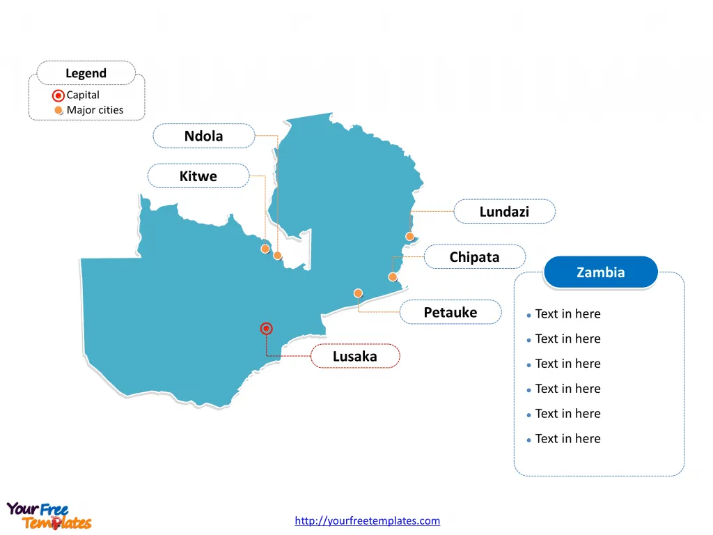
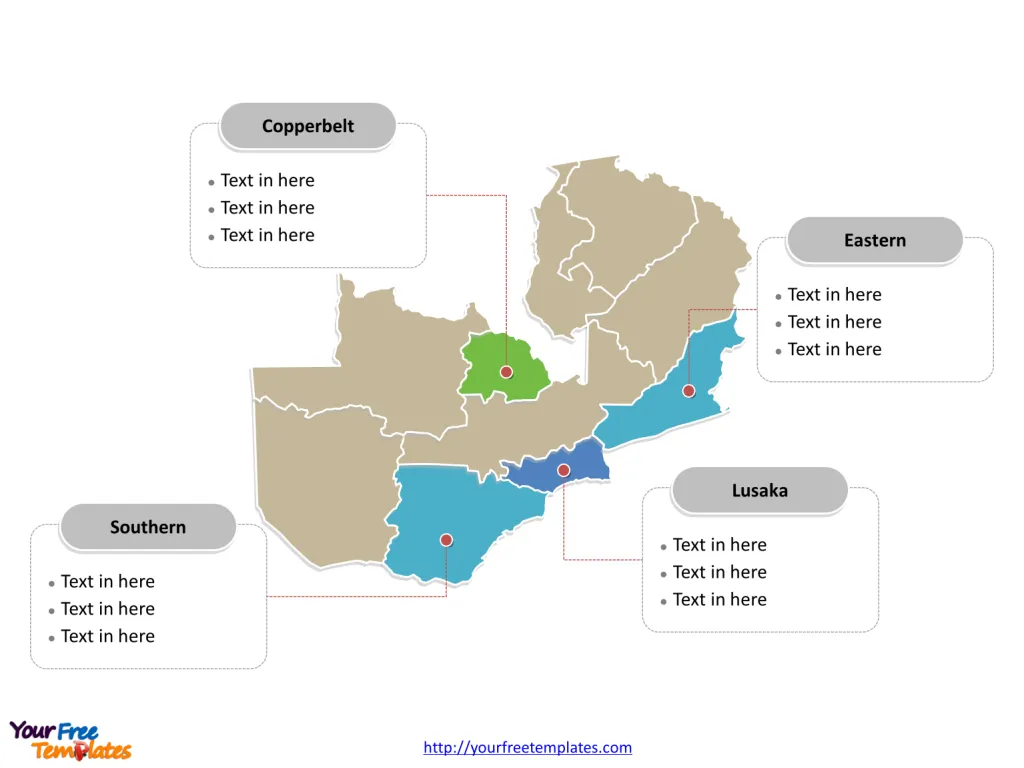
The Map of Zambia Template includes two slides. Zambia map with 10 provinces, highlighting Lusaka, Copperbelt, Eastern, and Southern provinces. Zambia map of outline labeled with Lusaka, Kitwe, Chipata, Ndola, Lundazi, and Petauke cities.
Zambia, located in Southern Africa, is a landlocked country known for its stunning landscapes and diverse wildlife. With a population of over 18 million people, Zambia is culturally rich, with over 70 ethnic groups contributing to its vibrant tapestry of traditions and customs. The country’s economy is largely dependent on copper mining, which is a major export, but it also has a growing agriculture and tourism sector due to its natural wonders such as the Victoria Falls and national parks.
Zambia shares its borders with several countries, including the Democratic Angola, Democratic Republic of the Congo, Malawi, Mozambique, Namibia, Tanzania, and Zimbabwe. This strategic location has historically influenced Zambia’s trade and regional interactions, contributing to its cultural diversity and economic activities.
Slide 1, Zambia map labeled with capital and major cities.
Major Cities on Zambia Map
Lusaka
Lusaka, the capital and largest city of Zambia, is a bustling urban center with a population of approximately 1.7 million. Situated in the southern part of the central plateau, Lusaka serves as the heart of the country’s commerce and government. The city is home to key institutions, including the national assembly, and is a center for education, boasting some of Zambia’s finest schools. Lusaka is a hub of economic activity and features a diverse population, with English as the primary language spoken.

Kitwe
Kitwe, also known as Kitwe-Nkana, is the second largest city in Zambia, with a population of about 504,194. Founded in 1936 during the construction of the railway in north-central Zambia, Kitwe is one of the country’s most developed areas. It is home to thriving businesses, industries, schools, and higher education institutions, with transportation options including railways, roads, and air travel.
Chipata
Chipata, formerly known as Fort Jameson, is the third most populous city in Zambia, with a population of approximately 455,783. Founded in 1899, Chipata is the fifth most developed city in the country and serves as an administrative and business center in the eastern province. The city features modern amenities such as shopping malls, a university, colleges, a central hospital, and a vibrant market.
Ndola
Ndola, the third largest and second oldest city in Zambia, has a population of around 455,194. Situated in the Copperbelt Province, Ndola serves as the primary industrial and commercial center of the region. Over the years, the city has developed into a prominent commercial hub and is home to an international airport, with transportation options including roads, air travel, pipelines, and railways.
Lundazi
Lundazi, a town located in the Eastern Province, is known for its scenic beauty and rich cultural heritage. Although smaller in population compared to the major cities, Lundazi plays a significant role in the province’s cultural and economic landscape.
Petauke
Petauke, located in the Eastern Province, is a town with a growing population and serves as an important center for trade and commerce within the region.
Slide 2, Zambial map labeled with major administration provinces.
Zambia map shows the country divided into 10 provinces, Lusaka, Copperbelt, Eastern, Southern, Central, Northern, Luapula, Western, North-Western, and Muchinga. The most populated provinces are Eastern, Lusaka, Southern and Copperbelt. Every individual political subdivision is an editable shape.
Major Provinces on Zambia Map
Lusaka
The Lusaka Province, with the capital city of the same name, is the country’s political and economic nucleus. It is the most densely populated province and houses key government institutions, international corporations, and a diverse population.

Copperbelt
The Copperbelt Province, where Ndola and Kitwe are located, is renowned for its thriving mining industry and serves as a vital economic and industrial hub in Zambia.
Eastern
The Eastern Province, home to Chipata, Lundazi, and Petauke, is an area of growing economic importance with a focus on trade, agriculture, and cultural heritage.
Southern
The Southern Province, although not represented by a major city in the list, is a region known for its natural beauty and significant contributions to Zambia’s agricultural sector.
In conclusion, Zambia’s major cities and provinces are emblematic of the country’s cultural, economic, and geographic diversity, each contributing to the nation’s rich heritage and development.
Looking for Premium maps, please visit our affiliate site: https://editablemaps.com/ or https://ofomaps.com/
Size: 97K
Type: PPTX
Aspect Ratio: Standard 4:3
Click the blue button to download it.
Download the 4:3 Template
Aspect Ratio: Widescreen 16:9
Click the green button to download it.
Download the 16:9 Template


