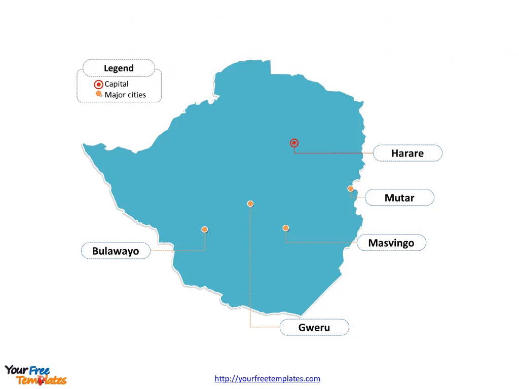
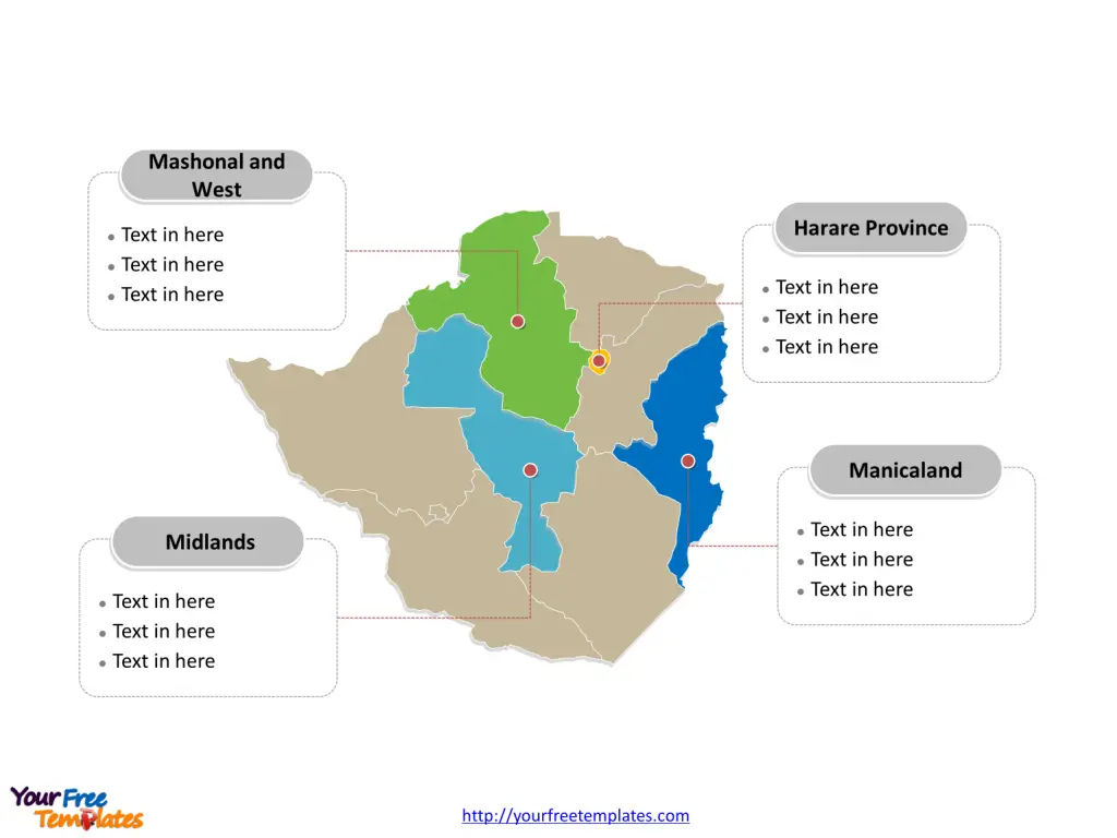
The Zimbabwe Map Template includes two slides. Zimbabwe map with eight provinces and two cities, labeling major provinces, Harare Province, Manicaland, Midlands, Mashonal and West. Zimbabwe map labeled with capital and major cities, Harare, Bulawayo, Mutare, Gweru, and Masvingo.
Location of Zimbabwe Zimbabwe is a landlocked country located in southern Africa, bordered by South Africa to the south, Mozambique to the east, Zambia to the northwest, and Botswana to the west. Its location in the southern part of the African continent gives it strategic regional importance.
Population of Zimbabwe As of the latest data, Zimbabwe had a population of approximately 15 million people. The country has a diverse population consisting of various ethnic groups, with the majority of the population residing in rural areas.
Economy of Zimbabwe Zimbabwe’s economy is primarily based on agriculture, mining, and manufacturing. The country is known for its natural resources, including gold, platinum, and diamonds. However, it has faced economic challenges in recent years, including hyperinflation and currency instability, impacting its overall economic performance.
Neighboring Countries Zimbabwe shares its borders with several countries in southern Africa, including South Africa, Mozambique, Zambia, and Botswana. These neighboring countries play a significant role in regional trade and economic cooperation with Zimbabwe.
Slide 1, Zimbabwe map labeled with capital and major cities.
The capital and largest city is Harare, other major cities including Bulawayo, Mutare, Gweru, and Masvingo.
Major Cities on Zimbabwe Map
Harare
- Population: Harare, the capital city of Zimbabwe, has a population of approximately 1.6 million people.
- Significance: As the largest city in Zimbabwe, Harare serves as the country’s political, economic, and cultural center. It is a bustling urban hub with significant commercial and administrative activities.

Bulawayo
- Population: Bulawayo, the second-largest city in Zimbabwe, has a population of around 653,337 people.
- Significance: Bulawayo is a key industrial and commercial center, known for its rich historical and cultural heritage. It plays a vital role in the country’s economy and development.
Mutare
- Population: Mutare, located in the Manicaland Province, has a population of approximately 188,243 people.
- Significance: Mutare is an important city in eastern Zimbabwe, serving as a center for agriculture, forestry, and manufacturing. It also acts as a gateway to the eastern border with Mozambique.
Gweru
- Population: Gweru, situated in the Midlands Province, has a population of around 201,879 people.
- Significance: Gweru is a major city with a focus on manufacturing, education, and agriculture. It is strategically positioned in the central part of the country.
Masvingo
- Population: Masvingo, located in the Masvingo Province, has a population of approximately 76,290 people.
- Significance: Masvingo is known for its historical significance, including the Great Zimbabwe ruins, a UNESCO World Heritage site. The city also plays a crucial role in agriculture and tourism in the region.
Slide 2, Zimbabwe map labeled with major administration districts.
Zimbabwe map template is a country divided into eight provinces and two cities with provincial status: they are Bulawayo Province, Harare Province, Manicaland, Mashonaland Central, Mashonaland East, Mashonaland West, Masvingo, Matabeleland North, Matabeleland South, and Midlands. Every individual political subdivision is an editable shape.
Major Provinces on Zimbabwe Map
Harare Province
- Capital: Harare serves as the capital of Harare Province.
- Significance: Harare Province is the country’s smallest but most densely populated province, encompassing the capital city and its surrounding urban and peri-urban areas.

Manicaland
- Capital: Mutare is the provincial capital of Manicaland.
- Significance: Manicaland is located in the eastern highlands of Zimbabwe and is known for its agricultural productivity, scenic landscapes, and proximity to the Mozambique border.
Midlands
- Capital: Gweru serves as the provincial capital of Midlands.
- Significance: Midlands Province is situated in the central part of Zimbabwe and is known for its diverse economic activities, including agriculture, mining, and manufacturing.
Mashonaland
- Capital: Bindura serves as the capital of Mashonaland Central, while Chinhoyi is the capital of Mashonaland West.
- Significance: The Mashonaland provinces are significant in Zimbabwe’s history and economy, with agriculture and mining being key contributors to the region’s development.
These major cities and provinces collectively contribute to Zimbabwe’s cultural, historical, and economic landscape, playing integral roles in the country’s identity and progress.
Looking for Premium maps, please visit our affiliate site: https://editablemaps.com/ or https://ofomaps.com/
Size:102K
Type: PPTX
Aspect Ratio: Standard 4:3
Click the blue button to download it.
Download the 4:3 Template
Aspect Ratio: Widescreen 16:9
Click the green button to download it.
Download the 16:9 Template


