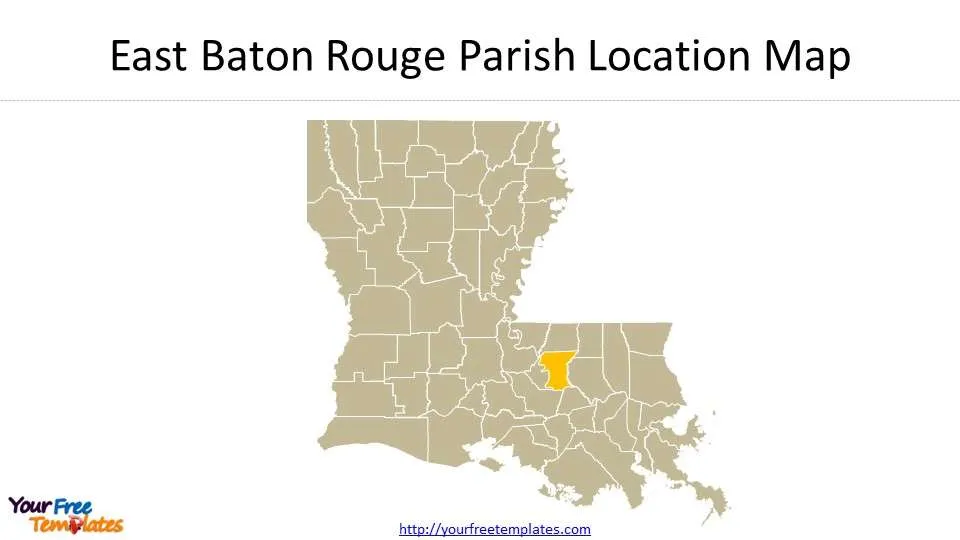
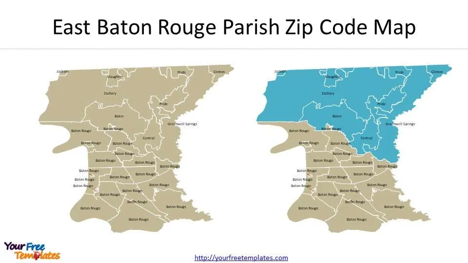
The Baton Rouge zip code map Template in PowerPoint format includes five slides. First, East Baton Rouge Parish Location in the Louisiana map with parishes. Secondly you can see Parishes around East Baton Rouge. Thirdly is the East Baton Rouge Parish boundary. The last two slides are East Baton Rouge Parish Zip Code Map, where you can have the zip codes labeled for this parish and Baton Rouge zip code map.
Baton Rouge is the capital of Louisiana, the second largest city and the most populous city in the United States. It is the county seat of East Baton Rouge Parish, on the east bank of the Mississippi River, 116 kilometers northwest of New Orleans. The city was originally the second largest city in Louisiana after New Orleans, with an urban population of 746,000 in 2021.
It became the state capital in 1849. There are large oil fields around, so the city has become centers for Oil refining and petrochemical, rubber, plastics, scientific instruments, wood, paper and other industries. Louisiana State University is a top-ranked university in the United States, attracting much attention for its strengths in football.
Slide 1, East Baton Rouge Parish Location Map
East Baton Rouge is one of the 64 parishes in the state of Louisiana, where Baton Rouge is located.
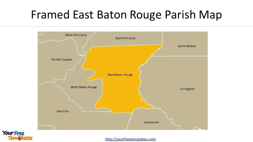
Slide 2, Framed East Baton Rouge Parish Map
The neighboring parishes are East Feliciana, Saint Helena, Livingston, Ascension, Iberville, West Baton Rouge, Pointe Coupee, and West Feliciana.
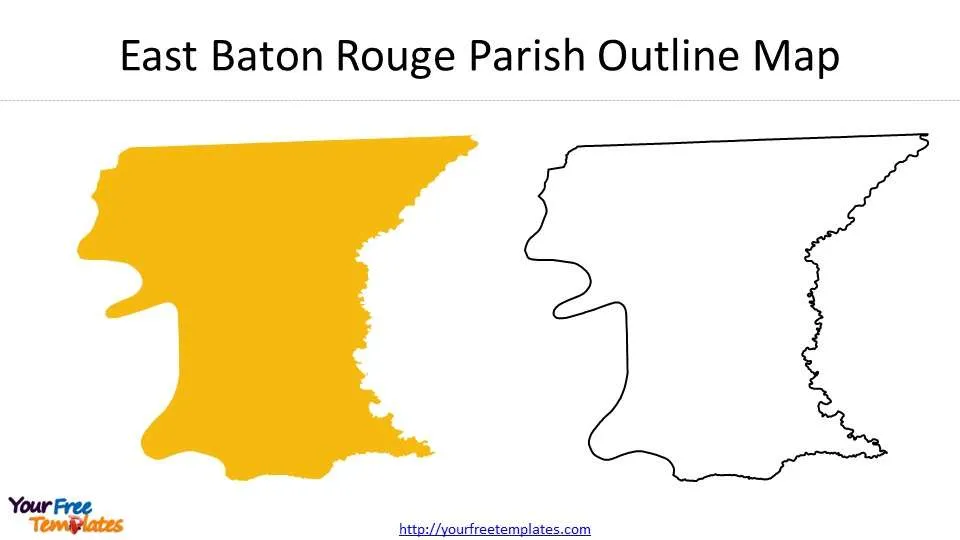
Slide 3, East Baton Rouge Parish Outline Map
Slide 4, zip code map of Baton Rouge
There are 27 zip codes for this parish. As showed in this map, you can highlight any zip code you like including 70714, 70722, 70739, 70748, 70770, 70777, 70791, 70801, 70802, 70803, 70805, 70806, 70807, 70808, 70809, 70810, 70811, 70812, 70813, 70814, 70815, 70816, 70817, 70818, 70819, 70820, 70836.
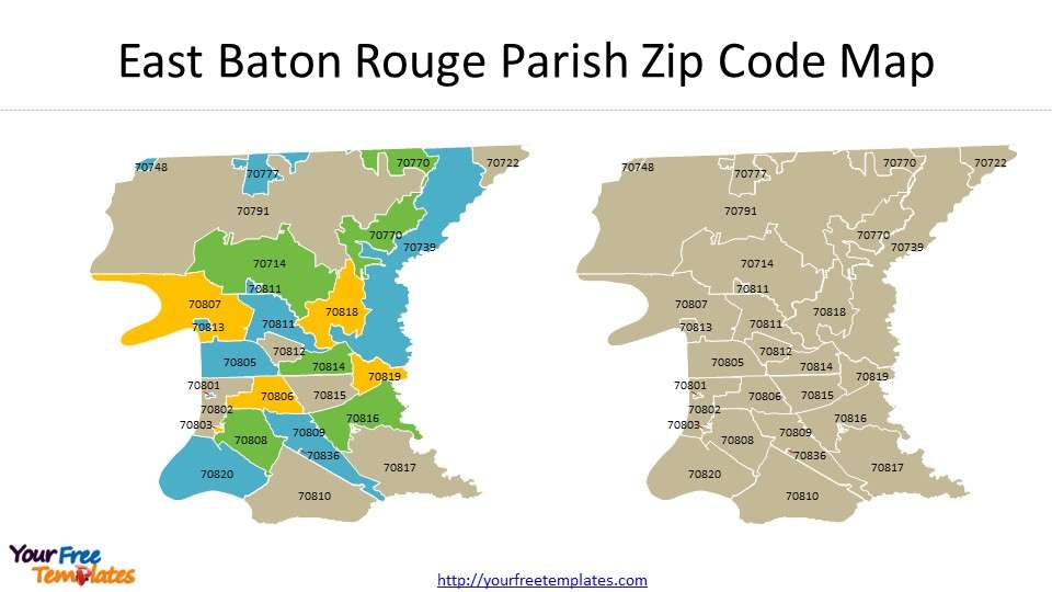
Slide 5, Baton Rouge zip code map
You can see here 19 zip codes for Baton Rouge, while the remaining marked in blue 8 for BAKER, CENTRAL, CLINTON, GREENWELL SPRINGS, JACKSON, PRIDE, SLAUGHTER, and ZACHARY. You can get your Baton Rouge map of Louisiana here.
For other interesting maps, pls visit our ofomaps.com
You can check our site for more US cities.
- For Chicago map covering 7 slides showing City Boundary, 77 Community Plan Areas, 50 wards, Central Business District, 26 Industrial Corridors, 6 Enterprise Zones, and 22 Police Districts
- For Los Angeles map covering 5 slides showing city Boundary,7 Area Planning Commission, 35 Community Plan Area, 15 Council Districts and 99 Neighborhoods.
- For Washington DC map covering 8 slides showing Washington DC Boundary, Quadrants, 8 Wards, 7 Police Districts, 21 Police Sectors, and 57 Police Service Areas (PSAs).
Size:800K
Type: PPTX
[sociallocker]Aspect Ratio: Standard 4:3
Click the blue button to download it.
Download the 4:3 Template
Aspect Ratio: Widescreen 16:9
Click the green button to download it.
Download the 16:9 Template[/sociallocker]


