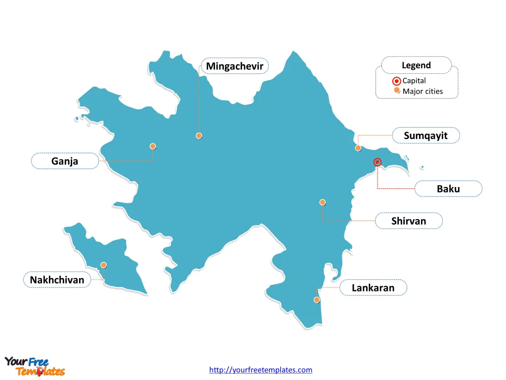
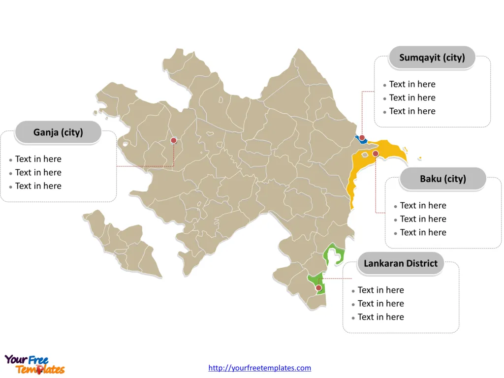
The Azerbaijan Map Template includes three slides. Azerbaijan map with 59 districts, 11 cities and 1 autonomous republic, labeling major districts and cities, Baku (city), Ganja (city), Sumqayit (city), and Lankaran District. Azerbaijan map labeled with capital and major cities, Baku, Sumqayit, Ganja, Mingachevir, Lankaran, Shirvan, and Nakhchivan.
Azerbaijan, a landlocked country in Southwestern Asia, is bordered by Russia, Georgia, Armenia, Iran, and the Caspian Sea. With a population of approximately 10,420,515, the country has a mix of ethnic groups, with Azerbaijanis comprising the majority. The economy is largely driven by industry, particularly in the exploitation of oil and gas resources.
Azerbaijan’s strategic location and rich energy resources contribute significantly to its economic standing. The nation faces challenges such as droughts and demographic changes, including an aging population. Moreover, the ongoing conflict with Armenia over the Nagorno-Karabakh region has had a significant impact on the country’s socio-political landscape.
Slide 1, Azerbaijan map labeled with capital and major cities.
The exclave of Nakhchivan is bound by Armenia to the north and east, Iran to the south and west, while having an 11 km border with Turkey in the North West. Baku is the capital and largest city of Azerbaijan, other major cities including Sumqayit, Ganja, Mingachevir, Lankaran, Shirvan, and Nakhchivan.
Capital and major cities on Azerbaijan map
Baku: The Vibrant Capital
Baku, the capital and largest city of Azerbaijan, stands as a bustling metropolis on the Caspian Sea and within the Caucasus region. With a population of over 2.2 million, Baku is not only the cultural and economic epicenter of the country but is also recognized as the largest city below sea level globally. The city’s dynamic blend of ancient architecture and modern developments makes it a compelling destination for visitors and a thriving hub for residents.

Sumqayit: A Port City
Sumqayit, the second-largest city and seaport in Azerbaijan, is a significant industrial and urban center. With a population of over 343,000, Sumqayit serves as a vital component of the country’s economy and urban landscape, contributing to Azerbaijan’s industrial prowess and maritime connectivity.
Ganja: A Cultural Hub
Ganja, the third-largest city in Azerbaijan, is celebrated for its rich historical heritage and cultural significance. With a population of over 332,000, Ganja stands as the largest city outside the Baku metropolitan area, offering a blend of cultural richness and urban vibrancy.
Mingachevir: A Northern Gem
Mingachevir, located in the north of the country, is known for its industrial significance and picturesque landscapes. With a population of over 104,500, Mingachevir plays a pivotal role in shaping the country’s economic and urban fabric.
Lankaran: A Coastal City
Lankaran, situated in the south on the coast of the Caspian Sea, stands out for its unique coastal beauty and historical charm. With a population of over 87,900, Lankaran offers a blend of natural landscapes and cultural attractions, making it an appealing destination for visitors and residents.
Shirvan: Along the Kura River
Shirvan, with a population of over 85,800, is located along the Kura River, contributing to the region’s historical significance and urban allure.
Nakhchivan: An Autonomous Region
Nakhchivan, an autonomous region of Azerbaijan, is known for its distinct cultural identity and historical significance. With a population of over 93,700, Nakhchivan adds to the country’s diverse urban and rural fabric.
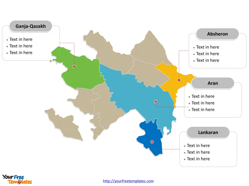
Slide 2, Azerbaijan map labeled with major economic regions.
Azerbaijan is a country divided into 10 economic regions; they are Absheron, Aran, Daglig-Shirvan, Ganja-Qazakh, Kalbajar-Lachin, Lankaran, Nakhchivan, Quba-Khachmaz, Shaki-Zaqatala, and Yukhari-Karabakh. Every individual political subdivision is an editable shape.

Slide 3, Azerbaijan map labeled with major districts and cities.
Azerbaijan is a country divided into 59 districts, 11 cities and 1 autonomous republic. Every individual political subdivision is an editable shape.
Major districts and cities on Azerbaijan map
The Baku City district, encompassing the capital, is a significant administrative, economic, and cultural hub, playing a pivotal role in shaping Azerbaijan’s national identity and development.
The Ganja City district, with Ganja as a notable city, offers a blend of historical significance and economic influence, shaping the region’s urban landscape.
The Sumqayit City district, with Sumqayit as a major seaport, is recognized for its industrial prowess and maritime connectivity, contributing to Azerbaijan’s economic diversity.
The Lankaran District, encompassing the coastal city of Lankaran, is known for its unique blend of natural beauty and cultural significance, adding to Azerbaijan’s coastal allure.

Azerbaijan’s capital, major cities, and significant districts collectively contribute to the country’s cultural, historical, and economic landscape, making it a captivating destination for visitors and a dynamic hub for residents.
Looking for Premium maps, please visit our affiliate site: https://editablemaps.com/ or https://ofomaps.com/
Size: 144K
Type: PPTX
Aspect Ratio: Standard 4:3
Click the blue button to download it.
Download the 4:3 Template
Aspect Ratio: Widescreen 16:9
Click the green button to download it.
Download the 16:9 Template


