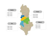
The Georgia Map Template includes two slides. Georgia map with 9 regions, 1 city, and 2 autonomous republics, labeling with major provinces, Tbilisi, Imereti, Kvemo Kartli, and Adjara. Georgia map labeling with national capital and major cities, Tbilisi, Batumi, Kutaisi, Rustavi, and Gori.
Location Georgia is situated at the crossroads of Eastern Europe and Western Asia, bordered by Russia to the north, Azerbaijan to the southeast, Armenia to the south, and Turkey to the southwest. It also has a coastline along the Black Sea to the west.
Population As of 2021, Georgia’s population was estimated to be around 3.7 million people. The country is known for its diverse ethnic makeup, with Georgians forming the majority, alongside significant Armenian, Azerbaijani, and other minority communities.
Economy Georgia has a developing free-market economy, with a focus on agriculture, mining, and tourism. It has made significant strides in economic reforms and has attracted foreign investment, particularly in sectors such as energy and infrastructure. The country also benefits from its strategic location as a key transit route for energy and trade between Europe and Asia.
Neighboring Countries Georgia shares its borders with Russia, Azerbaijan, Armenia, and Turkey, each playing a significant role in its economic and geopolitical dynamics. These neighboring countries impact Georgia’s trade, cultural exchange, and regional cooperation, shaping its position in the wider Eurasian context.
Slide 1, Georgia map labeled with capital and major cities.
The capital and largest city is Tbilisi, other major cities including Batumi, Kutaisi, Rustavi, and Gori.
Capital and Major Cities on Georgia map
Tbilisi Tbilisi, the capital and largest city of Georgia, is a vibrant cultural and historical center. It is characterized by its ancient architecture, including the Narikala Fortress and the Old Town, as well as modern developments like the Bridge of Peace. Tbilisi is a melting pot of diverse influences, offering a rich tapestry of arts, cuisine, and traditions.

Batumi Batumi, the second largest city, is a coastal gem known for its stunning Black Sea beaches and modern architecture. It is a popular tourist destination, featuring the Batumi Botanical Garden and the Alphabet Tower. The city’s blend of contemporary design and natural beauty makes it a unique and alluring destination.
Kutaisi As Georgia’s third largest city, Kutaisi holds historical significance and is home to notable landmarks such as the Bagrati Cathedral and Gelati Monastery. It is the capital of the Imereti region and serves as an important cultural and educational hub.
Rustavi Rustavi, Georgia’s fourth largest city, is an industrial center with a rich history. It is known for its diverse community and is a key player in the country’s economic landscape, boasting a mix of modern infrastructure and historical charm.
Gori Gori, birthplace of Joseph Stalin, is a city in the Shida Kartli region. It is steeped in history and is home to the Stalin Museum and the Uplistsikhe cave town. Gori offers a glimpse into Georgia’s past while embracing its modern identity.
Slide 2, Georgia map labeled with major administration districts.
Georgia is a country divided into divided into 9 regions, 1 city, and 2 autonomous republics, namely, Abkhazia, Adjara, Guria, Imereti, Kakheti, Kvemo Kartli, Mtskheta-Mtianeti, Racha-Lechkhumi and Kvemo Svaneti, Samegrelo-Zemo Svaneti, Samtskhe-Javakheti, Shida Kartli, and Tbilisi. Every individual political subdivision is an editable shape.
Major Provinces on Georgia map
Tbilisi Tbilisi, the capital region, is the heart of Georgia’s political, economic, and cultural activity. It encompasses the capital city and its surrounding areas, serving as the country’s administrative center and a hub of innovation and creativity.

Imereti The Imereti region, with Kutaisi as its capital, is known for its historical landmarks, religious sites, and picturesque landscapes. It is an important center for education and culture, contributing to Georgia’s rich heritage.
Kvemo Kartli Kvemo Kartli, with Rustavi as a major city, is an industrial and agricultural region. It is a melting pot of diverse communities and is notable for its economic significance and cultural diversity.
Adjara The Adjara region, with Batumi as its major city, is a coastal paradise with a unique blend of natural beauty and modern urban development. It is a key player in Georgia’s tourism industry, offering a captivating mix of sea, sun, and culture.
In conclusion, Georgia’s capital and major cities, along with its diverse provinces, reflect the country’s rich historical legacy, natural beauty, and modern aspirations. From the ancient streets of Tbilisi to the coastal allure of Batumi, these locales offer a captivating glimpse into Georgia’s multifaceted identity and enduring appeal.
Looking for Premium maps, please visit our affiliate site: https://editablemaps.com/ or https://ofomaps.com/
Size: 116K
Type: PPTX
Aspect Ratio: Standard 4:3
Click the blue button to download it.
Download the 4:3 Template
Aspect Ratio: Widescreen 16:9
Click the green button to download it.
Download the 16:9 Template


