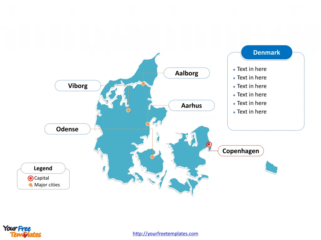
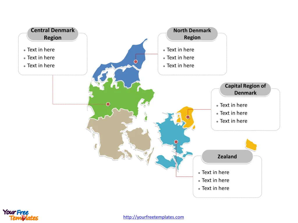
The Denmark Map Template includes two slides. Denmark map with 5 political regions, highlighting Capital Region of Denmark, Central Denmark Region, North Denmark Region, and Zealand regions. Denmark map of outline labeled with Copenhagen, Aarhus, Odense, Aalborg, and Viborg cities.
Denmark, located in Northern Europe, consists of the Jutland Peninsula and numerous islands, including Zealand and Funen. With a population of around 5.8 million people, Denmark is known for its high standard of living, well-developed welfare state, and emphasis on renewable energy and sustainability. The country boasts a strong and diversified economy, with key sectors including manufacturing, pharmaceuticals, renewable energy, and information technology. Denmark is also renowned for its agricultural exports, particularly in dairy and meat products.
Denmark shares its southern border with Germany and is connected to Sweden by the Øresund Bridge. Its strategic location in the heart of Scandinavia has contributed to its role as a regional hub for trade and commerce. The country’s proximity to the Baltic Sea and North Sea has historically shaped its maritime and trading heritage.
Slide 1, Denmark map labeled with capital and major cities.
Major Cities on Denmark Map
Copenhagen
Copenhagen, the capital and largest city of Denmark, is situated on the eastern coast of the island of Zealand. Known for its charming blend of historical and modern architecture, Copenhagen is a cultural and economic powerhouse. It is home to iconic landmarks such as the Tivoli Gardens, the Little Mermaid statue, and the vibrant Nyhavn waterfront. The city’s rich cultural scene, thriving culinary landscape, and emphasis on sustainability make it a top destination for travelers and a desirable place to live and work.

Aarhus
Aarhus, located on the east coast of the Jutland Peninsula, is Denmark’s second-largest city. Renowned for its innovative urban design, Aarhus seamlessly combines historical charm with contemporary living. The city is a hub for education, with Aarhus University being a prominent institution. Aarhus also boasts a dynamic arts and cultural scene, making it a cultural gem in the heart of Jutland.
Odense
Odense, situated on the island of Funen, is known as the birthplace of renowned author Hans Christian Andersen. This vibrant city offers a mix of historical sites, modern attractions, and a strong focus on innovation and technology. It is a center for research and education, with a thriving entrepreneurial spirit. The annual Hans Christian Andersen Festival celebrates the city’s cultural heritage and artistic prowess.
Aalborg
Aalborg, located in the North Denmark Region, is a historic city with a modern edge. It is known for its lively waterfront, rich Viking history, and the iconic Aalborg Tower. The city’s industrial and commercial significance, coupled with its dedication to sustainable practices, has positioned it as a key player in Denmark’s economic landscape.
Viborg
Viborg, situated in the Central Denmark Region, is steeped in history and is often referred to as the “City of Kings.” Its well-preserved medieval architecture, including the Viborg Cathedral, draws visitors seeking a glimpse into Denmark’s past. The city’s strategic location and strong sense of community make it an integral part of the region’s cultural and economic fabric.
Slide 2, Denmark map labeled with major administration districts.
Denmark is a country composed of 5 regions, Capital Region of Denmark, Central Denmark Region, North Denmark Region, Zealand and Region of Southern Denmark. Every individual political subdivision is an editable shape.
Major Regions on Denmark Map
Capital Region of Denmark
The Capital Region of Denmark, with Copenhagen as its center, encompasses the eastern part of Zealand and the northern part of the island of Amager. This region serves as the political and economic nucleus of Denmark, housing key government institutions, international corporations, and a diverse population.

Central Denmark Region
The Central Denmark Region, located on the Jutland Peninsula, is known for its dynamic mix of urban centers, picturesque landscapes, and innovative industries. Aarhus, as the regional capital, plays a pivotal role in the region’s cultural and economic development.
North Denmark Region
The North Denmark Region, encompassing the northern part of the Jutland Peninsula, is characterized by its coastal beauty, historical significance, and strong sense of community. The region’s cities, including Aalborg, contribute to its reputation as a thriving cultural and economic hub.
Zealand Region
The Zealand Region, comprising the island of Zealand and surrounding smaller islands, is a melting pot of historical landmarks, picturesque landscapes, and vibrant urban centers. With Copenhagen as its focal point, this region is a driving force behind Denmark’s cultural, economic, and political endeavors.
In conclusion, Denmark’s major cities and regions showcase a harmonious blend of history, innovation, and cultural significance, each contributing to the country’s rich tapestry of heritage and modernity.
Looking for Premium maps, please visit our affiliate site: https://editablemaps.com/ or https://ofomaps.com/
Size: 117K
Type: PPTX
Aspect Ratio: Standard 4:3
Click the blue button to download it.
Download the 4:3 Template
Aspect Ratio: Widescreen 16:9
Click the green button to download it.
Download the 16:9 Template


