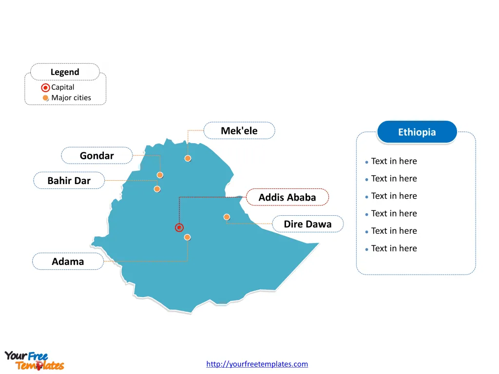
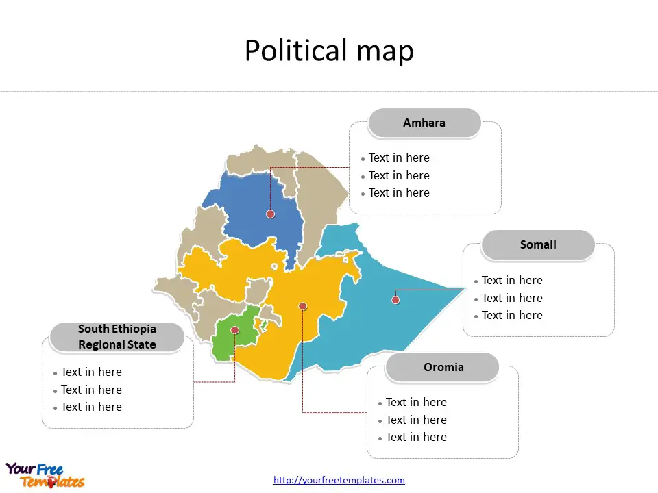
The Ethiopia map Template includes two slides. Ethiopia map with nine regional states, highlighting Amhara, Oromia, Somali, and (Southern Nations, Nationalities, and Peoples’ Region) states. The outline Ethiopia map labeled with Addis Ababa, Adama, Gondar, Mek’ele, Bahir Dar, and Dire Dawa cities.
Ethiopia, situated in the Horn of Africa, is a landlocked country known for its rich history, diverse culture, and stunning landscapes. With a population exceeding 118 million, it is the second-most populous country in Africa and possesses a wide array of ethnicities, languages, and traditions. The country shares its borders with Djibouti, Eritrea, Kenya, Somalia, South Sudan, and Sudan, giving it a strategic position in the region and influencing its cultural and economic interactions.
The country’s economy is primarily agrarian, with agriculture employing a majority of the population and contributing significantly to its GDP. Additionally, Ethiopia has been making strides in industrialization and has attracted foreign investment in sectors such as textiles, leather, and manufacturing.
Slide 1, Ethiopia map labeled with capital and major cities.
Major Cities on Ethiopia map
Addis Ababa
As the capital and largest city of Ethiopia, Addis Ababa holds significant cultural, political, and economic importance. Home to over 3 million people, the city serves as the seat of the African Union and various international organizations. Addis Ababa is a vibrant metropolis, featuring a mix of modern infrastructure and historical landmarks, including the National Museum and the Ethnological Museum.

Adama
Adama, also known as Nazret, is a bustling city located in the Oromia Region. With a population of over 300,000, it is a major industrial and commercial center. The city’s strategic location along the main route connecting Addis Ababa to the eastern regions makes it a crucial transportation hub.
Gondar
Gondar, situated in the Amhara Region, is renowned for its well-preserved medieval castles and churches, earning it the nickname “the Camelot of Africa.” The city’s rich history and architecture, including the Royal Enclosure, attract tourists and historians from around the world.
Mek’ele
Mek’ele, the capital of the Tigray Region, is a rapidly growing city and a key center for trade, education, and culture. It is known for its diverse population and its role as a gateway to the historic rock-hewn churches of Lalibela and the stunning landscapes of the Danakil Depression.
Bahir Dar
Bahir Dar, located on the southern shore of Lake Tana in the Amhara Region, is celebrated for its picturesque setting and as a gateway to the Blue Nile Falls. The city’s lush surroundings, historic monasteries, and vibrant marketplaces make it a popular destination for both domestic and international tourists.
Dire Dawa
Dire Dawa, the second-largest city in Ethiopia, is a vital industrial and commercial center in the eastern part of the country. With a diverse population and a strategic location near the border with Somalia, Dire Dawa serves as a key transportation and trade hub.
Slide 2, Ethiopia map labeled with major administration districts.
Ethiopia map presents the country’s political boundaries, which is divided into 12 states and two chartered cities are Addis Ababa, Afar, Amhara, Benishangul Gumz, Central Ethiopia Regional State, Dire Dawa, Gambela, Harari, Oromia, Sidama, Somali, South Ethiopia Regional State, South West Ethiopia, and Tigray. Every individual political subdivision is an editable shape.
Major States on Ethiopia map
Amhara
The Amhara Region, where Gondar and Bahir Dar are located, is known for its rich history, diverse culture, and significant contributions to Ethiopia’s heritage and economy.

Oromia
The Oromia Region, home to Addis Ababa and Adama, is the largest and most populous regional state in Ethiopia. It is a melting pot of diverse ethnicities and is known for its cultural vibrancy and economic significance.
Somali
The Somali Regional State, located in eastern Ethiopia, has Dire Dawa within its borders and is known for its distinctive cultural heritage and its role as a regional trade center.
South Ethiopia Regional State
The Southern Nations, Nationalities, and Peoples’ Region (SNNPR) is known for its cultural diversity and is home to a multitude of ethnic groups. It is a region of great natural beauty, featuring diverse landscapes and heritage sites.
In conclusion, Ethiopia’s major cities and states represent the country’s diverse cultural tapestry, historical significance, and economic vitality, each contributing to the nation’s multifaceted identity and development.
Looking for Premium maps, please visit our affiliate site: https://editablemaps.com/ or https://ofomaps.com/
Size: 97K
Type: PPTX
Aspect Ratio: Standard 4:3
Click the blue button to download it.
Download the 4:3 Template
Aspect Ratio: Widescreen 16:9
Click the green button to download it.
Download the 16:9 Template


